
Packing List for Trekking in Nepal: Complete Guide by Majestic Trails Nepal
2 Apr 2026
Your packing list for trekking in Nepal can be the difference between a transformative adventure and a dangerous ordeal. Nepal's trails stretch from s...

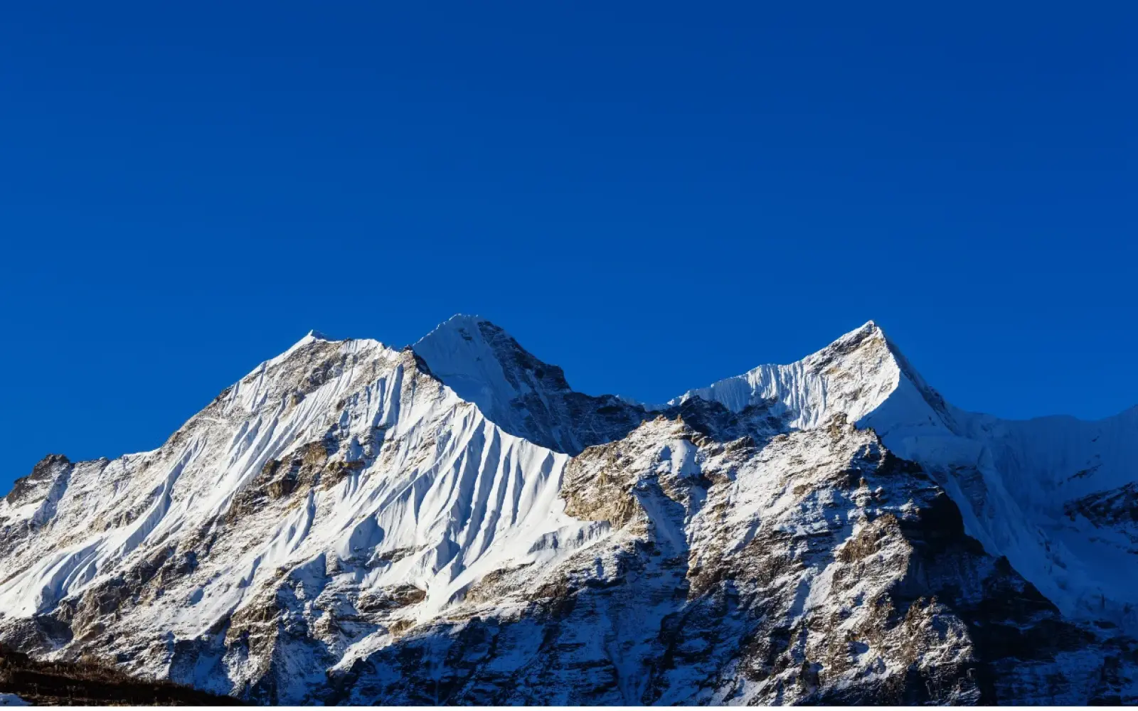

Kanchenjunga is 8,586 meters (28,169 feet) high. That is the elevation of its main summit above sea level, and it is the figure Nepal’s Department of Tourism publishes in Mountaineering in Nepal: Facts & Figures 2024. The Nepal Tourism Board and Britannica use the same number. It makes Kanchenjunga the third-highest mountain on Earth, after Everest and K2, and the second highest in Nepal.
Most answers stop there. This one keeps going, because the number has a past. Until 1852, surveyors believed Kanchenjunga was the tallest mountain in the world. Older books still print 28,208 feet. Its smaller summits carry different heights depending on whose list you read. And the trekkers who reach its base camps still stand more than three kilometers below the top. Below, we walk through each of those questions, and at the end we explain how we checked every figure on this page.
Kanchenjunga at a glance
Mount Kanchenjunga’s main summit stands 8,586 meters above sea level. In feet, that is 28,169. In kilometers, it is a little under 8.6.
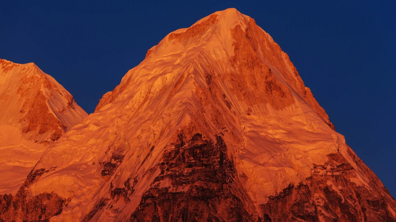
“Above sea level” matters here. The figure measures the summit against mean sea level, a reference surface that runs, in theory, beneath the continents. It does not mean the mountain rises 8,586 meters from its own base, and how tall Kanchenjunga feels depends entirely on where you stand. From Pangpema, its North Base Camp, the summit is about 3,440 meters higher. From the bazaar at Taplejung, where most treks begin at about 1,820 meters, it is nearly 6,800 meters higher.
The ground around the mountain makes those numbers even more striking. The 2015 assessment of Nepal’s part of the Kangchenjunga Landscape, prepared for the Ministry of Forests and Soil Conservation with Tribhuvan University’s RECAST and ICIMOD, gives the area an elevation range of 60 meters to 8,586 meters. The low end is Kechana in Jhapa, the lowest point in Nepal. The authors describe the region as one of the steepest in the world within a short aerial distance of 70 kilometers, and note that some valleys in Taplejung fall to about 550 meters. Few places on Earth pack that much vertical change into one corner of a country.
Is Kanchenjunga one mountain or a group of peaks? It is one mountain with several summits, what geographers call a massif. Five summits stand out, and four of them rise above 8,450 meters. When anyone quotes the Kanchenjunga height on its own, they mean the highest of these, Kangchenjunga Main. That summit is also a giant in its own right. Its topographic prominence, the drop to the lowest point you would cross to reach any higher ground, is 3,922 meters. That low point is a col at about 4,664 meters in Tibet, and the figure ranks 29th in the world.
The standard Kanchenjunga height converts like this:
| Unit | Kanchenjunga height |
|---|---|
| Meters | 8,586 m |
| Feet | 28,169 ft |
| Kilometers | 8.586 km (about 8.6 km) |
| Miles | 5.34 mi |
In feet, the height of Kanchenjunga is 28,169. If you see 28,208 or 28,146 feet, you are reading an older survey value, explained in the next section.
For Hindi readers, the answer is the same: कंचनजंगा की ऊँचाई 8,586 मीटर (28,169 फीट) है।
To picture it, stack ten Burj Khalifas (828 m each) on top of one another. You would still be about 300 meters short of the summit, which sits most of the way to the altitude where passenger jets cruise.
Searchers also ask for the Kanchenjunga elevation, the Kanchenjunga altitude and the Kanchenjunga height from sea level. For a mountain, these all point to the same figure. Elevation and altitude describe a point’s vertical position, and for summits that position is always measured above sea level. So 8,586 meters answers all of them.
Kanchenjunga is 8,586 meters. The 8,598 meter figure, usually written as 28,208 feet, comes from a Survey of India re-measurement in the 1950s. It has since been replaced, but it lingers in dictionaries, quiz books and older textbooks.
Here is the paper trail we could document:
| Recorded height | In meters | Where it comes from | Status today |
|---|---|---|---|
| 28,146 ft | about 8,579 m | Survey of India official figure before 1952 (Himalayan Journal, 1965) | Superseded |
| 28,150 ft | about 8,580 m | Francis Younghusband, The Epic of Mount Everest (1926) | A rounded figure in a popular book |
| 28,208 ft | about 8,598 m | Survey of India re-measurement, 1952 to 1954 (Himalayan Journal, 1965) | Superseded, still in some dictionaries |
| 28,169 ft | 8,586 m | Department of Tourism (2024), Nepal Tourism Board, Britannica, MoFSC/RECAST/ICIMOD (2015) | Current standard |
The Himalayan Journal recorded the 1950s change in 1965. Its note on revised heights of Himalayan peaks said the Survey of India had taken fresh measurements between 1952 and 1954, moving Kangchenjunga I from 28,146 to 28,208 feet.
We could not find a published record of exactly when, or by whom, 8,598 meters gave way to 8,586 meters, so we will not invent one. What we can say with confidence is that every current official and reference source we checked uses 8,586 meters.
So has Kanchenjunga’s official height changed? On paper, yes, more than once. In recent decades, no. And if you have seen the line “the elevation of Kanchenjunga is about 8,848 metres,” that number belongs to Everest. Kanchenjunga is about 263 meters lower.
Kanchenjunga’s height was first calculated by the Great Trigonometrical Survey of India, the British-era project that mapped the subcontinent in the 1800s. Its surveyors could not enter Nepal, let alone climb into the high mountains, so they measured the peaks from survey stations far to the south. In the survey’s records, Kanchenjunga appeared as Peak IX and Everest as Peak XV.
For a while, Peak IX was the champion. Until 1852, it was assumed to be the highest mountain in the world. Calculations based on observations made in 1849 then showed that Peak XV was taller. After the figures were checked, the survey announced in 1856 that Everest was the highest, and Kanchenjunga took third place behind K2.
The survey’s method was triangulation, and the idea is simpler than the name suggests.
The hard part is the corrections. Light bends as it passes through the atmosphere, which makes distant peaks appear slightly higher than they are. The Earth curves away over long distances. The sea-level surface itself is not a perfect shape, especially under a mountain range as massive as the Himalaya. A summit capped with deep snow adds yet another unknown. Each correction can move the answer by meters, and that is why the same mountain can carry several “official” heights over a century and a half.
Not to the centimeter, and no mountain can. Everest’s current figure of 8,848.86 meters came from a 2020 survey by Nepal and China in which teams carried satellite-positioning equipment to the summit itself. Our guide to how tall Mount Everest is explains that survey.
Kanchenjunga has not had a widely reported survey of that kind, so its official height still rests on earlier work. There is also a cultural wrinkle. A summit-based survey would mean placing instruments on the highest point, while climbers have traditionally stopped just short of it out of respect for the mountain’s sacred status. For now, 8,586 meters remains the reference.
| Year | What happened |
|---|---|
| 1848 to 1849 | Botanist Joseph Dalton Hooker explores Sikkim and eastern Nepal, reaching about 4,760 m in the mountain’s foothills. |
| 1849 to 1856 | The Great Trigonometrical Survey’s calculations show Peak XV (Everest) is higher than Peak IX (Kanchenjunga); the result is announced in 1856. |
| 1883 | William Woodman Graham’s party climbs in the Kanchenjunga area and reaches within 9 to 12 m of the top of Kabru. |
| 1885 to 1886 | Surveyor Rinzin Namgyal maps the full circuit of the massif, the first-known map of its north and west sides. |
| 1899 | Douglas Freshfield, with photographer Vittorio Sella, completes the first high-level circuit of the mountain. |
| 1905 | Aleister Crowley’s expedition attempts the Yalung Face; an avalanche kills Alexis Pache and three porters. |
| 1929 and 1931 | German teams under Paul Bauer reach about 7,400 m on the northeast spur, then climb about 300 m higher two years later. |
| 1952 to 1954 | The Survey of India re-measures the peak at 28,208 ft. |
| 1955 | Joe Brown and George Band make the first ascent on May 25, stopping just short of the summit. |
| 1977 | An Indian Army team led by Colonel Narendra Kumar makes the second ascent, by the northeast spur. |
| 1979 | Doug Scott, Peter Boardman and Joe Tasker make the first ascent without supplemental oxygen, by a new route on the North Ridge. |
| 1980 | Ang Phurba Sherpa becomes the first Nepali to reach the summit, on May 14. |
| 1986 | Jerzy Kukuczka and Krzysztof Wielicki make the first winter ascent, on January 11. |
| 1997 | Nepal declares the Kangchenjunga region a “Gift to the Earth” in April and grants it conservation area status in July. |
| 2000 | India closes the climbing route from Sikkim to expeditions. |
| 2016 | UNESCO inscribes Khangchendzonga National Park in Sikkim as India’s first mixed World Heritage Site. |
| 2026 | Nepal allows solo restricted-area permits from March 22; a rope-fixing team opens the summit route on May 20. |
The Kanchenjunga massif has five main summits, but their heights depend on whose list you read. The main summit and Yalung Kang are consistent across sources. The two summits on the southern ridge are not.
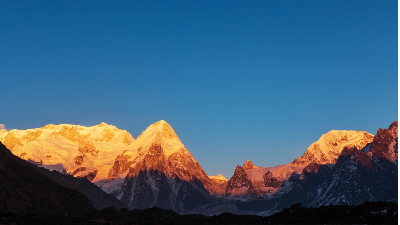
| Summit | Peak databases (Peakbagger) | Nepal sources | Where it stands |
|---|---|---|---|
| Kangchenjunga Main | 8,586 m | 8,586 m (Department of Tourism; NTB) | Nepal-India border |
| Yalung Kang (Kangchenjunga West) | 8,505 m | 8,505 m (Department of Tourism; NTB) | Taplejung, Nepal |
| Kangchenjunga South | 8,494 m | 8,476 m (NTB, listed as one of the “Twin Peaks”) | Nepal-India border |
| Kangchenjunga Central | 8,482 m | 8,476 m (NTB, listed as one of the “Twin Peaks”) | Nepal-India border |
| Kangbachen | 7,903 m | Not listed by NTB | Taplejung, Nepal |
Sources: Peakbagger values as cited by Wikipedia’s Kangchenjunga article; Department of Tourism, Mountaineering in Nepal: Facts & Figures 2024; Nepal Tourism Board. Wikipedia’s own article on Kangchenjunga South also gives 8,476 m. The NTB page lists a further “Kanchenjunga West” at 8,420 m, a figure that does not match any summit in the peak databases, and we could not resolve it.
Why the disagreement? Subsidiary summits get far less attention than a main peak. Kangchenjunga South and Central were not climbed until May 1978, names shift between lists (Kangchenjunga West and Yalung Kang are the same summit), and some sources still carry older survey values. Where the figures differ, we show both rather than pick a winner.
The prominence figures in peak databases also explain why these count as summits of one mountain rather than separate peaks. Kangchenjunga Central rises only 32 meters above the saddle that links it to Kangchenjunga South. It is really a high point on a shared ridge. Only the main summit stands as a fully independent peak.
Kanchenjunga ranks third in the world, and the gaps around it are surprisingly narrow.
| Mountain | Height (m) | Height (ft) | World rank | Compared with Kanchenjunga |
|---|---|---|---|---|
| Mount Everest | 8,848.86 | 29,032 | 1 | 263 m (862 ft) higher |
| K2 | 8,611 | 28,251 | 2 | 25 m (82 ft) higher |
| Kanchenjunga | 8,586 | 28,169 | 3 | Reference point |
| Lhotse | 8,516 | 27,940 | 4 | 70 m (230 ft) lower |
| Makalu | 8,485 | 27,838 | 5 | 101 m (331 ft) lower |
Makalu’s height varies slightly between published lists; the table uses the peak-database figure.
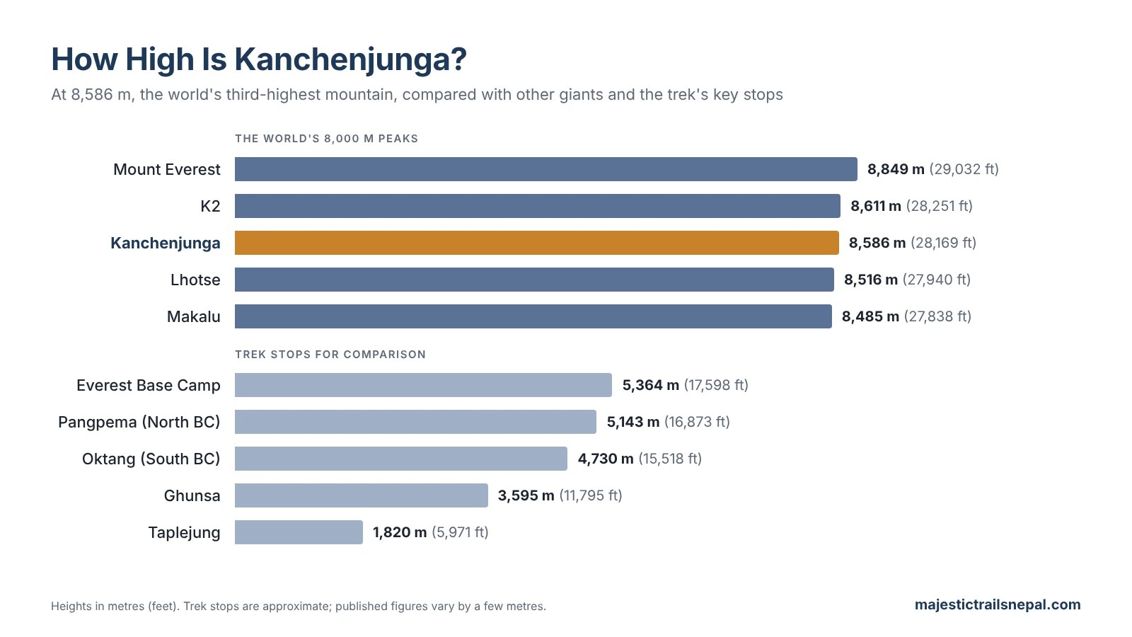
How much shorter is Kanchenjunga than Everest? About 263 meters, or 862 feet, roughly the height of an 80-story building. The two peaks stand about 125 kilometers apart on the same Himalayan arc, and on a clear day at Sandakphu on the Singalila Ridge, you can see both on one horizon, along with Makalu.
How much higher is K2 than Kanchenjunga? Only 25 meters, about 82 feet. That is the tightest gap among the world’s three highest mountains. K2 stands in the Karakoram range, far to the northwest, on the border between Pakistan-administered Gilgit-Baltistan and China.
Below Kanchenjunga, Lhotse sits 70 meters lower and Makalu, the next eight-thousander to the west, about 101 meters lower. Nepal holds eight of the world’s 14 peaks above 8,000 meters, and our guide to the 8,000-meter peaks in Nepal ranks them all. There is a neat symmetry in their history, too: Everest, K2 and Kanchenjunga were first climbed in consecutive years, 1953, 1954 and 1955.
In Nepal, no. Everest, at 8,848.86 meters on the Nepal-China border, is Nepal’s highest mountain, and Kanchenjunga ranks second.
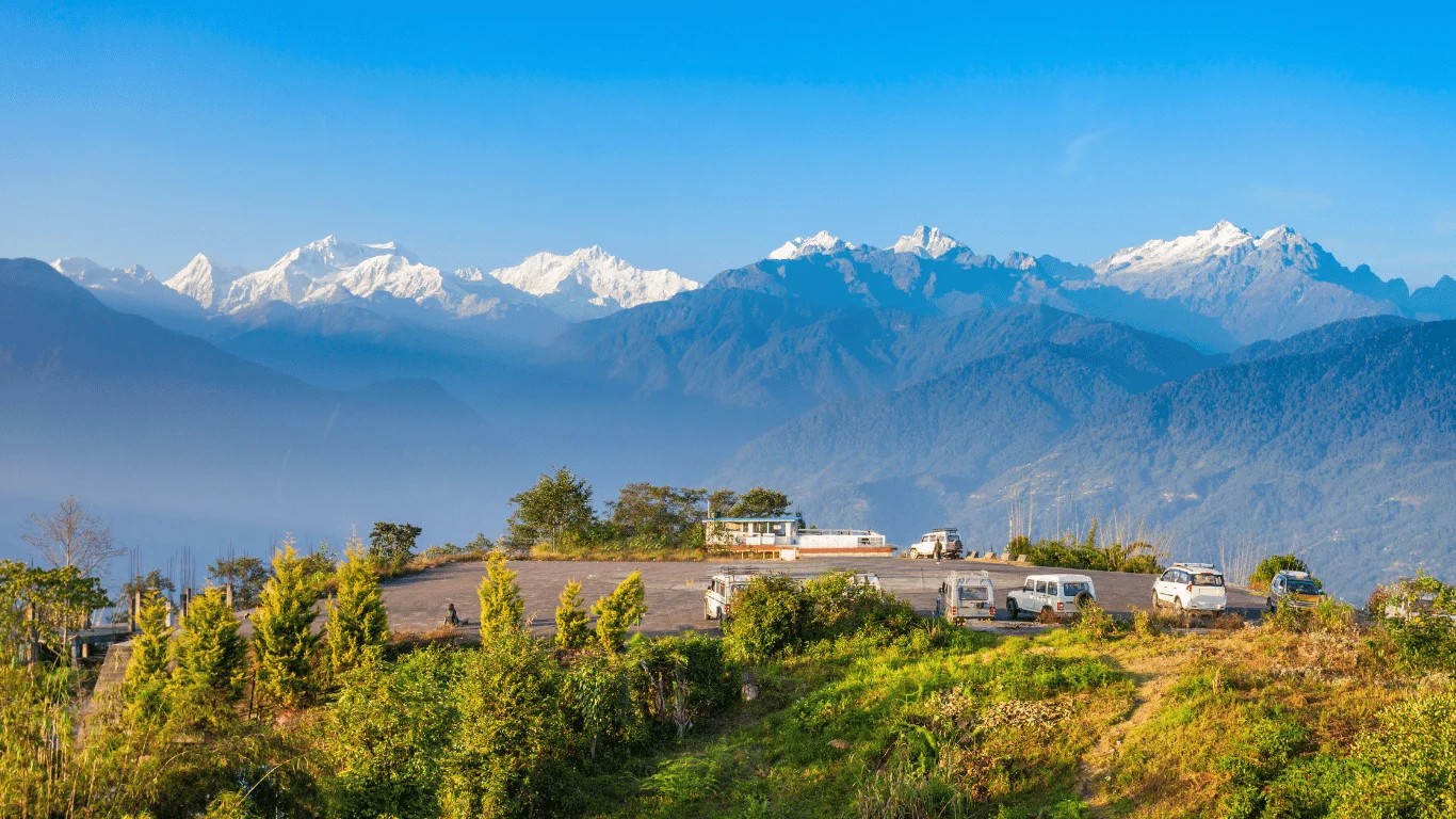
In India, the answer depends on how you define the country’s territory:
Kanchenjunga is also the highest point of Sikkim, and most Indian exam papers that ask for the country’s highest peak expect it as the answer. For the border, the districts and the map, see our guide to where Kanchenjunga is located.
“Base camp” means two different things on Kanchenjunga, and mixing them up causes a lot of confusion.
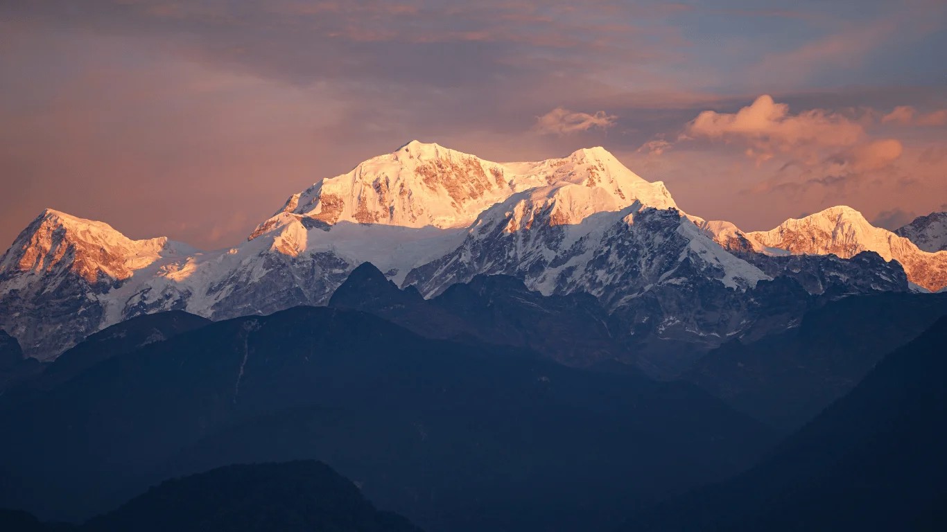
Trekking base camps are where trekkers go. There are two, both in Nepal. The North Base Camp at Pangpema sits at about 5,143 meters, at the end of the trail up the Kangchen Glacier. In the south, trekkers walk to the Oktang viewpoint, at about 4,730 meters, beside the Yalung Glacier. Oktang is often called the South Base Camp, but strictly it is a viewpoint; the climbing base camp lies higher up the same glacier.
The expedition base camp is where climbing teams live for weeks. On the southwest side, below the Yalung Face, it sits around 5,500 meters. One 2026 expedition reported its base camp at about 5,550 meters.
| Place | Altitude | Kanchenjunga’s summit is | Note |
|---|---|---|---|
| Expedition base camp (southwest side) | about 5,500 m | about 3,090 m higher | Climbers only; 5,550 m reported by one 2026 team |
| Pangpema (North Base Camp) | about 5,143 m | about 3,440 m higher | Highest point most trekkers reach |
| Oktang viewpoint (South Base Camp area) | about 4,730 m | about 3,860 m higher | View straight up the south face |
| Everest Base Camp, for comparison | 5,364 m | about 3,220 m higher | Everest’s own summit is about 3,485 m above it |
Trekkers who reach Pangpema sometimes expect to feel close to the top. They are not. The summit still rises more than three vertical kilometers above them, which says more about Kanchenjunga’s scale than any single number.
Altitude builds slowly on the way there. Operators’ published figures differ by up to about 100 meters, so treat these as approximate:
| Place | Approximate altitude | Note |
|---|---|---|
| Taplejung (Phungling) | 1,820 m | District headquarters, trek start |
| Amjilosa | 2,300 to 2,400 m | North route |
| Gyabla | 2,700 m | North route |
| Ghunsa | 3,595 m | Sherpa village, main acclimatization stop |
| Khambachen | 4,050 m | North route |
| Lhonak | 4,750 to 4,780 m | Last overnight stop before Pangpema |
| Pangpema (North Base Camp) | 5,143 m | Highest point of the trek |
| Sele La camp | 4,290 m | Crossing between north and south |
| Tseram (Cheram) | 3,870 m | South route |
| Ramche | 4,580 m | Base for the Oktang hike |
| Oktang viewpoint | 4,730 m | South face view |
| Yamphudin | 2,080 m | South route |
From Taplejung to Pangpema, you gain more than 3,300 meters. Above about 2,500 meters, altitude sickness becomes a real risk, so good itineraries climb gradually and rest at Ghunsa before pushing above 4,000 meters. Our guide to altitude sickness on Nepal treks covers the warning signs. For comparison with Nepal’s busier trails, see our guides to Everest Base Camp height and Annapurna Base Camp height; Oktang sits about 600 meters above Annapurna Base Camp.
Kanchenjunga is a restricted area. Foreign trekkers need a Restricted Area Permit and a Kanchenjunga Conservation Area Permit, and a licensed guide arranged through a registered agency is mandatory. Since March 22, 2026, solo travelers can apply for the permit, but the guide rule stays. Our 2026 trekking permit price guide lists current fees. Few people make the trip: the conservation area recorded 702 visitors in 2011, according to the 2015 landscape report, and local officials counted about 1,400 foreign visitors to the region in the Nepali year 2082 (2025 to 2026).
Trek to Kanchenjunga’s base camps with us. Majestic Trails Nepal is a government-registered company in Thamel, Kathmandu, and our guides lead treks to both base camps from the Nepal side. On high routes they check every trekker’s oxygen level each evening and carry bottled oxygen, and our safety standards explain the rest. Talk to us about your Kanchenjunga trek, including a free video call before you book.
Distance changes everything about how a mountain looks. A nearer peak fills more of your view, even if a farther one is taller, and that is why Kanchenjunga, not Everest, dominates the northern skyline in Darjeeling and western Sikkim.
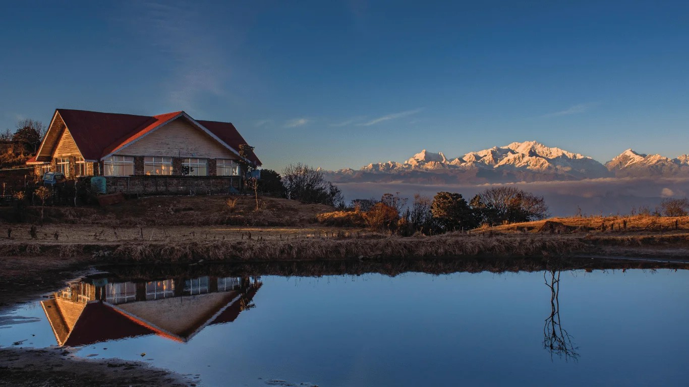
Darjeeling lies 74 kilometers south-southeast of Kanchenjunga, according to Britannica. From the town, at about 2,000 meters, the summit sits only around 5 degrees above the horizon, about half the width of a fist held at arm’s length, once you allow for the curve of the Earth. Yet the massif is so broad that it seems to fill the sky. Everest, seen from the same hills, is more than twice as far away and appears as a small point on the horizon, when it can be seen at all.
Sir Francis Younghusband captured the effect in The Epic of Mount Everest in 1926. He described looking from Darjeeling, about 7,000 feet up, down to the Rangeet River at about 1,000 feet, then up through ridge after ridge of forest to the summit about 40 miles away. In metric terms, that is a sweep from about 300 meters to 8,586 meters, more than 8 kilometers of vertical relief, across roughly 64 kilometers.
The best places to take in the mountain’s full height:
To the people who live beneath it, Kanchenjunga is not just tall. It is sacred. The 2015 landscape report records that the mountain is culturally regarded as the Five Treasures of Snow, repositories of gold, silver, gems, grain and holy books. In the Limbu language, it is Sewalungma, “the mountain that we offer greetings to.” In Sikkim, it is honored as a guardian deity.
That reverence changed mountaineering history. Before the 1955 expedition, its members promised Tashi Namgyal, the Chogyal of Sikkim, that the summit would remain untouched. On May 25, 1955, Joe Brown and George Band stopped just below the highest point, and climbers have largely kept to that tradition since.
Height also governs ice. According to the 2015 report, the average snowline in eastern Nepal lies around 5,000 meters, and 732 square kilometers of the Tamur River basin sit above it. About 479 square kilometers of Nepal’s part of the Kangchenjunga Landscape are covered by permanent snow, ice and glaciers. The Tamur itself rises from the Kangchenjunga glacier and drains almost a third of that area, while the Yalung Glacier alone covers about 82 square kilometers. Communities in Taplejung and Panchthar told the report’s researchers that snowfall and snow cover have declined in recent years. A fuller look at the region’s glaciers and wildlife belongs in its own guide.
For climbers, the height places the summit well inside the death zone, the band above about 8,000 meters where the air holds too little oxygen for the body to adapt. At 8,586 meters, air pressure is roughly a third of that at sea level. By May 2022, the Himalayan Database had recorded 532 summits of Kanchenjunga and 52 deaths on the main mountain, roughly one death for every ten successful ascents. Everest, by comparison, had about 12,900 summits and around 340 deaths by the end of 2024. The figures cover different periods and compare deaths with summits rather than all attempts, so they show a pattern, not a precise risk. The pattern is still clear.
We did not measure the mountain ourselves. What we did was compare every figure on this page across independent types of source, and decide in advance how to handle disagreements.
Our rules were simple. When official and reference sources agreed, we used that figure. When they disagreed, we showed both and said so. Trekking altitudes, which vary between operators, are rounded and labeled approximate. Time-sensitive claims carry a date.
Key statistics
| Statistic | Figure | Source |
|---|---|---|
| Height of the main summit | 8,586 m (28,169 ft) | Department of Tourism (2024); NTB; Britannica |
| World rank | 3rd | NTB; Britannica |
| Topographic prominence | 3,922 m (29th in the world) | Peakbagger, via Wikipedia |
| Summits above 8,450 m | 4 | Peak databases |
| Elevation range of Nepal’s Kangchenjunga Landscape | 60 m to 8,586 m | MoFSC/RECAST/ICIMOD (2015) |
| Average snowline, eastern Nepal | about 5,000 m | MoFSC/RECAST/ICIMOD (2015) |
| Permanent snow and ice, Nepal’s Kangchenjunga Landscape | 479 km² | MoFSC/RECAST/ICIMOD (2015) |
| Glaciers in the Tamur basin (2001 inventory) | 261, covering about 474 km² | ICIMOD, via the 2015 report |
| Summits and deaths on the main mountain | 532 summits, 52 deaths (to May 2022) | Himalayan Database, via Wikipedia |
| Highest point on the trek | Pangpema, about 5,143 m | Operator itineraries |
What we found
Mount Kanchenjunga is 8,586 meters (28,169 feet) above sea level, according to Nepal’s Department of Tourism, the Nepal Tourism Board and Britannica. It is the third-highest mountain in the world after Everest and K2, the second highest in Nepal, and the highest point in Sikkim.
Kanchenjunga is about 8.6 kilometers (8.586 km) tall, or 28,169 feet. Older references sometimes give 28,208 or 28,146 feet. Those come from earlier Survey of India measurements and have been superseded.
Kanchenjunga is about 263 meters (862 feet) shorter than Everest. Everest stands at 8,848.86 meters, measured in a joint 2020 survey by Nepal and China, while Kanchenjunga stands at 8,586 meters. The two peaks are about 125 kilometers apart.
K2 is 25 meters (82 feet) higher than Kanchenjunga. K2 measures 8,611 meters and ranks second in the world, while Kanchenjunga, at 8,586 meters, ranks third. K2 stands in the Karakoram, far to the northwest of Kanchenjunga.
Kanchenjunga is one mountain, or massif, with five main summits. Four of them rise above 8,450 meters. The quoted height of 8,586 meters belongs to the highest, Kangchenjunga Main, which is the only one that stands as a fully independent peak.
Yes, on paper. The Survey of India’s official figure moved from 28,146 feet to 28,208 feet (about 8,598 m) after a 1952 to 1954 re-measurement. Today’s standard is 8,586 meters (28,169 feet), used by Nepal’s Department of Tourism and other official sources.
No mountain can be measured to the centimeter. Results depend on corrections for atmospheric refraction, the Earth’s curvature, the sea-level reference and summit snow. Kanchenjunga has not had a widely reported summit-based survey like Everest’s in 2020, so 8,586 meters remains the reference.
Local communities regard Kanchenjunga as the Five Treasures of Snow, repositories of gold, silver, gems, grain and holy books. The Limbu call it Sewalungma, “the mountain that we offer greetings to,” and Sikkim honors it as a guardian deity. Climbers traditionally stop just short of the summit out of respect.
The North Base Camp at Pangpema sits at about 5,143 meters, and the Oktang viewpoint near the south side sits at about 4,730 meters. Both are trekking destinations. Climbing expeditions use a separate base camp on the southwest side, at around 5,500 meters.
The Himalaya is still being pushed upward as India moves north into Asia, at about 5 centimeters a year according to the American Museum of Natural History. Erosion works against that uplift, and no recent survey has changed Kanchenjunga’s official height of 8,586 meters.

Your packing list for trekking in Nepal can be the difference between a transformative adventure and a dangerous ordeal. Nepal's trails stretch from s...
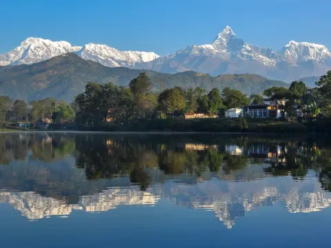
Annapurna is a section of the Nepal Himalayas containing 6 prominent peaks above 7,200 m and 15 peaks above 7,000 m, anchored by Annapurna I at 8,091...
Kathmandu is the capital and largest city of Nepal, located in the country's centre at 27.7172° N, 85.3240° E. It sits at an elevation of 1,400 meters...
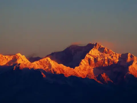
Kanchenjunga stands on the border between Nepal and India, in the eastern Himalaya, with Nepal's Taplejung district on its western side and Sikkim's M...
