[{"name":"Langtang Valley Trek \u2014 10 Days","duration":"10","image_url":"https:\/\/www.majestictrailsnepal.com\/storage\/trip-galleries\/1\/thumb_e7907ed736676d12e6ab17328008e746.webp","offer_price":null,"url":"https:\/\/www.majestictrailsnepal.com\/trips\/langtang-valley-trek"},{"name":"Everest Base Camp Trek","duration":"14","image_url":"https:\/\/www.majestictrailsnepal.com\/storage\/trip-galleries\/2\/thumb_4b769c9c4b5b007a61f4ce3b76ff440d.webp","offer_price":null,"url":"https:\/\/www.majestictrailsnepal.com\/trips\/everest-base-camp-trek"},{"name":"Everest Panorama Trek","duration":"9","image_url":"https:\/\/www.majestictrailsnepal.com\/storage\/trip-galleries\/3\/thumb_e6ee74caea3e2900c23ca370b06bab80.webp","offer_price":null,"url":"https:\/\/www.majestictrailsnepal.com\/trips\/everest-panorama-trek"},{"name":"Annapurna Base Camp Trek","duration":"14","image_url":"https:\/\/www.majestictrailsnepal.com\/storage\/trip-galleries\/4\/thumb_3f8d40f9472f701d7c46a827925201bc.webp","offer_price":null,"url":"https:\/\/www.majestictrailsnepal.com\/trips\/annapurna-base-camp-trek"},{"name":"Annapurna Base Camp Express Trek","duration":"9","image_url":"https:\/\/www.majestictrailsnepal.com\/storage\/trip-galleries\/5\/thumb_bac80de2bd257d651fa75d9c8025da1a.webp","offer_price":null,"url":"https:\/\/www.majestictrailsnepal.com\/trips\/annapurna-base-camp-express-trek"},{"name":"Annapurna Circuit Trek","duration":"15","image_url":"https:\/\/www.majestictrailsnepal.com\/storage\/trip-galleries\/6\/thumb_b73bdec74acacaa0d72a2a2a513f3d4a.webp","offer_price":null,"url":"https:\/\/www.majestictrailsnepal.com\/trips\/annapurna-circuit-trek"},{"name":"Ghorepani Poon Hill Trek","duration":"8","image_url":"https:\/\/www.majestictrailsnepal.com\/storage\/trip-galleries\/7\/thumb_aeda9e6388ab2692138cc9c9efa81a7f.webp","offer_price":null,"url":"https:\/\/www.majestictrailsnepal.com\/trips\/ghorepani-poon-hill-trek"},{"name":"Mardi Himal Trek \u2014 9 Days","duration":"9","image_url":"https:\/\/www.majestictrailsnepal.com\/storage\/trip-galleries\/8\/thumb_185a6bdd0bdb1ab5b4f218a2ec37ebf9.webp","offer_price":null,"url":"https:\/\/www.majestictrailsnepal.com\/trips\/mardi-himal-trek"},{"name":"Manaslu Circuit Trek","duration":"15","image_url":"https:\/\/www.majestictrailsnepal.com\/storage\/trip-galleries\/9\/thumb_7726908390ad6b249f2f6a7856f9dc17.webp","offer_price":null,"url":"https:\/\/www.majestictrailsnepal.com\/trips\/manaslu-circuit-trek"},{"name":"Upper Mustang Trek","duration":"16","image_url":"https:\/\/www.majestictrailsnepal.com\/storage\/trip-galleries\/10\/thumb_6a9b52ecd1d8cda92d594e5351431d6e.webp","offer_price":null,"url":"https:\/\/www.majestictrailsnepal.com\/trips\/upper-mustang-trek"},{"name":"Pokhara City Tour","duration":"1","image_url":"https:\/\/www.majestictrailsnepal.com\/storage\/trip-galleries\/11\/thumb_cf762ba4c20363bd1c0f239db35fcc84.webp","offer_price":null,"url":"https:\/\/www.majestictrailsnepal.com\/trips\/pokhara-city-tour"},{"name":"Paragliding in Pokhara","duration":"1","image_url":"https:\/\/www.majestictrailsnepal.com\/storage\/trip-galleries\/12\/thumb_b896201edf88bbe0f570e876c3c337a3.webp","offer_price":70,"url":"https:\/\/www.majestictrailsnepal.com\/trips\/paragliding-in-pokhara"},{"name":"Kathmandu City Tour","duration":"2","image_url":"https:\/\/www.majestictrailsnepal.com\/storage\/trip-galleries\/13\/thumb_846ad05bd3ce7bebb3843c24c08db6f9.webp","offer_price":null,"url":"https:\/\/www.majestictrailsnepal.com\/trips\/kathmandu-city-tour"},{"name":"Lumbini Buddhist Pilgrimage Tour","duration":"4","image_url":"https:\/\/www.majestictrailsnepal.com\/storage\/trip-galleries\/14\/a2998dca0ce22f28a61c3862dd47f6a3.webp","offer_price":null,"url":"https:\/\/www.majestictrailsnepal.com\/trips\/lumbini-buddhist-pilgrimage-tour"},{"name":"5 days langtang valley trek","duration":"5","image_url":"https:\/\/www.majestictrailsnepal.com\/storage\/trip-galleries\/15\/thumb_7a6c65c139b8085d220ac01913cb1448.webp","offer_price":510,"url":"https:\/\/www.majestictrailsnepal.com\/trips\/5-days-langtang-valley-trek"},{"name":"Leisure Port Nepal Price: Rafting and Camping Adventure","duration":"7","image_url":"https:\/\/www.majestictrailsnepal.com\/storage\/trip-galleries\/17\/thumb_02cb8c3f0697c7c5c4f73d744b47d87f.webp","offer_price":550,"url":"https:\/\/www.majestictrailsnepal.com\/trips\/leisure-port-nepal-price-rafting-and-camping-adventure"},{"name":"10 days spiritual tour in Nepal","duration":"10","image_url":"https:\/\/www.majestictrailsnepal.com\/storage\/trip-galleries\/18\/thumb_b4e7eba000673d1bce6b56abb422fe3b.webp","offer_price":1200,"url":"https:\/\/www.majestictrailsnepal.com\/trips\/10-days-spiritual-tour-in-nepal"},{"name":"Annapurna Circuit Short Trek","duration":"10","image_url":"https:\/\/www.majestictrailsnepal.com\/storage\/trip-galleries\/19\/thumb_769ee8cbe02a510d8db76419c97a2dc9.webp","offer_price":null,"url":"https:\/\/www.majestictrailsnepal.com\/trips\/annapurna-circuit-short-trek"},{"name":"Best Short Manaslu Circuit Trek","duration":"11","image_url":"https:\/\/www.majestictrailsnepal.com\/storage\/trip-galleries\/20\/thumb_ac1b4977a3fce9d11ee68240cad675b6.webp","offer_price":null,"url":"https:\/\/www.majestictrailsnepal.com\/trips\/best-short-manaslu-circuit-trek"},{"name":"Langtang Gosaikunda Trek","duration":"13","image_url":"https:\/\/www.majestictrailsnepal.com\/storage\/trip-galleries\/22\/thumb_577a6402f2ca4b3f12bfd80b96b33a23.webp","offer_price":940,"url":"https:\/\/www.majestictrailsnepal.com\/trips\/langtang-gosaikunda-trek"},{"name":"3 Passes Trek Nepal","duration":"22","image_url":"https:\/\/www.majestictrailsnepal.com\/storage\/trip-galleries\/24\/thumb_8020edea67aefce87e9012dc89a60087.webp","offer_price":null,"url":"https:\/\/www.majestictrailsnepal.com\/trips\/3-passes-trek-nepal"},{"name":"Tsum Valley Trek","duration":"13","image_url":"https:\/\/www.majestictrailsnepal.com\/storage\/trip-galleries\/25\/thumb_194c03e3c3463dff07a3f621a81ef9ea.webp","offer_price":null,"url":"https:\/\/www.majestictrailsnepal.com\/trips\/tsum-valley-trek"},{"name":"Gokyo and Renjo La Pass Trek","duration":"14","image_url":"https:\/\/www.majestictrailsnepal.com\/storage\/trip-galleries\/26\/thumb_7b865f0f0d0d4c6807b625b6e391b56d.webp","offer_price":1490,"url":"https:\/\/www.majestictrailsnepal.com\/trips\/gokyo-and-renjo-la-pass-trek"},{"name":"Honeymoon Tour in Nepal","duration":"9","image_url":"https:\/\/www.majestictrailsnepal.com\/storage\/trip-galleries\/27\/thumb_dabf449c090bb16efd5823c653eb61b3.webp","offer_price":null,"url":"https:\/\/www.majestictrailsnepal.com\/trips\/honeymoon-tour-in-nepal"},{"name":"Pikey Peak Trek","duration":"10","image_url":"https:\/\/www.majestictrailsnepal.com\/storage\/trip-galleries\/28\/thumb_5425e57ce3ea84d31a7b24b83b1af94f.webp","offer_price":1090,"url":"https:\/\/www.majestictrailsnepal.com\/trips\/pikey-peak-trek"},{"name":"Makalu Base Camp Trek","duration":"17","image_url":"https:\/\/www.majestictrailsnepal.com\/storage\/trip-galleries\/29\/thumb_d68c8ec6492540c922045d825a38cd50.webp","offer_price":null,"url":"https:\/\/www.majestictrailsnepal.com\/trips\/makalu-base-camp-trek"},{"name":"Nepal Winter Tour","duration":"8","image_url":"https:\/\/www.majestictrailsnepal.com\/storage\/trip-galleries\/30\/thumb_c8491c0c4b1fb19d8e93630866895799.webp","offer_price":null,"url":"https:\/\/www.majestictrailsnepal.com\/trips\/nepal-winter-tour"},{"name":"Maratika Tour in Nepal","duration":"6","image_url":"https:\/\/www.majestictrailsnepal.com\/storage\/trip-galleries\/31\/thumb_97948560c5a12a486f9ac2b76567cafd.webp","offer_price":null,"url":"https:\/\/www.majestictrailsnepal.com\/trips\/maratika-tour-in-nepal"},{"name":"Nepal Lake Trek","duration":"14","image_url":"https:\/\/www.majestictrailsnepal.com\/storage\/trip-galleries\/32\/thumb_d9b260fe13127816f5b3c25447caf70c.webp","offer_price":null,"url":"https:\/\/www.majestictrailsnepal.com\/trips\/nepal-lake-trek"},{"name":"Taste of Nepal Tour Package","duration":"9","image_url":"https:\/\/www.majestictrailsnepal.com\/storage\/trip-galleries\/33\/thumb_f4b55ab5760a8e057b4c3e208e25ab36.webp","offer_price":null,"url":"https:\/\/www.majestictrailsnepal.com\/trips\/taste-of-nepal-tour-package"},{"name":"Poon Hill Yoga Trek in Nepal","duration":"9","image_url":"https:\/\/www.majestictrailsnepal.com\/storage\/trip-galleries\/34\/thumb_904b238e690107c5c9b1092296880cc9.webp","offer_price":null,"url":"https:\/\/www.majestictrailsnepal.com\/trips\/poon-hill-yoga-trek-in-nepal"},{"name":"Nar Phu Nepal Trek","duration":"10","image_url":"https:\/\/www.majestictrailsnepal.com\/storage\/trip-galleries\/35\/thumb_f959e3e22c260629add0ba61a4038812.webp","offer_price":null,"url":"https:\/\/www.majestictrailsnepal.com\/trips\/nar-phu-nepal-trek"},{"name":"Annapurna Base Camp Helicopter Tour","duration":"1","image_url":"https:\/\/www.majestictrailsnepal.com\/storage\/trip-galleries\/36\/thumb_e81861e8772a9d7fac92ab4a7d43e3bf.webp","offer_price":null,"url":"https:\/\/www.majestictrailsnepal.com\/trips\/annapurna-base-camp-helicopter-tour"},{"name":"Annapurna Circuit with Nar Phu Valley Trek","duration":"16","image_url":"https:\/\/www.majestictrailsnepal.com\/storage\/trip-galleries\/38\/thumb_b70692cbd1c1dd772587c940be2d0bc9.webp","offer_price":null,"url":"https:\/\/www.majestictrailsnepal.com\/trips\/annapurna-circuit-with-nar-phu-valley-trek"},{"name":"Khopra Danda Trek","duration":"12","image_url":"https:\/\/www.majestictrailsnepal.com\/storage\/trip-galleries\/39\/thumb_6d5e38b2513af5a1ef359046decaffbf.webp","offer_price":null,"url":"https:\/\/www.majestictrailsnepal.com\/trips\/khopra-danda-trek"},{"name":"Manaslu Circuit with Tsum Valley Trek","duration":"20","image_url":"https:\/\/www.majestictrailsnepal.com\/storage\/trip-galleries\/40\/thumb_758926c6846b52ea9e258b1f06930d2c.webp","offer_price":null,"url":"https:\/\/www.majestictrailsnepal.com\/trips\/manaslu-circuit-with-tsum-valley-trek"}]
Where Is Kanchenjunga? Location, Height, and How to See It From Nepal and India
Kanchenjunga stands on the border between Nepal and India, in the eastern Himalaya, with Nepal's Taplejung district on its western side and Sikkim's Mangan district on its eastern side. At 8,586 metres (28,169 ft), it's the third-highest mountain on Earth, after Everest and K2. It rises about 125 km east-southeast of Everest, and on a clear day it's the great white wall you see from Darjeeling.
Our guides lead treks to Kanchenjunga's base camps from the Nepal side. This guide answers the questions people ask most about where it is, how high it is, and how to get there.
Key Takeaways
The essentials, in six points.
Location: on the Nepal–India border, in the eastern Himalaya; the main summit is shared by Nepal (Taplejung) and India (Sikkim).
Height: 8,586m (28,169 ft), the third-highest mountain in the world.
Five summits: the massif has five main peaks, which is where its name, "Five Treasures of the Great Snow", comes from.
Not K2: K2 (8,611m) is a different mountain, about 1,400 km away in the Karakoram, on the Pakistan–China border.
Visiting: you can trek to its base camps from Nepal, or see it from Darjeeling and Sikkim in India.
Sacred: climbers traditionally stop just short of the summit, and India doesn't allow expeditions from the Sikkim side.
Kanchenjunga at a Glance
The key facts, in one place.
Height
8,586m (28,169 ft)
World ranking
Third-highest mountain on Earth
Countries
Nepal and India (border)
Nepal side
Taplejung district, Koshi Province
India side
Mangan district (formerly North Sikkim), Sikkim
Coordinates
About 27.70°N, 88.15°E
Range
Kangchenjunga Himal, eastern Himalaya
Protected areas
Kanchenjunga Conservation Area (Nepal); Khangchendzonga National Park
First ascent
25 May 1955, Joe Brown and George Band
Best-known viewpoints
Darjeeling and Tiger Hill, Pelling, and Gangtok in India; the base camps and Pathibhara in Nepal
What Is Kanchenjunga?
Mount Kanchenjunga is located in eastern Nepal on the border with India, in the Himalayas.
Kanchenjunga is the third-highest mountain in the world and the highest mountain in India. It isn't a single peak but a huge massif, a cluster of five main summits joined by high ridges, with four great glaciers flowing down from it. For the Lepcha, Limbu, Sherpa, and Bhutia peoples who live around it, it's also a sacred mountain, home to a protective deity.
What Does "Kanchenjunga" Mean?
The name comes from Tibetan: kang (snow), chen (great), dzö (treasure), and nga (five), so it means "Five Treasures of the Great Snow". The five treasures are often linked to the mountain's five summits, and local tradition says they hold riches such as gold, salt, precious stones, sacred texts, and grain, revealed only when the world needs them.
You'll see the name spelled in several ways. Kangchenjunga is the official spelling used by the Government of India and the Royal Geographical Society. Kanchenjunga is the most common spelling online, Khangchendzonga is used in Sikkim (as in Khangchendzonga National Park), and Kanchanjangha is common in Nepal. They all mean the same mountain.
How to Pronounce Kanchenjunga (and Why It Has So Many Spellings)
Say it as KUN-chen-JUNG-ah: "kun" as in country, "chen" as in chess, "jung" as in jungle, with a soft "ah" at the end. In Nepal you will often hear Kan-chan-JUNG-ga, and in Sikkim the Tibetan-style Khang-chen-DZÖ-nga, which is closest to the original name.
The many spellings exist because the name was written down in English from Tibetan, Nepali and Lepcha sounds, and each surveyor and map-maker spelled what they heard. That is why people search for it as kang chen junga, kanchenchunga, kanchanjangha, kanchanjunga, kanjanjunga or kanchonjonga. Every one of them means the same mountain.
Where Is Kanchenjunga Located? Mt Kanchenjunga Location Explained
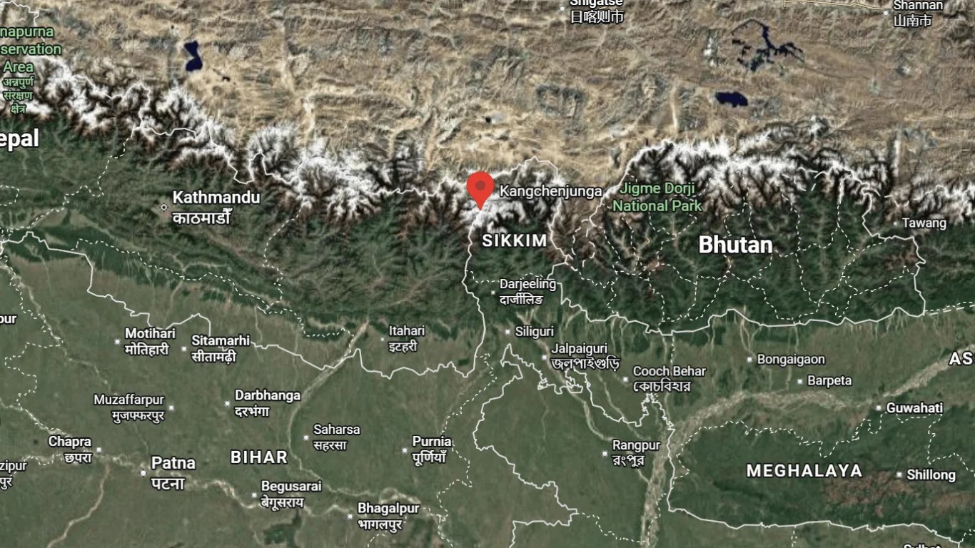
Kanchenjunga is located in the eastern Himalaya, on the border between Nepal and the Indian state of Sikkim. Its main summit lies on the boundary line itself: the western slopes are in Nepal's Taplejung district (Koshi Province), and the eastern slopes are in Sikkim's Mangan district (formerly the North Sikkim district). Its coordinates are about 27.70°N, 88.15°E.
To picture it on the ground:
From Everest: about 125 km to the east-southeast, in a straight line.
From Darjeeling: about 60–70 km to the north.
From Gangtok: to the north-west, across the deep valleys of Sikkim.
From Kathmandu: far to the east, near Nepal's eastern border, a long journey by road or air to Taplejung, then on foot.
Where Is the Kanchenjunga Peak Situated Within the Massif?
Of the five main summits, three (Main, Central, and South) stand directly on the Nepal–India border. The other two, Kanchenjunga West (also called Yalung Kang) and Kangbachen, are entirely in Nepal. So the highest point is shared by both countries, but most of the massif's high ground is on the Nepal side.
Kanchenjunga Himal: The Range Around the Mountain
Kanchenjunga is part of the Himalayas, and it gives its name to a whole section of them, the Kanchenjunga Himal (also written Kangchenjunga Himal). This is the easternmost of Nepal's Himalayan ranges, a block of high mountains bounded by rivers on three sides: the Tamor River to the west, the Lhonak Chu and Goma Chu to the north, and the Teesta River to the east.
Inside that block stand 16 peaks above 7,000m (22,966ft), including Jannu (Kumbhakarna, 7,711m), Kabru, Rathong and Kangbachen, and about 120 glaciers. Four big glaciers flow out from Kanchenjunga itself: the Yalung and Kangchen glaciers drain west into Nepal's Tamor and Koshi rivers, and the Zemu and Talung glaciers drain east into Sikkim's Teesta. From the trail you walk beside two of them: the Kanchenjunga (Kangchen) Glacier to the north base camp, and the Yalung Glacier to the south base camp.
Geographical Location of Mount Kanchenjunga: Where Exactly Is It Situated?
If you want the precise answer, here it is: the main summit of Kanchenjunga stands at about 27.70°N latitude and 88.15°E longitude, on the international border line between Nepal and India. The table shows exactly which country and province.
Country
Province / State
Protected area
Nepal
Koshi Province
Kanchenjunga Conservation Area
India
Sikkim
Khangchendzonga National Park
China
Tibet Autonomous Region
–
On the Nepal side, the mountain sits in Phaktanglung Rural Municipality of Taplejung, the most north-easterly district of the country. The nearest real town is Taplejung (Phungling) bazaar, about a week's walk to the south-west. On the Indian side, the nearest towns are Yuksom and Pelling in West Sikkim, and the state capital Gangtok is roughly 60 km away in a straight line.
What Continent Is Kanchenjunga In?
Kanchenjunga is in Asia, in the part geographers call South Asia. It is the most easterly of the world's 14 mountains above 8,000m, and the only one with a summit shared between Nepal and India.
Which State Is Kanchenjunga In?
In India, Kanchenjunga is in the state of Sikkim, in its Mangan district, on the border with Nepal. It is the highest point of Sikkim and sits about 70 km north of Darjeeling, which is in the neighbouring state of West Bengal. In Nepal it is in Koshi Province, in Taplejung district.
Where Is Kanchenjunga on the Map? Kanchenjunga on the India Map and Nepal Map
Mount Kanchenjunga is located in Taplejung, eastern Nepal, along the border with India’s Sikkim region.
On a map, look for the point where the Indian state of Sikkim meets Nepal's eastern border. Kanchenjunga sits on that line, close to where Nepal, Sikkim, and Tibet come together.
Where Is Kanchenjunga on the India Map?
On a political map of India, find Sikkim, the small state between Nepal and Bhutan, north of West Bengal. Kanchenjunga is in the north-west of Sikkim, on its border with Nepal, about 60–70 km north of Darjeeling. It's the highest point anywhere in India.
Is Kanchenjunga in India or Nepal?
Both. Kanchenjunga's highest summit stands exactly on the border between India and Nepal, so it belongs to both countries. That's why both claim it with pride: it's India's highest mountain and Nepal's second-highest, after Everest.
Kanchenjunga in India: Sikkim
The eastern side of the mountain is in Sikkim, inside Khangchendzonga National Park, which became a UNESCO World Heritage Site in 2016 for both its nature and its cultural importance. In Sikkim the mountain is deeply sacred, and India does not allow climbing expeditions from this side.
Khangchendzonga National Park lies in the north and west of Sikkim, with its western edge on the Nepal border at Kanchenjunga. The park is also the core of the wider Khangchendzonga Biosphere Reserve, which UNESCO added to its World Network of Biosphere Reserves in 2018.
Kanchenjunga in Nepal: Taplejung
The western side is in Nepal's Taplejung district, inside the Kanchenjunga Conservation Area. This is where trekkers walk to the mountain's north and south base camps, and where almost all summit climbs begin.
Is Kanchenjunga in Three Countries?
No. The summit is shared only by Nepal and India. The wider Kanchenjunga landscape, its forests, rivers, and protected areas, extends into Tibet (China) to the north and towards Bhutan to the east, which is why people sometimes say it's in three countries. But Tibet's border is several kilometres north of the main summit.
Is Kanchenjunga the Highest Mountain in India?
Kanchenjunga (8,586m) is the highest mountain in the territory India controls, and it is the answer most Indian school books and exams give. The full answer has one more layer, because the Government of India officially lists K2 (8,611m) as the country's highest peak.
The reason is the border. K2 stands in Gilgit-Baltistan, which India claims as part of Ladakh, but which Pakistan administers. So the two answers depend on how you read the map.
By India's official claim: K2 is the highest peak of India, and Kanchenjunga is second.
By the land India actually administers: Kanchenjunga is the highest mountain in India, on Sikkim's border with Nepal.
Either way, Kanchenjunga is the highest mountain you can see, visit or trek towards from Indian soil, and it is the highest point of the state of Sikkim. India's next-highest peaks after it are Nanda Devi (7,816m) in Uttarakhand and Kamet (7,756m).
What Is the Height of Kanchenjunga? Mount Kanchenjunga Height in m, ft and km
Kanchenjunga Mountain
Kanchenjunga is 8,586 metres (28,169 feet) high, or about 8.6 km above sea level. Until 1852 it was believed to be the highest mountain in the world; then measurements by the Great Trigonometrical Survey of India showed that Everest, then known only as "Peak XV", was higher, and later surveys confirmed K2 as higher too.
The table gives the same height in every unit people search for.
Unit
Height of Kanchenjunga
Metres
8,586 m
Feet
28,169 ft
Kilometres
8.586 km (about 8.6 km)
Miles
About 5.3 miles
Height above Pangpema (north base camp, 5,143m)
About 3,440 m
Height above Darjeeling (about 2,050m)
About 6,500 m
Is Kanchenjunga 8,586m or 8,598m?
The accepted height today is 8,586m (28,169ft). You will still see 8,598m (28,208ft) in older books, school textbooks and some websites; that was the figure used for much of the 20th century, before newer surveys revised it down. Both numbers refer to the same summit, and neither changes its rank as the third-highest mountain in the world.
Which Is the Third-Highest Mountain in the World?
Kanchenjunga. Only Everest and K2 are higher, and the gap to K2 is just 25 metres.
How Many Peaks Does Kanchenjunga Have?
Kanchenjunga has five main summits, four of them above 8,400m, which is why it's called the "Five Treasures of the Great Snow". Around them, the wider Kangchenjunga range holds 16 peaks above 7,000m.
The Five Peaks of Kanchenjunga
The peaks of Kanchenjunga are five summits on one massif, and four of them are higher than 8,400m. If they were counted as separate mountains, all four would rank among the eight highest on Earth. The table lists them from highest to lowest.
Summit
Height
Where it stands
Kanchenjunga Main
8,586m (28,169ft)
Nepal–India border
Kanchenjunga West (Yalung Kang)
8,505m (27,904ft)
Nepal
Kanchenjunga South
8,494m (27,867ft)
Nepal–India border
Kanchenjunga Central
8,482m (27,828ft)
Nepal–India border
Kangbachen
7,903m (25,928ft)
Nepal
From Pangpema, the north base camp, you look straight up at the Main summit with Yalung Kang to its right. From Oktang on the south side, the Main, Central and South summits line up in one long wall above the Yalung Glacier. From Darjeeling the three central summits look like a single white crest, which is why most people think of it as one peak.
What Was the Highest Mountain Before Everest Was Discovered?
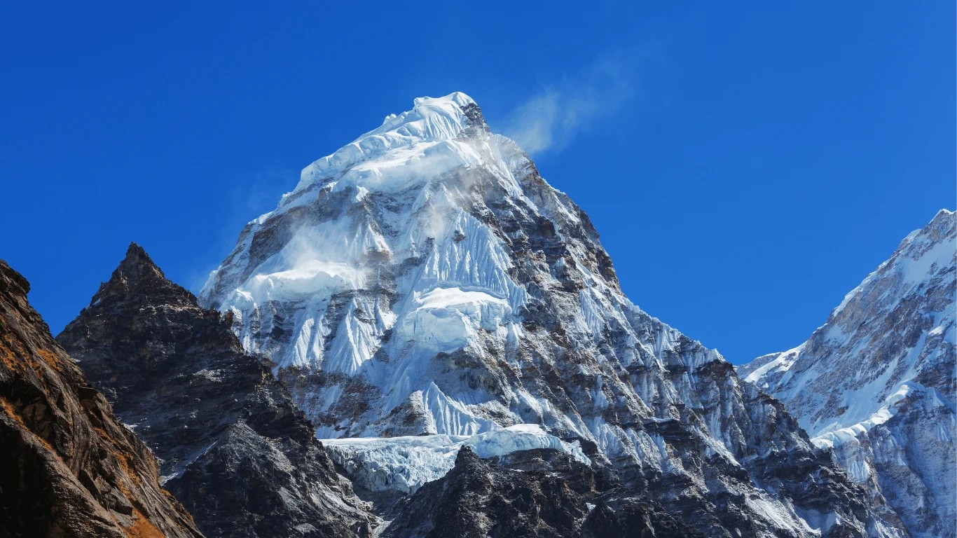
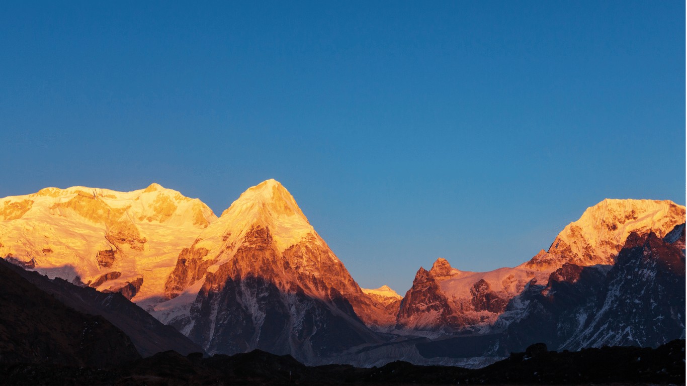
At 8,586 meters (28,169 feet), Mount Kanchenjunga is the third-highest mountain in the world.
Kanchenjunga. Until 1852 it was believed to be the highest mountain in the world. British surveyors of the Great Trigonometrical Survey of India had measured it from the plains, and nothing else they had seen looked higher.
The change came from calculations based on observations made in 1849. They showed that a distant summit in Nepal, labelled only "Peak XV", was higher still. In 1856 the Survey officially announced Peak XV as the highest mountain on Earth (it was named Everest in 1865), and Kanchenjunga dropped to third once K2 in the Karakoram was also measured higher. So for a few decades of the 19th century, Kanchenjunga, the mountain seen every morning from Darjeeling, was thought to be the top of the world.
How Was Kanchenjunga Formed? Geology of the Kanchenjunga Massif
Kanchenjunga was formed the same way as the rest of the Himalayas: by the Indian tectonic plate pushing north into the Eurasian plate, a collision that started around 50 million years ago and is still going on. The pressure folded and stacked layers of rock on top of each other and lifted them kilometres into the sky, which is why the Himalayas, Kanchenjunga included, are called fold mountains.
The massif itself is built mostly of hard metamorphic rock, gneiss and schist that were once buried deep under the surface and changed by heat and pressure, with bands of pale granite pushed up through them. Because the collision has not stopped, the Himalayas are still rising by a few millimetres a year, while ice, rockfall and landslides wear them down at almost the same pace. Trekkers see both sides of this on the trail: fresh landslide scars below Kambachen, and huge glaciers carrying broken rock down from the peaks.
Is K2 the Same as Kanchenjunga?
No. They're two completely different mountains, more than 1,400 km apart, and the confusion probably comes from the names both starting with K and both being among the world's three highest.
K2
Kanchenjunga
Height
8,611m (28,251 ft)
8,586m (28,169 ft)
World ranking
2nd
3rd
Range
Karakoram
Himalaya
Countries
Pakistan and China
Nepal and India
First climbed
1954
1955
Known for
Being one of the hardest 8,000m peaks to climb
Its five summits, and the tradition of not standing on the very top
Where Can You See Kanchenjunga From?
You don't have to climb, or even trek, to see Kanchenjunga. On a clear morning it fills the northern sky from several hill towns.
From India
Most people who have seen Kanchenjunga saw it from the Indian side, where hill stations face it across the valleys.
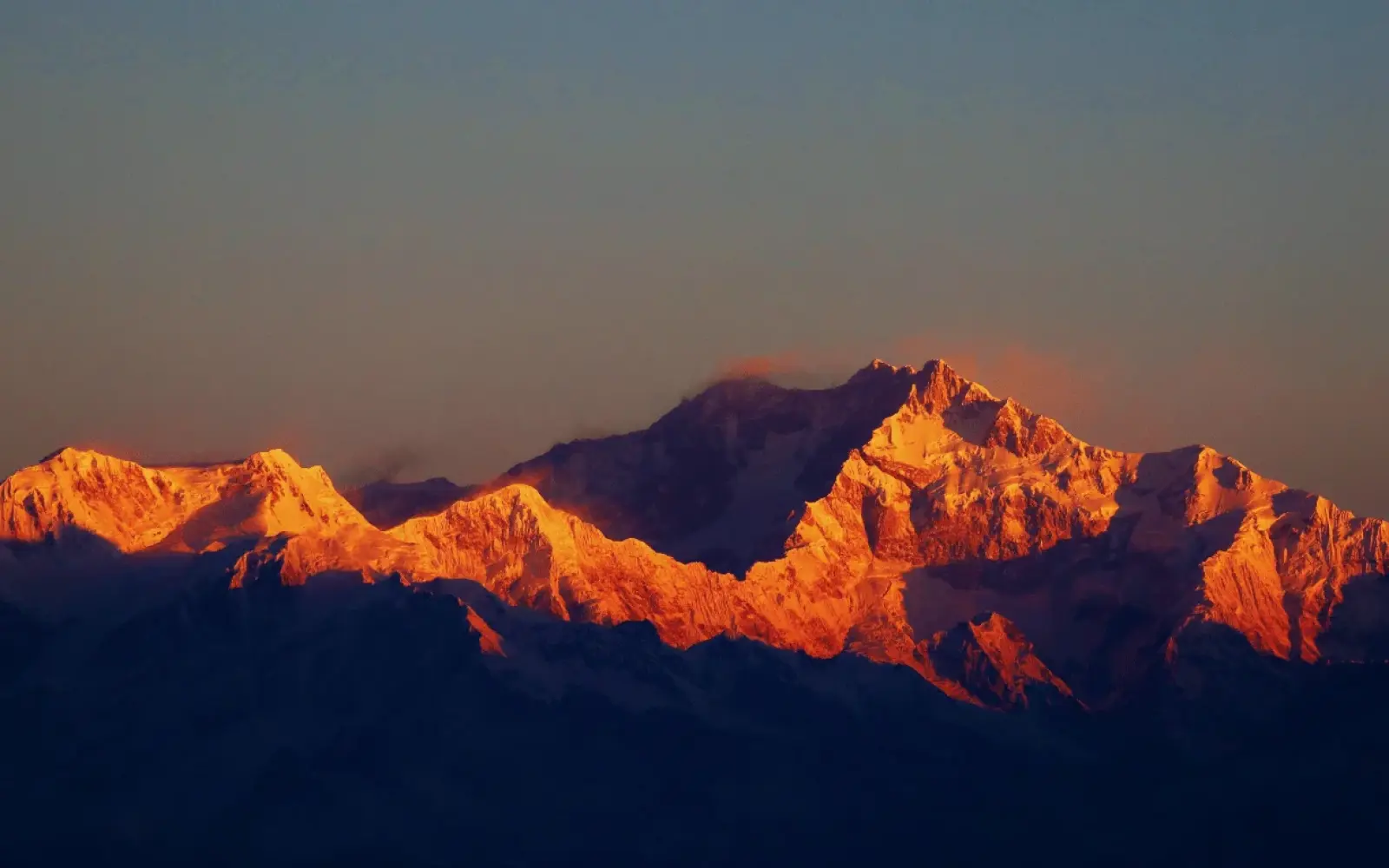
Darjeeling and Tiger Hill: the classic view, especially at sunrise from Tiger Hill, when the snow turns pink and gold.
Sandakphu (3,636m): the highest point in West Bengal, on the Singalila Ridge along the Nepal border, with Kanchenjunga close by and Everest far to the west.
Pelling: in West Sikkim, with one of the closest roadside views of the mountain.
Gangtok: Sikkim's capital, with Kanchenjunga on the north-western skyline on clear days.
Seeing Kanchenjunga From Darjeeling
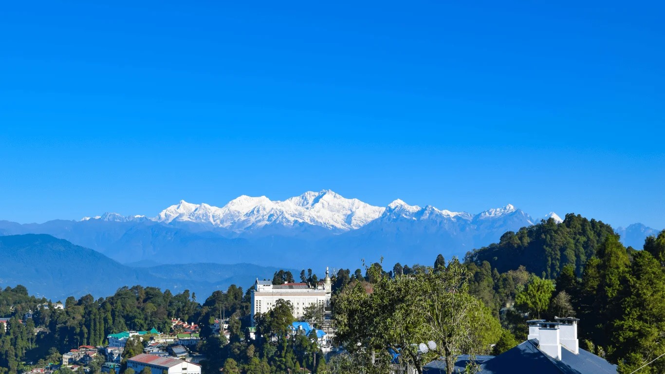
A breathtaking view of Mount Kanchenjunga from India, revealing the majestic beauty of the world’s third-highest mountain at 8,586 meters.
Darjeeling is the most famous place to see Kanchenjunga, because the whole massif rises straight across the valleys to the north, only about 70 km away. The best view is at sunrise from Tiger Hill (2,590m), about 11 km from town: leave at around 4am to get a place before the first light hits the summits. In town, Observatory Hill, the Mall (Chowrasta) and the Batasia Loop also face the mountain.
The clearest months are October to early December and March to April. From June to September the monsoon usually hides it for weeks. Even in good months, cloud tends to build by mid-morning, so the early start really matters.
From Nepal
From Nepal, you see it up close, but only after a long trek into the remote east of the country.
The base camps: Pangpema (north) and Oktang (south) put you at the foot of its huge faces.
Pathibhara Devi Temple, Taplejung: a hilltop pilgrimage site with wide views of the Kanchenjunga range.
Climbers on Everest's summit see it on the eastern horizon, but it's generally not visible from the Kathmandu Valley, which is too far west and blocked by other ranges.
How to Go to Kanchenjunga
There are two ways to get close: trek to its base camps from Nepal, or trek into its foothills from Sikkim in India. Either way, the last part is on foot, and both sides need special permits.
How to Reach Kanchenjunga Base Camp From Nepal
Nepal is the only side where you can trek right to the mountain's base camps.
Kathmandu to eastern Nepal: fly to Bhadrapur or Biratnagar, then drive into the hills to Taplejung, the district headquarters. Some trekkers drive all the way from Kathmandu.
Trek to the North Base Camp (Pangpema, about 5,140m): up the Tamur and Ghunsa valleys, through the Tibetan-influenced village of Ghunsa, to the foot of the north face.
Trek to the South Base Camp (Oktang, about 4,730m): via the Yalung Glacier, with a close view of the south-west face.
Or do both: many trekkers link the two base camps across high passes. The full trek takes about three weeks.
Kanchenjunga is a restricted area in Nepal. You need a special restricted area permit and the Kanchenjunga Conservation Area permit, and you must trek with a licensed guide through a registered agency. Since March 2026, solo trekkers can get the permit, but a guide is still required. Read more in our guide to trekking in Nepal without a guide.
How to Go to Kanchenjunga From India
The best-known trek on the Indian side is the Goecha La trek in West Sikkim, starting from Yuksom and climbing through Khangchendzonga National Park to viewpoints facing the mountain's south-east face. It needs permits from the Sikkim authorities, and the rules differ for Indian and foreign trekkers, so check the current requirements before you go. Shorter options include the Sandakphu trek near Darjeeling.
Can We Climb Kanchenjunga?
Yes, but only as a serious, fully equipped mountaineering expedition, and only from Nepal. This isn't a trek: it's one of the hardest of the world's fourteen 8,000-metre peaks, for experienced high-altitude climbers.
How to Climb Kanchenjunga
There are four main routes to the summit. Three start in Nepal (from the south-west, north-west, and north-east), and the one from Sikkim in India has been closed since India banned expeditions on the mountain in 2000. Most climbers today use the south-west route over the Yalung Face, the line of the 1955 first ascent, or the north-west route from the north base camp. Climbers need a summit permit from Nepal's government, a licensed expedition operator, and previous experience on other high peaks.
Why Climbers Stop Just Short of the Top
When Joe Brown and George Band made the first ascent on 25 May 1955, they stopped a few metres below the true summit, keeping a promise to the Chogyal (king) of Sikkim that the sacred top would remain untouched. Many climbers since have followed the same tradition out of respect.
How Long Does It Take to Climb Kanchenjunga?
A Kanchenjunga expedition usually takes about six to eight weeks: around two weeks to trek in to base camp, several weeks of climbing and acclimatising between the high camps, a summit push that depends on a weather window, and the trek out.
How Much Does It Cost to Climb Kanchenjunga?
A lot. The cost of a guided expedition commonly runs to tens of thousands of US dollars per climber, covering the government summit permit, the restricted area permit, the expedition operator, high-altitude Sherpa support, oxygen, food, equipment, and insurance. The exact figure depends on the operator and the level of support. Trekking to the base camps costs a small fraction of that.
Kanchenjunga Summits and Deaths: How Many People Have Climbed It?
Only around 530 people had stood on Kanchenjunga's main summit by May 2022, and 52 climbers had died on it, roughly one death for every ten successful ascents. Everest, by comparison, had over 12,800 summits and about one death for every 38 by the end of 2024. That makes Kanchenjunga one of the deadliest of the 14 eight-thousanders, behind Annapurna I.
The table puts the two mountains side by side so the difference is easy to see.
Kanchenjunga
Everest
Successful summits
About 532 (to May 2022)
About 12,884 (to Dec 2024)
Deaths
52
About 340
Deaths per summit
About 1 in 10
About 1 in 38
The rate has improved in recent years, as more teams use fixed ropes, oxygen and better forecasts. A few milestones in its climbing history:
1905: Aleister Crowley's expedition made the first serious attempt; an avalanche killed Alexis Pache and three porters.
1955: Joe Brown and George Band made the first ascent, stopping just below the summit.
1977: An Indian Army team made the second ascent, by the north-east spur.
1998: Ginette Harrison became the first woman to reach the top.
Trekkers are a different story. The trekking route to the base camps does not go onto the mountain itself, and its risks are altitude, landslides and weather, not avalanches on the summit slopes.
Why Is Kanchenjunga So Dangerous?
Kanchenjunga has one of the highest death rates among the world's 8,000-metre peaks. Several things make it so serious:
Avalanches: its huge, heavily glaciated faces are prone to avalanches, which have claimed climbers since the first attempts in 1905.
A long, exposed summit day: the final climb is long and high, with little room for error on the way down, when climbers are most exhausted.
Unpredictable weather: it sits at the eastern end of the Nepal Himalaya, where monsoon cloud arrives early and storms build quickly.
Remoteness: it's far from roads and hospitals, and rescue takes longer than on busier peaks.
Fewer climbers: far fewer people attempt it than Everest, so there's less shared support, fewer fixed ropes, and fewer teams nearby to help.
None of this applies to trekking to the base camps, which is demanding because of its length and altitude, but well within reach of fit, experienced trekkers with a good guide.
People of Kanchenjunga: Limbu, Sherpa, Lepcha and Bhutia Communities
Kanchenjunga is not an empty wilderness. Several peoples have lived in its valleys for centuries, and for all of them the mountain is sacred rather than something to conquer.
Limbu (Yakthung) people, Taplejung, Nepal: they call the mountain Sewalungma, "the mountain we offer greetings to", and believe it is home to Yuma Sammang, their ancestral guardian spirit. The lower part of the trek, from Sekathum down to Yamphudin, is Limbu country.
Sherpa and Tibetan-speaking people, Nepal: villages such as Gyabla, Phale and Ghunsa in the upper valley are Buddhist, with gompas, prayer flags and mani walls, and they move their yaks up to the high pastures at Kambachen and Lhonak in summer.
Lepcha people, Sikkim: in Lepcha tradition the first man and woman were made from the snows of Kanchenjunga.
Bhutia people, Sikkim: they honour the mountain as the seat of the guardian deity Dzö-nga. Every year Sikkim celebrates Pang Lhabsol, a festival with masked dances and offerings to the mountain god.
This respect is also why the first climbers in 1955 stopped short of the summit, and why India does not allow climbing on its side of the mountain.
Flora and Fauna of the Kanchenjunga Region
The land around Kanchenjunga drops from 8,586m to under 1,200m within a few days' walk, so it holds an unusual range of life, from subtropical forest to glacier. In Nepal, the Kanchenjunga Conservation Area records around 158 bird species and over 30 mammal species.
Snow leopard: the upper Ghunsa valley around Kambachen and Lhonak is one of the best snow leopard habitats in Nepal. Sightings are rare, but paw prints in fresh snow are not.
Red panda: lives in the bamboo and rhododendron forest of the middle valleys.
Himalayan black bear, musk deer and blue sheep: blue sheep (bharal) graze on the open slopes near Ramche and Lhonak.
Birds: the Himalayan monal (Danphe), Nepal's national bird, and the blood pheasant live in the forests and meadows.
Plants: dense forests of rhododendron, oak, fir, juniper and birch; in April the rhododendrons between Amjilosa and Ghunsa and below Tseram turn whole hillsides red and pink.
Kanchenjunga in Different Languages
The mountain has a different name in almost every language spoken around it, and all of them point to the same peak. The table shows the most common ones.
Language
Name
English
Kanchenjunga / Kangchenjunga
Nepali
कञ्चनजङ्घा (Kanchanjangha)
Hindi
कंचनजंगा (Kanchenjunga)
Bengali
কাঞ্চনজঙ্ঘা (Kanchanjangha)
Tibetan
གངས་ཆེན་མཛོད་ལྔ (Kangchen Dzönga)
Sikkimese usage
Khangchendzonga
Limbu
Sewalungma
Conservation and Rules in the Kanchenjunga Region
Both sides of the mountain are protected, and both are run with an eye on local people as well as wildlife.
On the Nepal side, the Kanchenjunga Conservation Area covers 2,035 square km of Taplejung. It was declared in the late 1990s, and in 2006 its management was handed over to a council of local communities, the first conservation area in Nepal run this way. Trekkers pay a conservation area fee, the area is a restricted zone that needs a special permit and a licensed guide, and lodges in the upper valley work with the council on rubbish and firewood rules.
On the Indian side, Khangchendzonga National Park has been a UNESCO World Heritage Site since 2016 for both its nature and its sacred landscape, and it sits inside the Khangchendzonga Biosphere Reserve. The three countries around the mountain, Nepal, India and Bhutan, also cooperate on the wider Kangchenjunga Landscape, a cross-border conservation programme supported by ICIMOD.
Kanchenjunga FAQs
These short answers cover the other questions people search for about the mountain.
What Is the Highest Mountain in Nepal?
Mount Everest (8,848.86m / 29,031.7ft) is the highest mountain in Nepal and in the world. Kanchenjunga is Nepal's second-highest mountain and the highest in the far east of the country.
What Is the Tallest Peak in the Himalayas?
Everest is the tallest peak in the Himalayas. Kanchenjunga is the second-tallest Himalayan peak, because K2, the world's second-highest, is in the Karakoram range, not the Himalayas.
Is Kanchenjunga in the Himalayas?
Yes. It is in the eastern Himalayas, in the section called the Kanchenjunga Himal, and like the rest of the range it was formed by the Indian plate pushing into Asia, which is why geographers class it as a fold mountain.
Can You See Kanchenjunga From Kathmandu?
No. Kathmandu is around 300 km to the west, and other ranges block the view. You can see it from the window on the flight from Kathmandu to Bhadrapur or Biratnagar, from Darjeeling and Sikkim in India, and from the trail in eastern Nepal.
Can Tourists Visit Kanchenjunga?
Yes, as trekkers. Tourists can walk to the north base camp (Pangpema, 5,143m) and the south base camp (Oktang, 4,740m) in Nepal with a restricted area permit and a licensed guide, or see it on the Goecha La and Sandakphu treks in India. Climbing to the summit is only for expedition mountaineers.
Can I Trek Alone to Kanchenjunga Base Camp?
You can book as a solo traveller since March 2026, but you cannot walk without a guide. Kanchenjunga is a restricted area, and Nepal's rules still require a licensed guide arranged through a registered agency.
Which Country Is Kanchenjunga In?
Kanchenjunga is in two countries, Nepal and India. Its main summit stands on the border between Nepal's Taplejung district and India's state of Sikkim.
Is Kanchenjunga Taller Than Everest?
No. Everest (8,848.86m) is about 263m higher than Kanchenjunga (8,586m). Kanchenjunga was only believed to be taller until 1852.
Why Is Kanchenjunga Called the "Five Treasures of Snow"?
Because of its five summits. In Tibetan, Kang-chen-dzö-nga means "five treasures of the great snow", and local belief links each summit to a treasure such as gold, salt, precious stones, holy books and grain.
Is Kanchenjunga Still Growing?
Very slowly. The Indian plate is still pushing into Asia, so the Himalayas, Kanchenjunga included, are rising by a few millimetres a year, though erosion takes away almost as much.
Which Is the Nearest Airport to Kanchenjunga?
In Nepal, the nearest airports are Bhadrapur and Biratnagar, both a long drive from Taplejung, where the trek begins. In India, the nearest airports are Bagdogra in West Bengal and Pakyong in Sikkim.
How Long Does It Take to Trek to Kanchenjunga Base Camp?
About 16–17 days for the north base camp only, and about three weeks (our itinerary is 22 days, Kathmandu to Kathmandu) to visit both the north and south base camps.
Final Thoughts: Where Kanchenjunga Is, and Why It Matters
Kanchenjunga stands where Nepal meets India's Sikkim, at the eastern end of the Nepal Himalaya, 8,586m above the sea. It is the third-highest mountain on Earth, the highest mountain in the land India controls, and once believed to be the highest of all. To the Limbu, Lepcha, Bhutia and Sherpa people around it, it is not a summit to be conquered but a guardian to be respected.
For most people it is a white wall on the Darjeeling skyline. For the few hundred trekkers a year who walk to its base camps from Taplejung, it is something closer and quieter: three weeks in one of the least visited corners of the Himalaya, with the mountain growing bigger every day.
Trek to Kanchenjunga With Us
Our guides have led many groups to Kanchenjunga's base camps, one of the wildest and least crowded treks in Nepal. Because it's a restricted area, you'll need a licensed guide and a registered agency, and we handle the permits, lodges, and transport from Kathmandu to Taplejung and back. Message Bibek on WhatsApp (+977 9700937981) to plan your Kanchenjunga trek, or to ask anything about the mountain.
See the full day-by-day plan, costs and best seasons on our Kanchenjunga Base Camp Trek page: 22 days from Kathmandu to Pangpema and Oktang, linked by three high passes.
Written by
Bibek Dhamala
Founder & Trekking Guide
Bibek Dhamala is the CEO of Majestic Trails Nepal, a locally operated trekking company based in Thamel, Kathmandu. With a background in trekking and mountain guiding, he understands the challenges of Himalayan adventures and the importance of responsible tourism, experienced local guides, and personalized service. Through Majestic Trails Nepal, Bibek aims to help trekkers explore Nepal’s Himalayas safely and authentically, from Everest Base Camp and the Annapurna region to the remote trails of Manaslu. He is passionate about supporting local communities, creating meaningful trekking experiences, and sharing the natural and cultural beauty of Nepal with travelers from around the world.
Related Travel Blogs
Join our Newsletter
Sign up to stay updated with latest offers, recent events and more news.