
Kalapathar – The Best Viewpoint of Mount Everest
20 Feb 2026
Kalapathar stands at 5,545 meters (18,192 feet) as the highest accessible viewpoint on the Everest Base Camp trek and arguably the most spectacular pa...

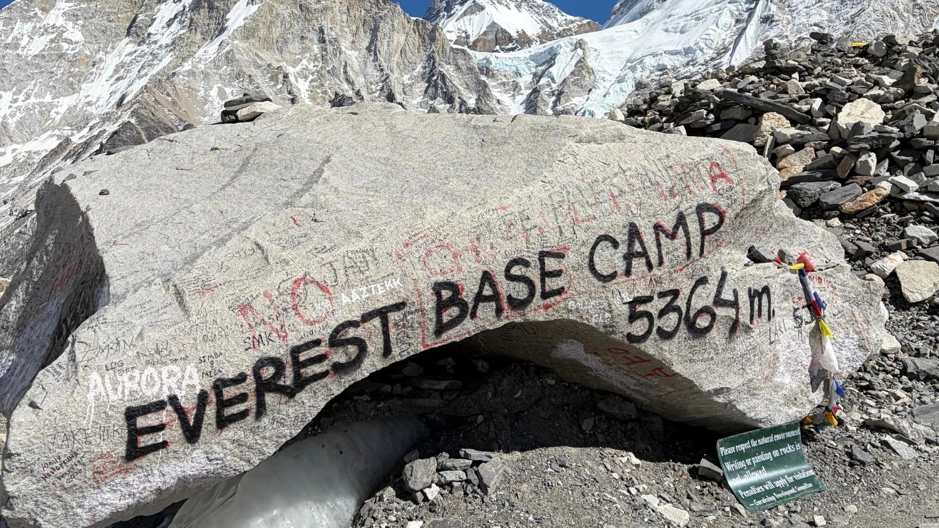
Everest Base Camp in Nepal sits at 5,364 meters above sea level, which converts to 17,598 feet. That is the number you will find on official trekking permits, topographic maps, and every reputable guide service operating in the Khumbu region.
What that number does not tell you is that the camp sits on a living glacier. The Khumbu Glacier moves, thins, and shifts throughout the year, which means the physical surface of base camp is never quite static. The 5,364 meter figure is the surveyed reference point. Your GPS at camp may read 5,358 or 5,371 depending on the season and the ice conditions underfoot. That is not an error; it is the glacier.
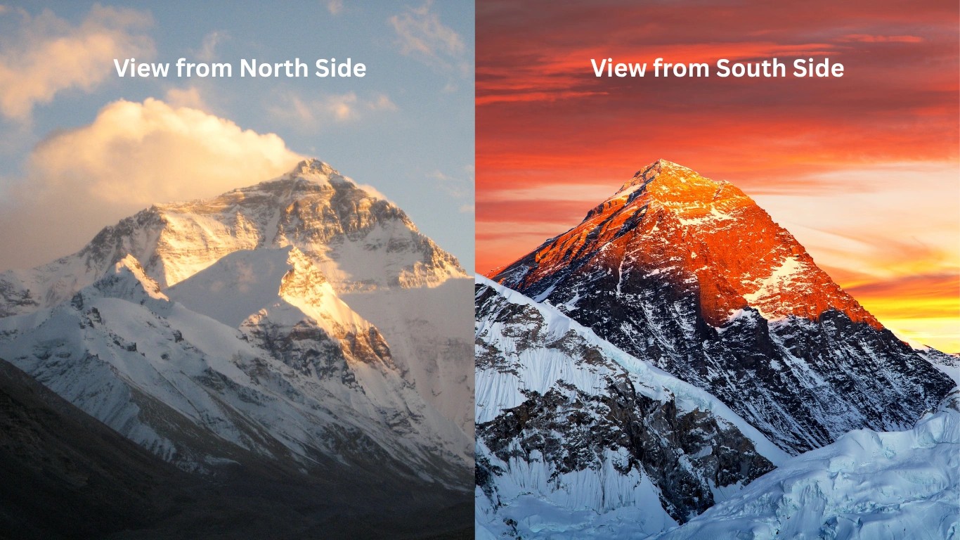
There are two base camps on Everest, and they are not the same place.
South Base Camp in Nepal sits at 5,364 meters (17,598 feet). This is the one most people mean when they ask about EBC height, elevation or altitude. You walk to it over 9 to 10 days from Lukla, through some of the most dramatic valley terrain on Earth.
North Base Camp in Tibet sits at 5,150 meters (16,900 feet). A paved road runs directly to it from China. You can drive there in a day, which sounds convenient until you understand what arriving at 5,150 meters by vehicle does to a body that has not had time to acclimatize.
Everest Base Camp represents the quintessential foundational staging point for high-altitude expeditions within the formidable Himalaya mountain range.
Everest Base Camp is not one place. It is two, on opposite sides of the same mountain, separated by an international border and about 214 meters of elevation. For elite mountaineers, it stands as the absolute logistical gateway for grueling summit attempts; for global trekkers, it represents one of the premier long-distance trekking destinations in the world.
Furthermore, the title of Everest Base Camp (EBC) refers to two separate campsites located at the base of Mount Everest on opposite sides of the mountain. These rudimentary campsites serve as vital staging areas and crucial acclimatization hubs for mountaineers attempting to summit Everest, and they remain celebrated, world-famous destinations for high-altitude hikers.
The two Everest Base Camps are located on opposite sides of the mountain. One lies in Nepal and the other in Tibet (China), offering different routes, landscapes, and experiences. While both camps provide incredible views of Mount Everest, the journey to reach them is quite different. Here's a closer look at each base camp and what makes it unique.
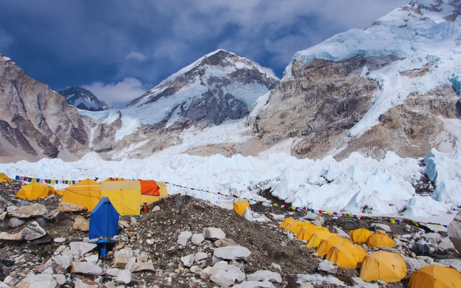
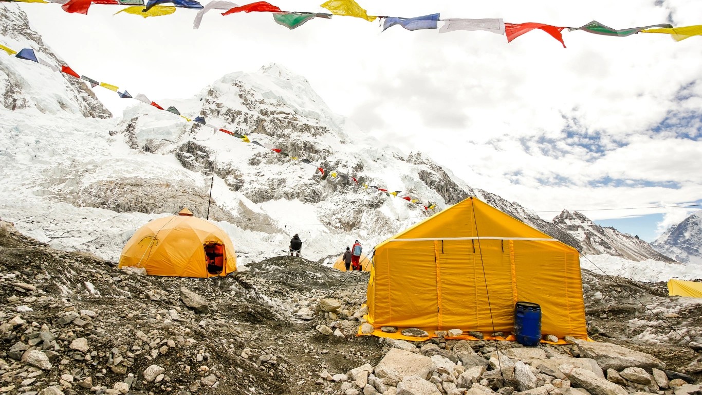
Situated at a dizzying altitude of 5,364 meters (17,598 feet), South Everest BC is indisputably the more popular trekking destination. South Base Camp (Nepal) is located entirely within the Solukhumbu District of Nepal, tucked deep inside the fiercely protected boundaries of Sagarmatha National Park, a UNESCO World Heritage Site. According to official reports and research about Everest Base Camp, this barren glacial landscape undergoes a magical metamorphosis as winter thaws.
During the spring climbing season, it transforms into a bustling "tent city" for hundreds of climbers, guides, and support staff, turning the silent ice into a vibrant hive of human ambition.
Perched at an elevation of 5,150 meters (16,900 feet), this camp is situated on the northern side of the mountain. Unlike the South Base Camp, which requires days of grueling trekking through labyrinthine mountain trails, the North camp can be accessed directly by a paved road. The rapid ascent presents a unique, perilous challenge for acclimatization compared to the gradual, foot-powered journey through Nepal.
The exact height of Mount Everest Base Camp depends on which side of the mountain you are visiting:
The Everest Base Camp (South) in Nepal sits at an exact altitude of 5,364 meters (17,598 feet) above sea level. The precise height of Everest Base Camp on the Nepal side is measured at 5,364 meters above sea level, and this specific measurement converts to an absolute height of 17,598 feet.
The physical terrain of the camp rests on the lateral moraine of the Khumbu Glacier. Because glacial ice moves, thins, and shifts continuously throughout the year, the exact physical elevation varies by several meters depending on seasonal ice movement. However, the international trekking industry, global navigation systems, and topographical mapping programs maintain the official standard reference point of 5,364 meters.
When comparing this altitude to global geographical landmarks, the altitude of Everest Base Camp exceeds the summits of most major mountain peaks outside of Asia:
Trekkers resting at this historical staging area are positioned more than 3.3 vertical miles above sea level, occupying an alpine microclimate that demands careful, calculated physiological acclimatization.
The geography of Mount Everest includes two distinct base camps positioned on opposite sides of the international border between Nepal and China. Understanding the altitude and logistical differences between these two destinations is essential for accurate trip planning.
Comparing the Everest Base Camp (EBC) in Tibet to the one in Nepal reveals major differences in altitude, terrain, and how you get there. The Tibet (North) Base Camp sits slightly lower at 5,150 meters (16,900 ft), whereas the Nepal (South) Base Camp is higher at 5,364 meters (17,598 ft).
The South Everest Base Camp (EBC) in Nepal sits at an altitude of 5,364 meters (17,598 feet) above sea level on the lateral moraine of the Khumbu Glacier
The southern staging area demands a classic, multi-day pedestrian pilgrimage. Because this perimeter sits directly on a hyper-dynamic ice mass, the physical landscape is a shifting matrix of seracs and crevasses.
In absolute contrast, the northern alternative sits on stable gravel beds nestled inside the Rongbuk Valley. While it rests at a lower baseline than its Nepalese counterpart, the logistical ease of vehicular transport introduces a hidden physiological risk.
Ascending rapidly by car via China National Highway 318 eliminates the natural, gradual acclimatization process, making the sudden barometric drop a swift and grueling test of physical endurance if proper high-altitude staging is ignored.
The table below breaks down the key stops along the classic Everest Base Camp Route, organized from the lowest trail points to the ultimate Himalayan peak:
| Landmark Trail Station | Elevation in Meters | Elevation in Feet | Elevation in Kilometers |
| Kala Patthar Viewpoint | 5,545 m | 18,192 ft | 5.545 km |
| Everest South Base Camp (Nepal) | 5,364 m | 17,598 ft | 5.364 km |
| Gorak Shep Flat Field | 5,164 m | 16,942 ft | 5.164 km |
| Everest North Base Camp (Tibet) | 5,150 m | 16,900 ft | 5.150 km |
| Lobuche | 4,940 m | 16,207 ft | 4.940 km |
| Dingboche Valley Hub | 4,410 m | 14,468 ft | 4.410 km |
| Tengboche Monastery | 3,860 m | 12,664 ft | 3.860 km |
| Namche Bazaar Sherpa Capital | 3,440 m | 11,290 ft | 3.440 km |
| Lukla Airport Trailhead | 2,860 m | 9,383 ft | 2.860 km |
The official altitude of the South Everest Base Camp (Nepal) is exactly 5,364 meters (17,598 feet) above sea level. Measured across standard horizontal and vertical global positioning units, this elevation translates to roughly 5.364 kilometers or 3.333 miles directly up into the sky.
| Base Camp Location | Meters (m) | Feet (ft) | Kilometers (km) | Miles (mi) |
| South Base Camp (Nepal) | 5,364 | 17,598 | 5.364 | 3.333 |
| North Base Camp (Tibet) | 5,150 | 16,900 | 5.150 | 3.200 |
The Everest Base Camp trek height increases over an extended multi-day walking timeline, initiating a stark physiological transition as the trail penetrates the upper troposphere. The journey begins with a high-altitude flight landing at Lukla Airport, which is located at an elevation of 2,860 meters.
The net mathematical elevation gain between Lukla and the final camp is 2,504 meters. However, the Everest Base Camp trek total elevation gain is substantially higher due to the undulating layout of the trail. The mountain path frequently descends into deep river canyons before climbing steep ridges, generating a cumulative elevation gain of 3,500 to 4,000 meters over the course of the ascent.
This classic Everest Base Camp route tracks across a grueling 130 km (80 miles) round-trip circuit. Voyagers typically battle the thinning atmosphere for 10 to 15 km daily, enduring 5 to 7 hours of demanding physical exertion per shift.
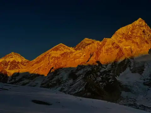
Spanning an arduous 12–14 days, the itinerary strategically weaves in essential acclimatization pauses to ward off acute mountain sickness (hypoxia), tracing a relentless upward trajectory from Lukla (2,860m) to the frozen world of EBC (5,364m), before finally peaking at the dizzying, panoramic crest of Kala Patthar (5,545m).
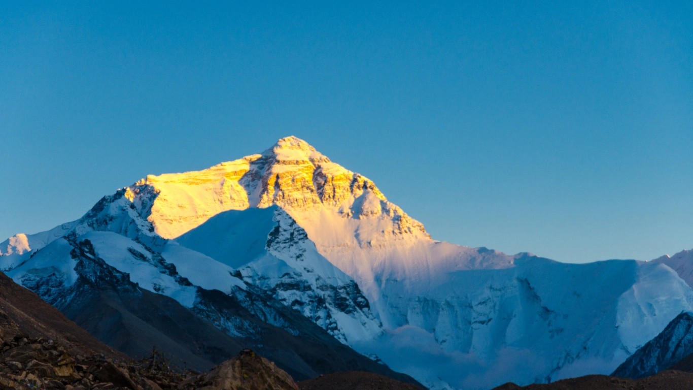
The Kala Patthar Viewpoint is the highest and most iconic altitude point you reach on the classic Everest Base Camp trek. Situated at an elevation of about 5,545 meters (18,192 feet) to 5,644 meters (18,517 feet), depending on the measurement, it towers above the settlement of Gorak Shep.
Selecting an international trekking goal requires comparing the specific altitude profiles and physical demands of popular routes.
Mount Kilimanjaro’s summit is higher than both Everest Base Camps. The peak of Kilimanjaro stands at 5,895 meters (19,341 feet), which is 531 meters higher than Everest South Base Camp in Nepal and 745 meters higher than Everest North Base Camp in Tibet.
| Elevation Metric | Mount Kilimanjaro (Summit) | Everest South Base Camp (Nepal) | Everest North Base Camp (Tibet) |
|---|---|---|---|
| Official Altitude | 5,895 m (19,341 ft) | 5,364 m (17,598 ft) | 5,150 m (16,900 ft) |
| Oxygen Level | 49% of sea level | 53% of sea level | 55% of sea level |
| Destination Type | Mountain Summit | Glacial Base Camp | Plateau Base Camp |
| Maximum Trek Altitude | 5,895 m (Uhuru Peak) | 5,545 m (Kala Patthar) | 5,150 m |
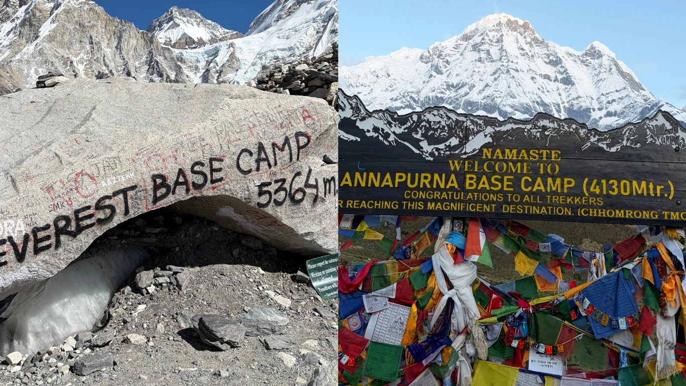
Everest Base Camp, Annapurna Circuit/Base Camp, and Manaslu offer vastly different trekking options and elevation profiles. While Everest Base Camp is an out-and-back trek to a high-altitude glacial basin, Annapurna and Manaslu are legendary loop circuits that cross high mountain passes.
The Annapurna Base Camp Trek targets a maximum altitude of 4,130 meters, making it a shorter, warmer, and physically easier option with a significantly lower risk of altitude sickness. The Annapurna Circuit is slightly higher than Base Camp of EBC, which is at an elevation of 5,416 meters.
The Manaslu Circuit Trek enters a remote wilderness area that tops out at 5,160 meters at the crest of the Larke La Pass.
| Feature | Everest Base Camp (EBC) | Annapurna Circuit / ABC |
|---|---|---|
| Max Elevation | 5,364 m / 5,545 m | 5,416 m / 4,130 m |
| Trek Type | Out-and-back | Circuit / Valley Trek |
| Crowd Level | High | Moderate to High |
| Guide Rules | Independent allowed | Partially independent |
| Accommodations | Luxury to standard tea houses | Well-developed tea houses |
| Feature | Manaslu Circuit |
|---|---|
| Max Elevation | 5,106 m |
| Trek Type | Circuit Loop |
| Crowd Level | Low |
| Guide Rules | Guide mandatory |
| Accommodations | Basic tea houses |
The core challenge of high-altitude travel is the change in atmospheric physics. As altitude increases, the absolute percentage of oxygen molecules in the air remains fixed at roughly 21%, but the drop in barometric pressure spreads these air molecules further apart.
At sea level, the standard barometric pressure registers at 1,013 millibars, delivering 100% oxygen density to the lungs. At the Nepal Everest Base Camp height of 5,364 meters, the atmospheric pressure drops to approximately 540 millibars. This reduction means each breath draws in exactly 50% of the oxygen volume available at sea level, requiring your heart and lungs to work twice as hard to sustain normal blood oxygen saturation levels.
5,364 meters is the number. Now you know what it means, how it feels at the physiological level, and what the trail looks like getting there.
If you are at the stage of actually booking, Majestic Trails Nepal runs guided treks to Everest Base Camp with itineraries built around proper acclimatization schedules and local Sherpa guides from the Khumbu region. You can reach out to them directly to ask about dates, group sizes, permits, and costs.
For most people, the next step after reading is comparing itineraries and asking questions. That is exactly what the team is there for.
Everest Base Camp (South) in Nepal sits at an official altitude of 5,364 meters (17,598 feet) above sea level. If you look at the alternative route, the North Base Camp in Tibet actually sits slightly lower, resting at approximately 5,150 meters (16,900 feet).
Everest Base Camp actually sits at two completely different heights depending on which side of the mountain you visit. If you are trekking the classic South Base Camp route in Nepal, you will reach an altitude of 17,598 feet (5,364 meters).
On the other hand, if you visit the North Base Camp over in Tibet, it sits slightly lower at 16,900 feet (5,150 meters).
The net elevation gain from the airport at Lukla to base camp is 2,504 meters. However, because the trail climbs over ridges and drops into river valleys, the cumulative elevation gain adds up to between 3,500 and 4,000 meters.
A primary question for aspiring hikers is whether beginners can successfully complete the journey to an altitude of 5,364 meters. The Everest Base Camp trek is classified as moderate to strenuous.
No technical skills are required. No crampons, no ice axe, no rope work on the standard route. The trail to base camp is a walking trail, and a well maintained one for most of its length.
The standard Everest Base Camp trek takes 12 to 14 days round-trip from Kathmandu, which includes 9 to 10 days to hike up to Base Camp and 3 to 4 days to descend. This duration incorporates mandatory acclimatization days to prevent altitude sickness.
At Everest Base Camp (5,364 meters / 17,598 feet), the atmospheric pressure is much lower than at sea level. While the air still contains about 21% oxygen, the reduced pressure means there is only about 50% of the oxygen available to your lungs and bloodstream compared to sea level.
The atmospheric pressure drops to 540 millibars, requiring a slow trekking pace so your body can adapt.
Nepal. The South Base Camp sits at 5,364 meters (17,598 feet). The North Base Camp in Tibet sits at 5,200 meters (17,060 feet). That is a 164 meter difference.
The elevation gap is real but it is not the most interesting difference between the two camps. What actually separates them is how you arrive. The Nepal side requires 9 to 10 days of walking through the Khumbu Valley. The Tibet side has a paved road running directly to camp, meaning you can drive up from lower Tibetan towns in a single day.
Technically, no. The medical classification for extreme altitude begins at 5,500 meters. EBC at 5,364 meters sits in the very high altitude category, 136 meters below that threshold.
But that classification gap does not mean your body treats it casually. Above 5,000 meters, virtually everyone experiences some physiological effect, whether that is a persistent headache, broken sleep, reduced appetite, or a noticeable drop in energy. The human body was not designed to live at this elevation. It adapts, given time, but it does not feel at home.
No. Oxygen tanks are for climbers going above 7,000 meters on the mountain itself, not for trekkers walking to base camp.
Your body handles 5,364 meters better than most people expect, provided you give it enough time to adjust. That is the whole point of the 12 to 14 day itinerary. The acclimatization days at Namche Bazaar and Dingboche are not rest days in the tourist sense. They are the days your blood is quietly doing the work, producing extra red blood cells to carry more oxygen per breath.
Some trekkers carry a small pulse oximeter to check their blood oxygen saturation along the way. That is a reasonable thing to pack. An oxygen cylinder is not.
Kalapathar stands at 5,545 meters (18,192 feet) as the highest accessible viewpoint on the Everest Base Camp trek and arguably the most spectacular pa...

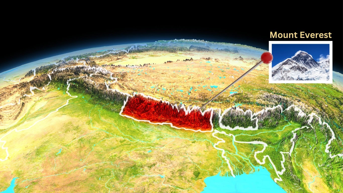
Mount Everest belongs to both Nepal and China, as the international boundary line runs directly across its summit point. The southern slope of the mou...
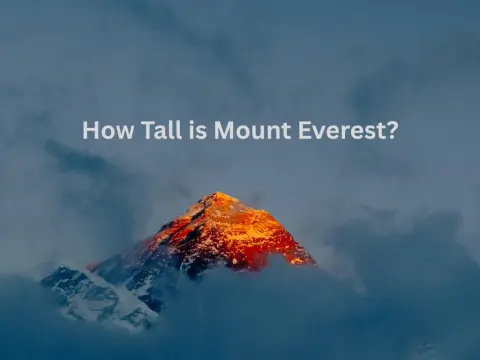
Mount Everest is 8,848.86 meters tall. That is 29,031.7 feet, or roughly 5.5 miles straight up from the ocean's average surface. Nepal and China joint...
