
Thupten Chholing Monastery, Solu-Khumbu: History, Culture & Festivals
15 Jan 2026
Situated in the peaceful Solu-Khumbu region of Nepal, near the village of Junbesi, Thupten Chholing Monastery is a living testament to Tibetan Buddhis...

After more than fifteen years of leading trekkers across Thorong La Pass, we have witnessed everything this mountain crossing can deliver—perfect bluebird mornings where the Annapurna range glows pink at sunrise, sudden whiteout conditions that force emergency retreats, and countless moments of triumph when exhausted trekkers finally touch the prayer flags at 5,416 meters (17,769 feet).
This guide represents everything we have learned through direct experience. Not theory from guidebooks, but real knowledge earned through hundreds of crossings, emergency evacuations, difficult decisions at 4:00 AM, and the privilege of helping thousands of trekkers achieve one of the Himalaya's most iconic high-altitude challenges.
Thorong La Pass is recognized by the Nepal Tourism Board as one of Nepal's premier high-altitude trekking destinations, drawing adventurers from around the world to test themselves against thin air and steep terrain. At Majestic Trails Nepal, we believe that proper preparation and honest information matter more than motivation alone. This crossing rewards those who respect it and humbles those who underestimate it.
Everything written here comes from our direct field experience. We share it because we want you to cross safely, successfully, and with full understanding of what lies ahead.
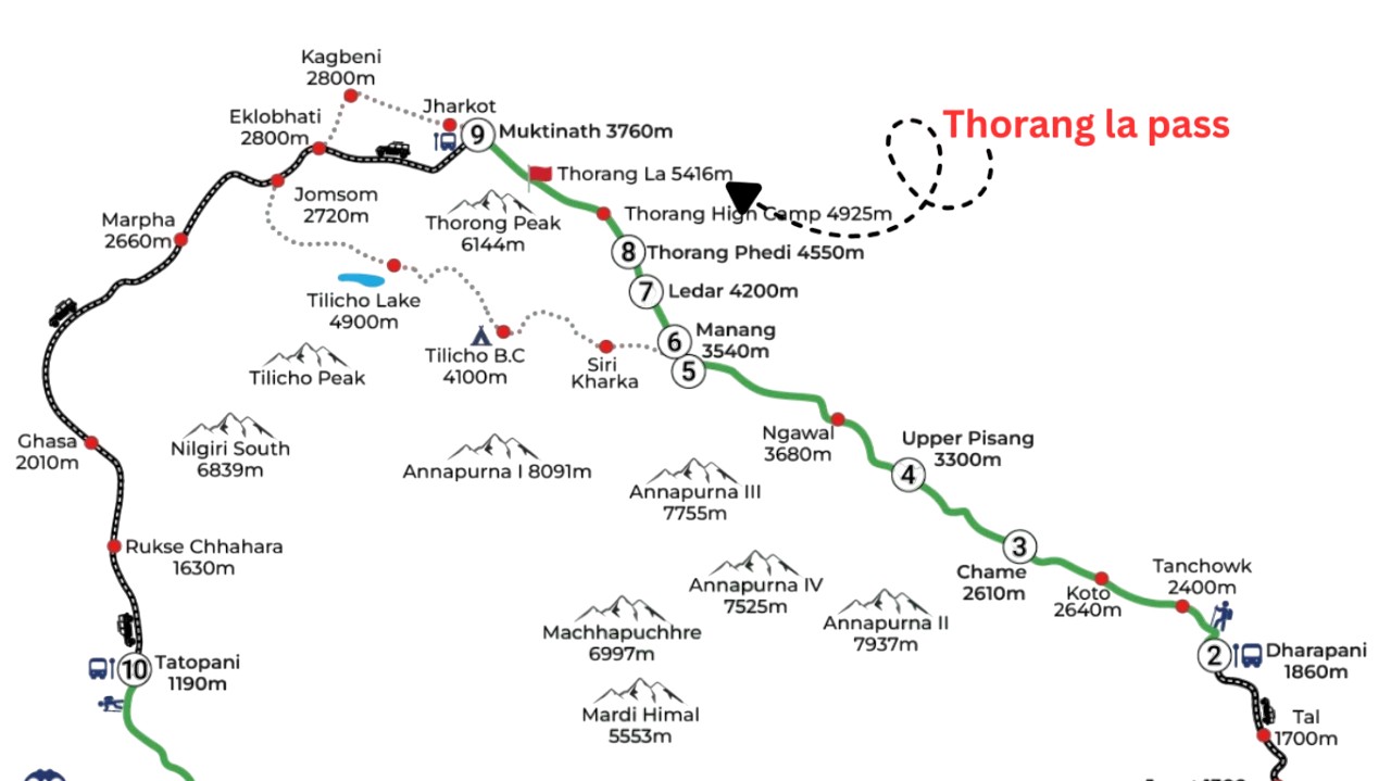
Thorong La Pass sits in the Annapurna Conservation Area of north-central Nepal, serving as the geographic and emotional climax of the Annapurna Circuit Trek. The pass marks the boundary between Manang District to the east and Mustang District to the west, creating a natural gateway between two dramatically different Himalayan landscapes.
Approaching from the Manang side, you trek through increasingly barren terrain—the lush forests and terraced villages of lower elevations give way to rocky moonscapes and sparse vegetation. After crossing, you descend into the sacred Mustang region, eventually reaching the ancient pilgrimage site of Muktinath Temple.
The pass itself occupies a notch in the ridge connecting the Annapurna massif to the north and the Chulu peaks to the south. On clear days, the views encompass some of Nepal's most dramatic mountain scenery, though we must be honest: many trekkers are so focused on breathing and moving forward that they barely register the panorama until reaching the summit.
Understanding this geographic context matters because it explains why Thorong La cannot be avoided on the classic circuit. There is no alternative route. Every trekker completing the complete Annapurna Circuit adventure must cross this pass or turn back.
Thorong La Pass stands at 5,416 meters (17,769 feet) above sea level. This makes it one of the highest trekking passes in the world that requires no technical climbing skills—a distinction that attracts thousands of adventurers annually but also creates dangerous misconceptions about difficulty.
To put this Thorong La Pass height in meters and feet in perspective: you are standing higher than any point in the European Alps, higher than Mount Blanc (4,809m/15,778ft), higher than any peak in the contiguous United States. The air contains roughly 50% of the oxygen available at sea level.
Based on our observations guiding hundreds of clients:
At rest, most acclimatized trekkers feel relatively normal but notice deeper breathing. Simple tasks like tying boots or organizing a backpack require more concentration than expected.
While walking, even fit trekkers must adopt a slow, rhythmic pace. What would feel like a casual stroll at sea level becomes a focused effort. Speaking full sentences while moving becomes difficult, and most trekkers communicate in short phrases.
During exertion (climbing steeper sections), heart rates spike dramatically. We regularly see fit individuals whose heart rates exceed 150 beats per minute during sustained uphill sections. Rest stops every 15-20 steps become necessary for most people.
The Thorong La Pass elevation affects everyone differently, but everyone is affected. We have guided elite marathon runners who struggled terribly and seen moderately fit middle-aged trekkers cruise steadily to the top. Genetics, hydration, sleep quality, and mental attitude all influence individual responses.
What we tell every client: respect the altitude completely. Your fitness matters less here than your humility.
The Thorong La Pass difficulty stems from multiple factors combining simultaneously. Any single element would be manageable; together, they create the most demanding day most trekkers will ever experience.
Starting from Thorong Phedi (4,540m/14,895ft), you face approximately 900 meters (2,953 feet) of elevation gain followed by 1,600 meters (5,249 feet) of descent—all in a single day. Total walking time ranges from 8-12 hours depending on fitness and conditions. Starting from High Camp (4,880m/16,010ft) reduces the ascent by roughly 340 meters (1,115 feet) but still leaves a monumentally long day ahead.
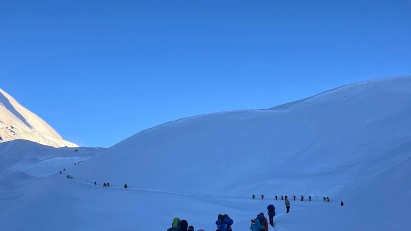
Waking at 3:30 AM after sleeping poorly at altitude (almost everyone sleeps poorly above 4,500m/14,764ft) means beginning the hardest day of your trek already fatigued. The darkness, cold temperatures often reaching -15°C to -20°C (5°F to -4°F), and disorientation of headlamp trekking add psychological stress.
Movements that feel effortless at lower elevations become laborious. Your body craves oxygen that simply isn't available. Mental clarity decreases, reaction times slow, and emotional resilience diminishes. We have seen experienced trekkers break down crying from frustration—not weakness, but a physiological response to extreme oxygen deprivation.
Thorong La weather is notoriously unpredictable and potentially dangerous. Mornings typically offer calmer conditions, but by late morning winds often intensify dramatically. We have experienced gusts exceeding 80 kilometers per hour (50 mph) that made forward progress nearly impossible. Snow can arrive suddenly even in peak season. This is why timing matters critically.
Every step toward the pass takes you further from safety. If you experience altitude sickness symptoms near the top, descent becomes your only option—and descending means either continuing over the pass (still far away) or retreating all the way down (losing the entire crossing). This psychological pressure weighs heavily, even subconsciously.
We share these realities not to discourage but to ensure proper mental preparation. Crossing Thorong La is absolutely achievable for prepared trekkers. But underestimating the challenge creates dangerous situations.
For those planning their Annapurna Circuit trekking experience, understanding these challenges in advance makes all the difference.
One of the most consequential decisions of your Annapurna Circuit happens the afternoon before your crossing: should you sleep at Thorong Phedi or continue to Thorong High Camp? This choice significantly impacts your summit day experience and potentially your success.
| Location | Elevation (Meters) | Elevation (Feet) |
|---|---|---|
| Thorong Phedi | 4,540m | 14,895ft |
| Thorong High Camp | 4,880m | 16,010ft |
| Difference | 340m | 1,115ft |
This 340-meter (1,115-foot) difference may seem modest on paper, but at these elevations, every hundred meters matters substantially. The oxygen availability at High Camp is measurably lower than at Phedi, and this difference affects sleep quality dramatically.
Thorong Phedi offers approximately five teahouses with reasonable capacity and slightly better facilities. Competition among lodges keeps standards relatively consistent, and you have options if one establishment is full or unappealing.
Thorong High Camp has only one lodge operation, with a maximum capacity of roughly 300-400 trekkers in dormitory-style accommodation. During peak season (October-November especially), this single property becomes extremely crowded. We have seen trekkers sleeping in dining rooms, hallways, and any available floor space.
Here is the honest truth most blogs don't mention: almost nobody sleeps well at High Camp. The combination of altitude, crowding, noise from hundreds of trekkers preparing simultaneously at 4:00 AM, and anxiety about the coming day results in minimal rest for most people.
At Thorong Phedi, sleep quality is still compromised by altitude, but the difference is noticeable. Many trekkers report getting 4-5 hours of fragmented sleep at Phedi versus 2-3 hours or less at High Camp.
Sleeping at High Camp saves approximately one hour of walking the following morning—one hour of uphill effort in darkness and cold that you instead complete the previous afternoon in daylight. This is a genuine advantage.
The walk from Phedi to High Camp takes 1-2 hours depending on pace and involves steep switchbacks that feel challenging with a full pack after an already long day.
At Majestic Trails Nepal, we follow a careful assessment process:
At Thorong Phedi, our guides spend time with each client evaluating energy levels, appetite, hydration status, and any symptoms of altitude discomfort. We have honest conversations about how each person is feeling—not what they think they should say, but the truth.
If both guide and trekker feel confident that energy levels are good, no altitude symptoms are present, and the additional elevation gain feels manageable, we proceed to High Camp together.
If there is any doubt, we stay at Thorong Phedi. The one-hour time savings from High Camp means nothing if poor sleep compromises the entire next day.
We have seen too many trekkers push to High Camp because they wanted to save time, only to spend a miserable sleepless night and start the crossing already exhausted. Some develop altitude symptoms that force them to descend, losing not just one hour but the entire crossing attempt.
Our strong recommendation: do not rush to save one hour. High Camp is not easy to spend the night. Make this decision based on how you genuinely feel, not how you think you should feel.
| Starting Point | Recommended Departure | Altitude |
|---|---|---|
| Thorong Phedi | 4:00 AM | 4,540m / 14,895ft |
| Thorong High Camp | 5:00-5:30 AM | 4,880m / 16,010ft |
These times are not arbitrary. They reflect decades of collective experience with Thorong La weather patterns and safety realities.
The Himalayan wind pattern on Thorong La follows a consistent daily rhythm. Mornings are typically calmer, with winds picking up substantially by late morning and often becoming severe by early afternoon. We have personally experienced days when calm 7:00 AM conditions transformed into near-hurricane force winds by 11:00 AM.
Starting early ensures you reach the pass during the window of best conditions and descend before afternoon weather deterioration. It also provides buffer time for the unexpected: route-finding in snow, helping slower group members, or managing mild altitude symptoms.
Trekkers who start late—whether from sleeping in, slow preparation, or underestimating the day—put themselves at significantly higher risk. We have witnessed too many close calls from late starts.
Understanding the route helps you mentally prepare and manage energy appropriately. Here is what to expect:
Distance: ~2 km (1.2 miles)
Time: 1-2 hours
Elevation gain: 340m (1,115ft)
Terrain: Steep switchbacks
If staying at Phedi, your day begins with the steepest section of the entire crossing. Switchbacks climb relentlessly through rocky terrain. This section feels brutal at 4:00 AM in freezing darkness, but completing it while other trekkers still sleep provides a psychological boost.
Distance: ~2 km (1.2 miles)
Time: 1.5 hours
Elevation gain: ~200m (656ft)
Terrain: Gradual uphill, some flat sections
Above High Camp, the trail moderates considerably. Gradual uphill grades replace the steep switchbacks, and you settle into a sustainable rhythm. The first tea house appears roughly 90 minutes from High Camp—a small stone structure offering hot drinks and basic snacks.
Important note: during off-season months (December-February, June-August), this tea house is frequently closed. Do not count on it for sustenance.
The trail remains straightforward in good conditions but becomes confusing when snow covers the path. Always stay on the left side of the trail, as horses carrying emergency evacuees or supplies use these routes.
Horse rescue costs:
Worth knowing but hopefully unnecessary information.
Distance: ~1.5 km (0.9 miles)
Time: 45 minutes
Elevation gain: ~150m (492ft)
Terrain: Rocky, increasingly barren
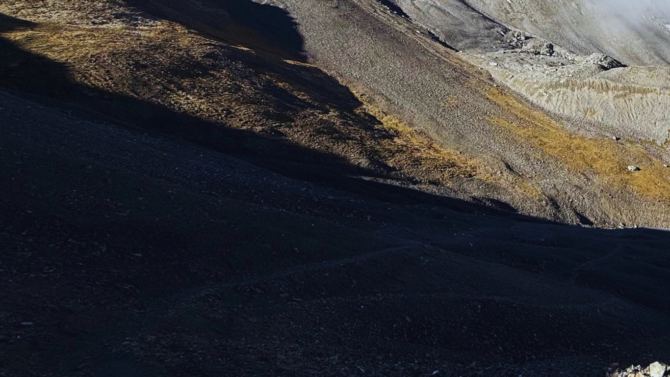
Continuing upward, the terrain becomes more barren and rocky. Approximately 45 minutes past the tea house, you reach a cluster of ruined stone structures—former shelters long abandoned. This marks roughly the halfway point of elevation gain from High Camp.
Distance: ~1.5 km (0.9 miles)
Time: 45 minutes
Elevation gain: ~150m (492ft)
Terrain: Final push through moonscape
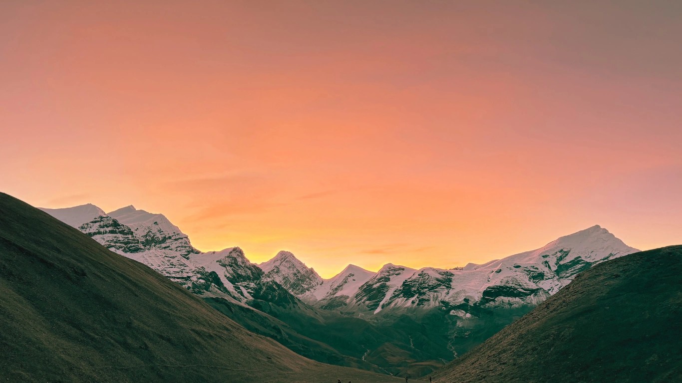
The final push to the pass involves continued gradual climbing through increasingly moonscape terrain. If timing is right, sunrise illuminates the surrounding peaks during this section—a reward for the early start. The cold intensifies at these highest elevations; we have recorded temperatures below -25°C (-13°F) at the pass in winter months.
Total walking time to summit varies significantly based on individual pace, conditions, and rest stops. Fast trekkers may complete Phedi to summit in 4 hours; slower trekkers may require 6+ hours. Neither pace is wrong—listen to your body.
Proper equipment transforms this crossing from survival mode to challenging-but-manageable. Here is what we recommend carrying:
Trekking poles: Our single strongest recommendation. Poles dramatically reduce leg fatigue, improve balance on loose terrain, and provide psychological support when exhaustion sets in. We have seen the difference they make hundreds of times.
Microspikes or light crampons: Even when the main trail is clear, ice patches appear unexpectedly. Keep these accessible in your pack—not buried at the bottom. We carry these on every crossing, regardless of season.
Sufficient water: Minimum 2 liters (68 oz), ideally in insulated containers to prevent freezing. Dehydration at altitude compounds all other challenges.
High-energy snacks: Chocolate, nuts, energy bars, or whatever your body accepts. Eating is difficult at altitude, but calories are essential. Small, frequent intake works better than large meals.
Warm layers: Temperatures vary dramatically. You may start at -15°C (5°F) and finish the descent in +15°C (59°F) sunshine. Layer removal and addition will happen multiple times.
Sun protection: At 5,400m (17,717ft), UV intensity is extreme. Snow reflection amplifies exposure. Quality sunglasses and sunscreen are non-negotiable.
Majestic Trails Nepal guides carry emergency equipment including first aid supplies, emergency oxygen, satellite communication devices, and additional warm layers for clients who underestimate cold. We believe this safety infrastructure matters—trekkers should know support exists if needed when they trek the Annapurna Circuit with our team.
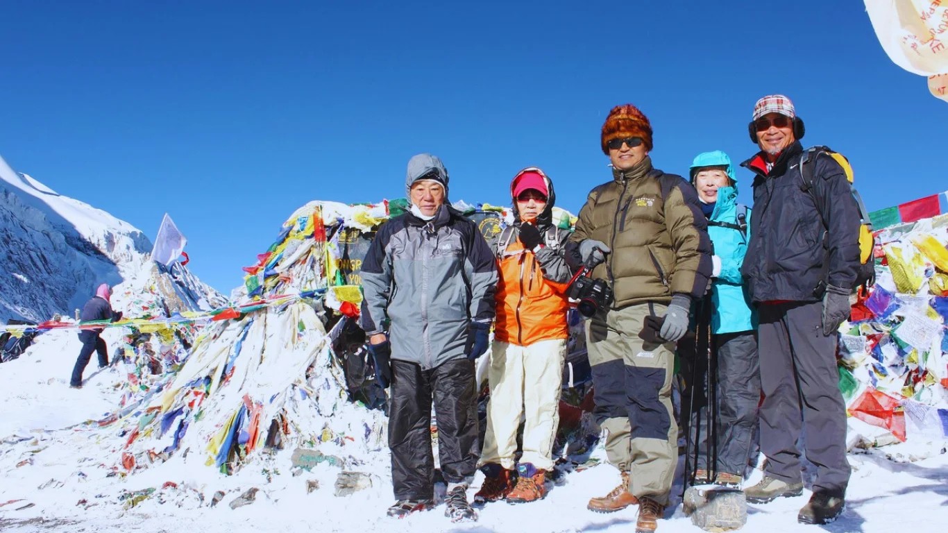
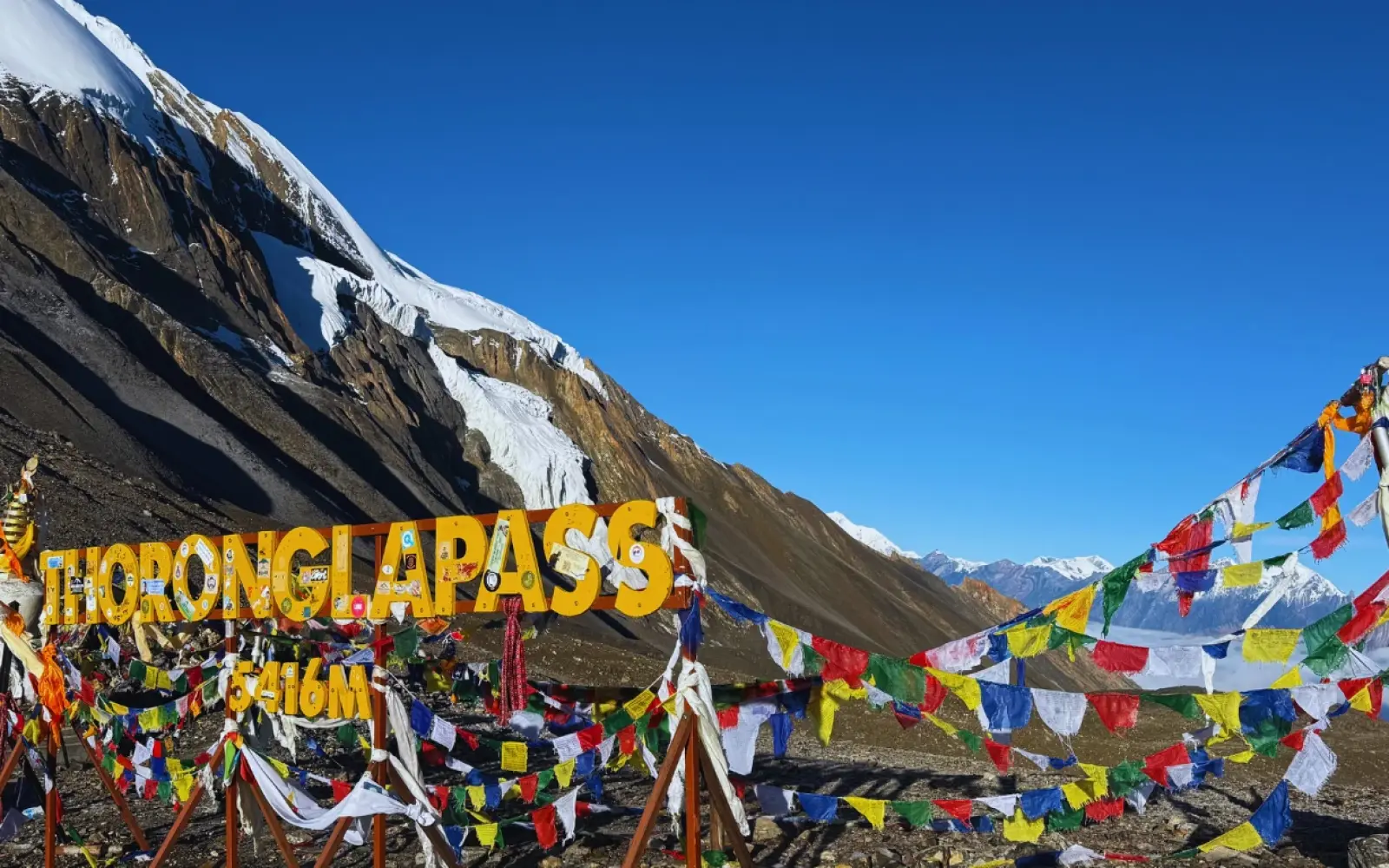
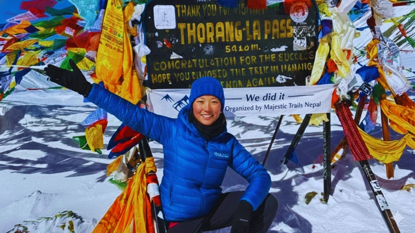
Reaching Thorong La's summit delivers a rush of emotion unlike almost anything else in trekking. The famous Thorong La sign surrounded by colorful Buddhist prayer flags marks your achievement. At this moment, you stand higher than you have likely ever stood.
A small tea house operates at the pass during peak season, offering hot drinks and basic snacks. Prayer flags flutter in constant wind, representing prayers carried by the breeze according to Buddhist tradition. Many trekkers purchase prayer flags in Kathmandu or Manang specifically to hang at the pass—a meaningful ritual for those so inclined.
Take photographs. Celebrate briefly. Touch the prayer flags. Then begin descending.
We cannot emphasize this strongly enough: the summit of Thorong La is not a place to linger. At 5,416 meters (17,769 feet), every minute spent at extreme altitude stresses your body unnecessarily. Weather can change rapidly. Afternoon winds may already be building.
Our standard guidance: spend no more than 15-20 minutes at the top. This is not about denying you the experience—it is about ensuring you have energy and conditions favorable for the long descent ahead.
The crossing is not complete when you reach the top. A 3-4 hour descent to Muktinath (3,800m/12,467ft) remains—often underestimated after the focus on reaching the pass.
The Mustang side of Thorong La features steep switchbacks covered in small loose stones. These surfaces become slippery, especially when fatigue reduces concentration. More knee strain occurs on this descent than during the entire ascent. Trekking poles prove valuable again.
During the first 1.5-2 hours of descent, no tea houses operate. This changes at lower elevations, where 4-5 lunch establishments cluster near the bottom of the steep section. By the time you reach these, you will have earned a substantial meal.
From the lunch stop cluster, approximately 1.5 additional hours of walking reaches Muktinath. Many trekkers describe the lunch in Muktinath as the best meal of their entire trek—a combination of genuine hunger, relief, and celebration.
Fifteen years of guiding reveals patterns. These mistakes cause the most problems:
Moving to High Camp without feeling well: The desire to save one hour overrides honest self-assessment. Better to sleep at Phedi (4,540m/14,895ft) and start earlier than suffer through a sleepless night at higher altitude (4,880m/16,010ft).
Not listening to body signals: Mild headaches, slight nausea, or unusual fatigue are altitude warnings. These symptoms at Thorong Phedi often become serious symptoms at higher elevations. Acknowledge and respond to them.
Not carrying sufficient snacks: Some trekkers assume tea houses along the route will provide food. During off-season or very early mornings, these facilities are often closed. Self-sufficiency matters.
Starting too late: We have seen trekkers leave High Camp at 7:00 AM or later, reaching the pass during deteriorating weather. Early starts are uncomfortable but safe.
Staying too long at the summit: Excitement and accomplishment feelings mask continued altitude stress. Your body doesn't know you've reached a goal—it just knows oxygen remains scarce. Descend promptly.
Thorong La Pass stands at 5,416 meters (17,769 feet) above sea level. This makes it one of the highest non-technical trekking passes in the world. At this elevation, oxygen availability drops to approximately 50% of sea-level concentration, which significantly affects breathing, energy levels, and physical performance. The Thorong La Pass height in meters and feet places it higher than any peak in Europe or the contiguous United States, requiring proper acclimatization over 7-10 days before attempting the crossing.
The Thorong La Pass difficulty is rated as challenging to strenuous, primarily due to altitude rather than technical terrain. The crossing involves:
The trail itself requires no climbing skills or ropes—it is a hiking trail throughout. However, the combination of thin air, early morning start, physical exhaustion, and mental pressure makes this the most demanding day on the Annapurna Circuit. We estimate that 85-90% of properly acclimatized trekkers successfully complete the crossing in normal weather conditions.
Thorong La weather is most favorable during two primary seasons:
Autumn (October-November): Generally considered the best window. Stable weather, clear skies, moderate daytime temperatures (still cold at altitude), and reliable trail conditions. This is also the busiest period, with accommodation filling quickly.
Spring (March-May): Good conditions with slightly more precipitation risk. Fewer crowds than autumn. Late spring (May) may bring afternoon clouds but mornings remain clear.
Winter (December-February): Possible but challenging. Heavy snow may close the pass temporarily. Extreme cold reaching -30°C (-22°F), fewer open teahouses, and reduced rescue availability. Only recommended for experienced high-altitude trekkers.
Monsoon (June-September): Not recommended. Heavy precipitation, obscured views, trail damage, and landslide risk make this period unsuitable for crossing.
The Thorong Phedi vs High Camp decision depends on your physical condition and honest self-assessment:
Choose Thorong Phedi (4,540m/14,895ft) if:
Choose Thorong High Camp (4,880m/16,010ft) if:
Our professional recommendation: when in doubt, stay at Thorong Phedi. The one-hour time savings from High Camp is not worth risking a miserable night that compromises your entire crossing.
| Starting Point | Departure Time | Altitude |
|---|---|---|
| Thorong Phedi | 4:00 AM | 4,540m / 14,895ft |
| Thorong High Camp | 5:00-5:30 AM | 4,880m / 16,010ft |
These early departure times are essential for safety. Thorong La weather patterns typically bring increasing winds throughout the day, with afternoon conditions often becoming severe. Starting early ensures you reach the pass during the calmest weather window and complete the descent before conditions deteriorate.
Based on our fifteen years of guiding experience, these Thorong La safety tips matter most:
Beginners with good physical fitness can successfully cross Thorong La Pass, but we recommend previous trekking experience at moderate altitude (3,000-4,000m/9,843-13,123ft) before attempting this crossing. The Thorong La Pass difficulty is not technical—no climbing skills are required—but the physical demands, altitude stress, and mental challenges favor those with some high-altitude experience.
If Thorong La would be your first major high-altitude trek, we strongly recommend:
Many first-time high-altitude trekkers successfully complete this crossing with proper preparation and realistic expectations.
If altitude sickness, weather, or other factors prevent your crossing, several options exist:
Medical evacuation: Helicopter rescue is available from Thorong Phedi and High Camp areas. Costs range from $3,000-5,000 USD depending on location and conditions. Travel insurance covering high-altitude helicopter evacuation is essential.
Horse evacuation: Emergency descent by horse costs $150-250 USD depending on starting point. This is slower but less expensive than helicopter.
Retreat to Manang: If symptoms are mild, descending to lower elevation (Manang at 3,540m/11,614ft) often resolves altitude issues within 24-48 hours. Some trekkers rest and successfully attempt the crossing later.
Alternative route: Though the classic Annapurna Circuit requires crossing Thorong La, trekkers unable to complete the crossing can return through Manang and exit via Besisahar, completing approximately 70% of the circuit.
At Majestic Trails Nepal, we carry emergency oxygen, satellite communication devices, and maintain relationships with evacuation services. Client safety always takes priority over summit goals.
Total crossing time from Thorong Phedi to Muktinath typically ranges from 10-14 hours depending on fitness, conditions, and rest stops:
| Section | Distance | Elevation Change | Time Required |
|---|---|---|---|
| Thorong Phedi to High Camp | ~2 km (1.2 mi) | +340m (+1,115ft) | 1-2 hours |
| High Camp to Thorong La Pass | ~4 km (2.5 mi) | +536m (+1,759ft) | 3-5 hours |
| Thorong La Pass to Muktinath | ~9 km (5.6 mi) | -1,616m (-5,302ft) | 4-5 hours |
| Total from Phedi | ~15 km (9.3 mi) | 10-14 hours | |
| Total from High Camp | ~13 km (8.1 mi) | 8-11 hours |
These times assume normal weather conditions and adequate acclimatization. We recommend reaching the pass by 9:00-10:00 AM to avoid afternoon wind and complete the descent in good daylight.
Thorong La Pass can be crossed independently—no regulations require guided trekking on the Annapurna Circuit. However, we strongly recommend professional guiding support for several reasons:
Safety considerations: Guides carry emergency equipment, recognize altitude sickness symptoms, and make critical decisions about weather windows and crossing timing. In emergencies, this experience can be life-saving.
Navigation: While the trail is generally clear, snow coverage, darkness during early morning starts, and confusing terrain near the pass can challenge independent trekkers.
Logistics: Guides coordinate accommodation (critical during peak season when lodges fill quickly), manage permits, and handle unexpected situations.
Local knowledge: Experienced guides understand current trail conditions, weather patterns, and can communicate with local communities and rescue services.
Independent trekking is possible for experienced individuals comfortable with self-sufficiency at extreme altitude. First-time Himalayan trekkers and those unfamiliar with high-altitude decision-making benefit significantly from joining a professionally guided Annapurna Circuit expedition.
Crossing Thorong La Pass as part of the Annapurna Circuit requires two permits:
Both permits can be obtained in Kathmandu (Nepal Tourism Board office in Bhrikutimandap) or Pokhara (Nepal Tourism Board office and ACAP counter). Majestic Trails Nepal arranges all permits for our guided clients as part of trek packages.
After more than fifteen years of crossing Thorong La Pass with trekkers from around the world, we have learned that success comes from respect more than fitness, from preparation more than determination, and from honest self-assessment more than pride.
This crossing rewards those who take it seriously. The views from 5,416 meters (17,769 feet) are extraordinary. The sense of accomplishment is profound. The stories you carry home last a lifetime.
But the Himalaya demands humility. Every season brings reminders—evacuation helicopters overhead, trekkers turning back with altitude sickness, close calls from weather changes. These are not meant to frighten but to ensure appropriate respect.
If you are considering your own attempt to experience the full Annapurna Circuit journey, know that guided support makes a significant difference. Our team's experience, safety equipment, and real-time decision-making capability have helped hundreds of trekkers achieve this goal safely.
Whether you trek independently or with our team, carry this guide's information with you. Make decisions based on conditions and honest self-assessment, not schedules or expectations. The mountain will be there on another day if you need to turn back.
Cross safely. We hope to hear about your success.
The guiding team at Majestic Trails Nepal has collectively completed over 500 Thorong La crossings across all seasons and conditions. This guide reflects direct operational experience, not secondary research. For questions about specific conditions or planning your Annapurna Circuit trek, contact our Kathmandu office.
Situated in the peaceful Solu-Khumbu region of Nepal, near the village of Junbesi, Thupten Chholing Monastery is a living testament to Tibetan Buddhis...

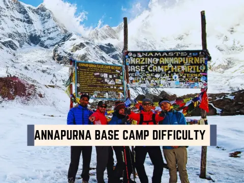
Trekking to Annapurna Base Camp Trek is one of Nepal’s most iconic mountain journeys. For mountaineers, the climb begins here, but for trekkers, Annap...

The Annapurna Circuit Trek is one of the world’s most legendary long-distance treks — a journey that circles the Annapurna massif through Nepal’s most...

Nepal is a country defined by mountains. Stretching across the country’s northern edge, the Himalayas pack Earth’s highest peaks into one nation. Eigh...
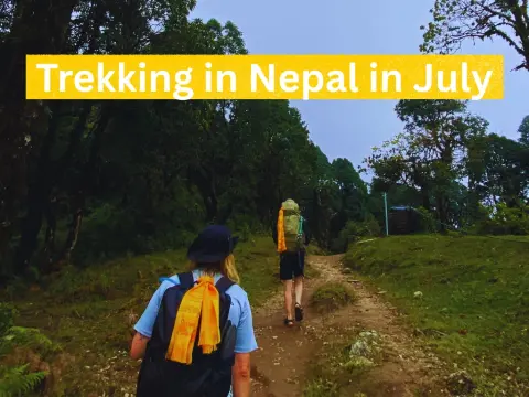
Trekking in Nepal in July offers a completely different yet deeply rewarding adventure for travelers seeking lush landscapes, peaceful trails, and aut...
Introduction: Why Nepal is Perfect for Budget TrekkingNepal has long been celebrated as one of the world's premier trekking destinations, but what man...
What Is the "3 Peaks Trek Nepal"?If you've been searching for the 3 Peaks Trek Nepal, you're likely looking for one of the most challenging and reward...
Last October, I watched a 67-year-old grandmother from Japan reach Annapurna Base Camp with tears streaming down her face. Three days earlier, she'd q...
IntroductionPlanning a trek in Nepal requires more than just physical preparation—you also need the right permits. Trekking permits are official docum...

The alarm rings at 4:30 AM. You stumble out of your sleeping bag in Machhapuchhre Base Camp, cursing the cold—until you step outside.The first rays of...
