
Trekking to Everest Base Camp in December: A Quiet Winter Journey
16 Jan 2026
IntroductionNepal — the final destination for every mountaineer. A place where almost everyone dreams of going at least once in their lifetime. To see...


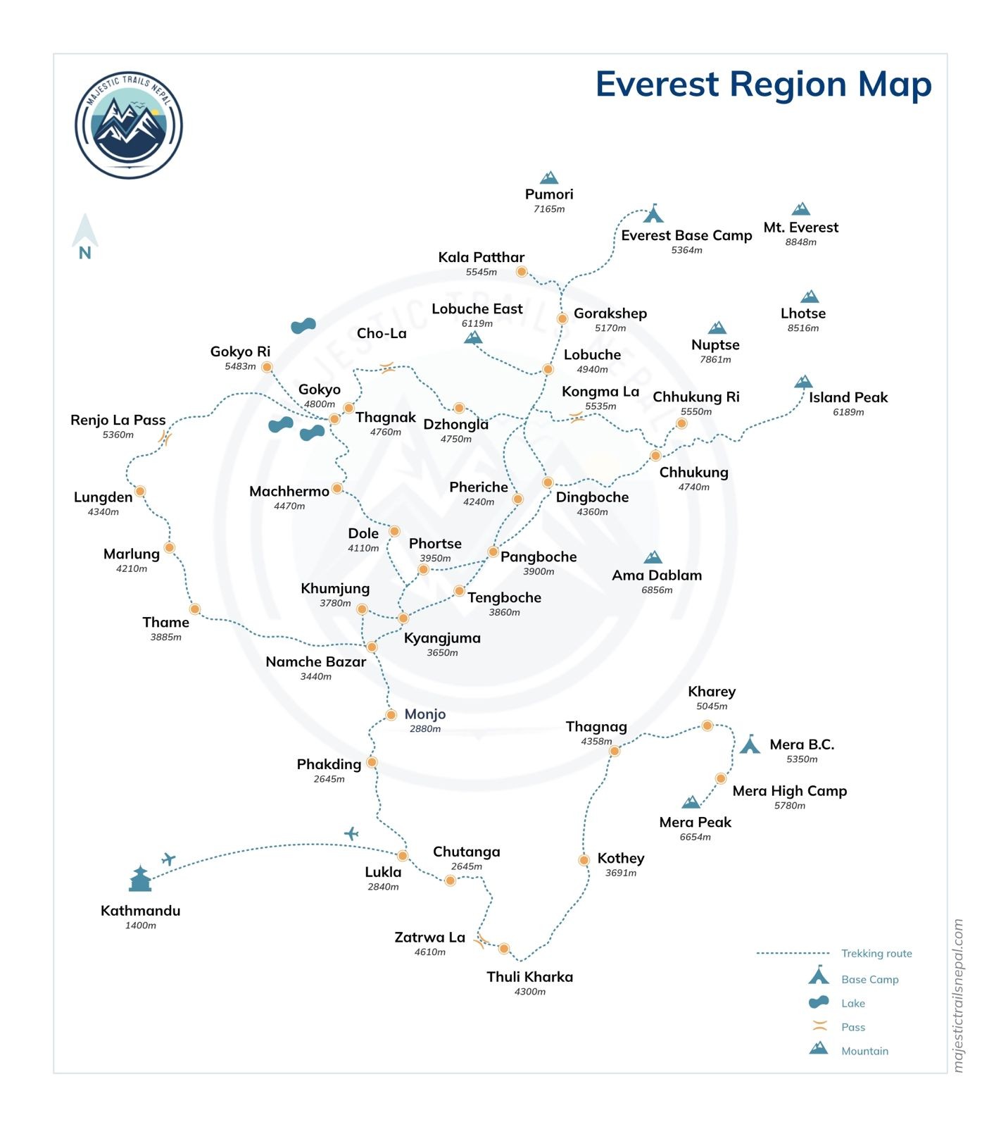
The Nepal EBC trek map displays the complete trekking route from Lukla (2,860m) to Everest Base Camp (5,364m) through the Khumbu Valley. This map shows all major villages, teahouse stops, elevation gains, daily walking distances, and acclimatization points along the 130-kilometer round-trip trail in the Sagarmatha National Park region of northeastern Nepal.
Understanding the Everest Base Camp route map helps trekkers plan their journey, anticipate daily challenges, and visualize the gradual altitude progression essential for safe acclimatization.
This guide breaks down the Nepal EBC trek map into clear sections—villages, distances, elevation profiles, and downloadable resources.
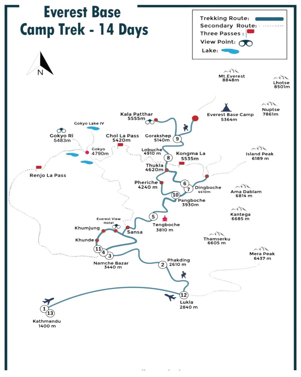
The Everest Base Camp trekking map follows a well-established route through the Khumbu region.
The trail begins at Tenzing-Hillary Airport in Lukla, the gateway to Everest. From there, it follows the Dudh Koshi River northward through Sherpa villages, crossing suspension bridges and climbing steadily into high-altitude terrain.
The route passes through Sagarmatha National Park, a UNESCO World Heritage Site. Trekkers stop at villages with teahouses, lodges, and basic services.
Key Route Highlights:
The trail is non-technical. No climbing equipment is required. However, altitude and weather present challenges that demand preparation.
Most trekkers follow the same route up and down. Some variations exist for acclimatization side hikes or alternative return routes.
For a full breakdown of what to expect day-by-day, see our detailed EBC itinerary.
The Nepal EBC trek map includes several key villages. Each serves as a rest stop, acclimatization point, or overnight location.
The trek begins here. Lukla is accessible only by small aircraft from Kathmandu (or Ramechhap during peak season).
The village has lodges, gear shops, and restaurants. Most trekkers spend one night before starting the trail.
A short 3–4 hour walk from Lukla. Phakding sits along the Dudh Koshi River.
This is a common first-night stop. The village offers basic teahouses and a gentle introduction to trekking rhythm.
Namche is the largest town on the EBC trekking map. It serves as the main acclimatization stop.
Trekkers spend two nights here. The town has bakeries, gear shops, internet cafes, and a Saturday market.
Side hikes to Everest View Hotel (3,880m) or Khumjung village support altitude adjustment.
Tengboche is home to the region's most famous monastery. Morning prayer ceremonies are open to trekkers.
The village offers stunning views of Everest, Lhotse, and Ama Dablam.
This is a popular overnight stop after Namche Bazaar.
Dingboche is the second major acclimatization point. Most itineraries include a rest day here.
Side hikes to Nagarjun Hill (5,100m) or Chhukung village prepare trekkers for higher altitudes.
The village has several lodges and a small medical clinic.
Lobuche is a small, high-altitude settlement. Facilities are basic.
Nights here are cold. Most lodges lack heating in sleeping rooms.
This is typically the last stop before reaching Gorak Shep.
Gorak Shep is the highest permanent settlement on the EBC route map.
Trekkers stay overnight here and make early morning trips to Everest Base Camp or Kala Patthar (5,545m).
Altitude effects are common. Hydration and rest are critical.
The final destination. EBC sits on the Khumbu Glacier.
Most trekkers spend 1–2 hours here before returning to Gorak Shep for the night.
Views of the Khumbu Icefall and surrounding peaks make the effort worthwhile.
For cost estimates and package details, check our Everest Base Camp trek cost breakdown.
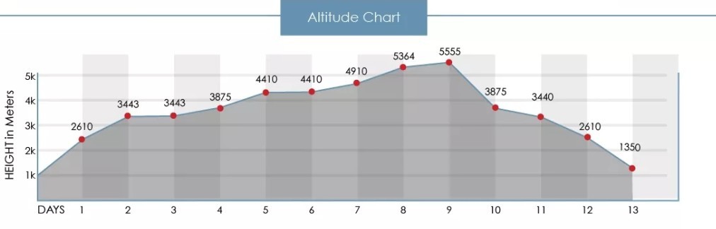
Understanding the altitude profile on the Nepal EBC trek map is essential for safe trekking.
The route gains approximately 2,500 meters of elevation over 8–9 days of ascent.
| Village | Altitude | Elevation Gain from Previous Stop |
|---|---|---|
| Lukla | 2,860m | Starting point |
| Phakding | 2,610m | -250m (descent) |
| Namche Bazaar | 3,440m | +830m |
| Tengboche | 3,867m | +427m |
| Dingboche | 4,410m | +543m |
| Lobuche | 4,940m | +530m |
| Gorak Shep | 5,164m | +224m |
| Everest Base Camp | 5,364m | +200m |
The elevation map shows why rest days are necessary.
Trekkers who skip acclimatization days risk altitude sickness. Symptoms include headache, nausea, and fatigue.
Our guides carry pulse oximeters and monitor oxygen levels daily.
Learn more about managing altitude in our Everest Base Camp difficulty guide.
The Nepal EBC trek map covers approximately 65 kilometers one way (130 kilometers round trip).
Daily walking distances vary based on terrain and altitude.
| Day | Route | Distance | Walking Time |
|---|---|---|---|
| 1 | Lukla to Phakding | 8 km | 3–4 hours |
| 2 | Phakding to Namche Bazaar | 10 km | 5–6 hours |
| 3 | Namche acclimatization day | Side hikes 3–5 km | — |
| 4 | Namche to Tengboche | 10 km | 5–6 hours |
| 5 | Tengboche to Dingboche | 12 km | 5–6 hours |
| 6 | Dingboche acclimatization day | Side hikes 4–6 km | — |
| 7 | Dingboche to Lobuche | 8 km | 4–5 hours |
| 8 | Lobuche to Gorak Shep to EBC | 13 km (round trip) | 7–8 hours |
| 9 | Gorak Shep to Kala Patthar to Pheriche | 13 km | 7–8 hours |
| 10–12 | Return to Lukla | Same route descending | 3 days |
The Everest Base Camp route map follows well-maintained trails.
The trail is clearly marked. Signposts appear at major junctions.
Trekkers do not need navigation equipment, but downloading offline maps is recommended.
Yes. Several reliable sources offer downloadable Everest Base Camp trekking maps.
1. Nepalese Survey Department Maps
Official topographic maps available in Kathmandu. These show contour lines, villages, and trails.
2. Digital Trekking Apps
Download maps before departure. Internet is limited above Namche Bazaar.
3. Printed Maps from Trekking Agencies
Most agencies provide clients with laminated route maps. These include village names, distances, and altitude markers.
At Majestic Trails Nepal, we supply every trekker with a detailed EBC route map during the pre-trek briefing.
4. Google Maps Offline
Google Maps covers the main trail. Download the Khumbu region for offline access.
For comprehensive trip planning, explore our complete Everest Base Camp Trek guide.
The Khumbu region offers more than just the standard EBC route.
The Nepal EBC trek map intersects with several side trails and alternative routes.
Kala Patthar (5,545m)
The highest viewpoint accessible to trekkers. Offers 360-degree Everest panoramas.
Most trekkers climb Kala Patthar on the morning after reaching EBC.
Gokyo Lakes Trek
An alternative route through turquoise glacial lakes. Can be combined with EBC via the Cho La Pass (5,420m).
Chhukung Valley
A side valley east of Dingboche. Leads to Island Peak Base Camp and offers excellent acclimatization hikes.
Three Passes Trek
An advanced route crossing Kongma La, Cho La, and Renjo La passes. Combines EBC with Gokyo.
These variations require additional days and higher fitness levels.
The Everest Base Camp route is approximately 65 kilometers one way from Lukla to EBC. Round trip totals about 130 kilometers. Most trekkers complete the journey in 12–14 days including acclimatization rest days.
Yes. The Everest Base Camp trail is well marked with signposts at major junctions. Villages and teahouses are clearly visible along the route. However, carrying an offline map or GPS device adds safety, especially in poor weather.
The main villages are Lukla, Phakding, Namche Bazaar, Tengboche, Dingboche, Lobuche, and Gorak Shep. Each offers teahouse accommodation and basic services. Namche Bazaar is the largest town and main supply hub.
Yes, with proper preparation. The EBC route is non-technical and does not require climbing skills. However, altitude and long walking days present challenges. Beginners should train for cardiovascular fitness and follow acclimatization guidelines carefully.
Legally, solo trekking is allowed on the EBC route. However, hiring a licensed guide improves safety, provides cultural insights, and supports emergency response. Most first-time trekkers benefit from professional guidance.
The best seasons are pre-monsoon (March–May) and post-monsoon (September–November). These periods offer clear skies, stable weather, and the best visibility of Everest and surrounding peaks. Avoid monsoon (June–August) and deep winter (December–February).
The Nepal EBC trek map is more than a navigation tool. It represents a journey millions dream of completing.
Understanding the route—its villages, altitudes, distances, and challenges—transforms anticipation into preparation.
At Majestic Trails Nepal, we provide every trekker with detailed maps, experienced guides, and pre-trek briefings that ensure safe, informed journeys.
Whether you're studying the elevation profile, planning rest days, or choosing side trips, clarity about the route builds confidence.
Ready to turn the map into reality?
Explore our fully guided Everest Base Camp trekking packages. Our team handles permits, logistics, and daily support—so you can focus on the experience.
Contact Majestic Trails Nepal for personalized itinerary planning and transparent pricing. Let's walk this legendary route together.
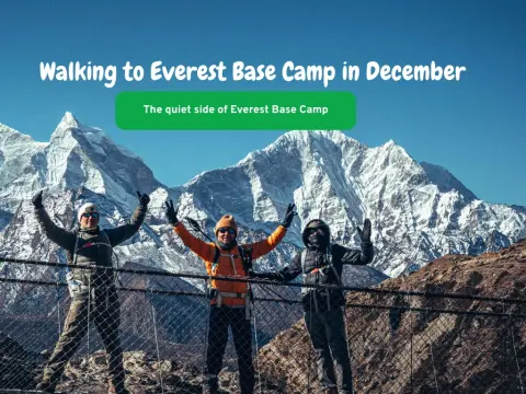
IntroductionNepal — the final destination for every mountaineer. A place where almost everyone dreams of going at least once in their lifetime. To see...
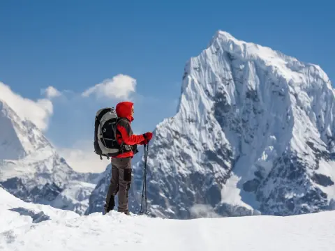
What Is the "3 Peaks Trek Nepal"?If you've been searching for the 3 Peaks Trek Nepal, you're likely looking for one of the most challenging and reward...
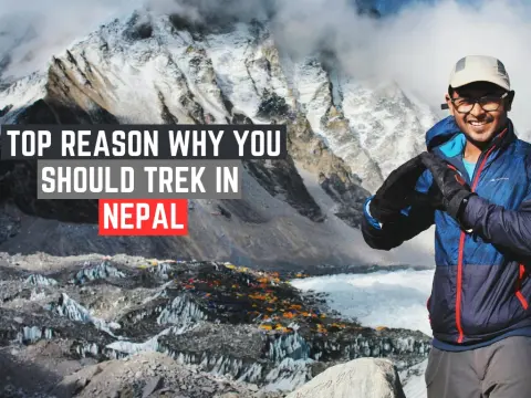
If you've ever wondered why trekking in Nepal captivates adventurers from every corner of the globe, the answer lies in its extraordinary combination...
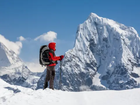
The 3 passes trek Nepal itinerary represents one of the most challenging and rewarding high-altitude adventures in the Himalayas. This epic journey ta...
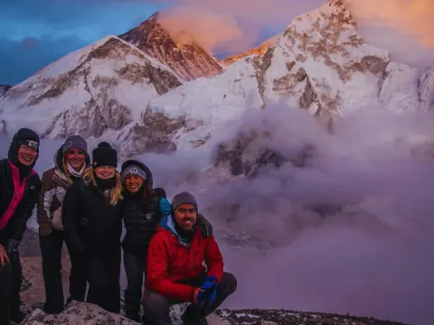
If you're curious about trekking in Nepal, you've landed in the right place. Nepal is home to the world's most breathtaking mountain trails, ancient c...
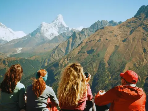
Standing face-to-face with Mount Everest doesn't require weeks of grueling trekking or extreme altitude exposure. The Everest View Trek Nepal offers o...
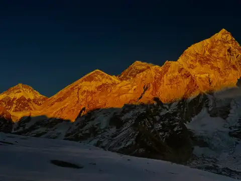
Kalapathar stands at 5,545 meters (18,192 feet) as the highest accessible viewpoint on the Everest Base Camp trek and arguably the most spectacular pa...
