
All Mountains in Nepal: Peaks, Himalayan Ranges & Trekking Highlights
15 May 2026
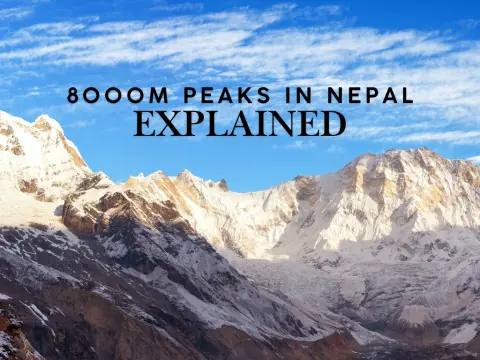
Nepal is a country defined by mountains. Stretching across the country’s northern edge, the Himalayas pack Earth’s highest peaks into one nation. Eigh...

Geographically secluded within one of Asia's most dramatic territorial corridors yet profoundly sovereign in every constitutional sense, Nepal is a landlocked federal democratic republic in South Asia. Positioned between China's Tibet Autonomous Region to the north and India to the south, east, and west, it occupies coordinates ranging from approximately 26° to 31°N latitude and 80° to 89°E longitude, covering a total area of 147,516 square kilometres.
Nepal is not part of either India, China, or Pakistan. It is an independent, sovereign, and landlocked country located in South Asia.
Nepal is nestled directly between these two giant neighbors:
Nepal is not a territorial extension of either neighbouring power. It maintains full constitutional sovereignty, exercises independent governance, and holds Kathmandu, situated at 1,400 metres above sea level, as its capital city.
| Attribute | Detail |
| Full Name | Federal Democratic Republic of Nepal |
| Capital City | Kathmandu (1,400 metres above sea level) |
| Area | 147,516 sq km (93rd largest country in the world) |
| Population | Approximately 29.6 million (2026 UN estimate) |
| Official Language | Nepali (Devanagari script) |
| Currency | Nepalese Rupee (NPR) |
| Religion | Hindu 81.3%, Buddhist 9%, Muslim 4.4%, Kirant 3%, Christian 1.4% |
| Government | Federal Democratic Republic |
| Prime Minister | Balendra Shah (since 27 March 2026) |
| Time Zone | Nepal Standard Time, UTC +5:45 |
| Calendar | Bikram Sambat (approx. 56 years ahead of the Gregorian calendar) |
| Flag | Double-pennon design, the world's only non-rectangular national flag |
| Total Land Border | 2,926 km |
| Highest Point | Mount Everest, 8,848.86 metres |
| Lowest Point | Mukhiyapatti Musharniya, 59 metres |
| UNESCO World Heritage Sites | 10 |
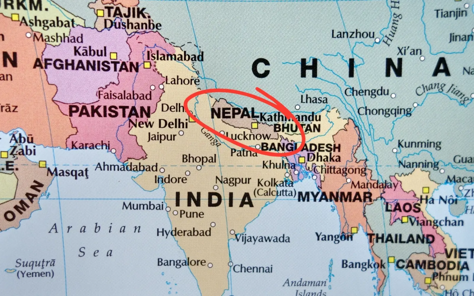
On the world map, Nepal is a landlocked South Asian country nestled along the southern slopes of the Himalayan mountain range. Shaped as a rough trapezoid, it is sandwiched directly between two massive nations: China to the north and India to the south, east, and west.
Nepal occupies a longitudinal strip along the southern escarpment of the Himalayan mountain range, sandwiched between two of Asia's most territorially vast nations. On most world maps, it appears as a small, roughly trapezoidal landmass that is easy to overlook between the expansive territories of India and China, yet the country's geographic compactness belies a staggering degree of natural and cultural complexity.
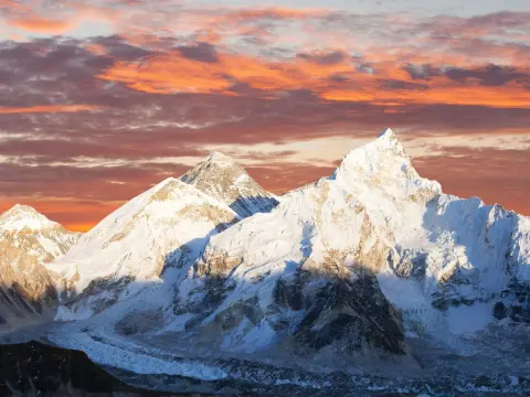
Small in cartographic representation does not mean peripheral in global significance. Nepal stretches approximately 880 kilometres from east to west and between 150 and 250 kilometres from north to south, and within that comparatively narrow band of territory it contains eight of the world's ten highest mountain peaks, including Mount Everest, the highest point above mean sea level on Earth.
Geographically, Nepal belongs to South Asia, the same regional bloc as India, Pakistan, Bangladesh, Sri Lanka, Bhutan, and the Maldives. It is neither Southeast Asia nor East Asia. Its central coordinates rest at approximately 28°N and 84°E, placing it just above the Tropic of Cancer in the Northern Hemisphere.
| Attribute | Detail |
| Continent | Asia (South Asia) |
| Hemisphere | Northern and Eastern |
| Latitude Range | 26°22'N to 30°27'N |
| Longitude Range | 80°4'E to 88°12'E |
| Geographic Centre | Approx. 28°N, 84°E |
| Shape | Roughly trapezoidal |
| Orientation | 880 km east to west, 150 to 250 km north to south |
No. Nepal is not part of India, and it is not part of China or Pakistan. They are two entirely separate, independent countries in South Asia. Nepal is a completely independent, sovereign nation.
This question surfaces with remarkable persistence in global search queries, and the confusion is geographically understandable. Nepal shares borders with both countries and occupies the territorial space between them on virtually every world map.
On small-scale cartographic representations, Nepal nearly vanishes within the enormous footprints of India and China. Being geographically encircled, however, is categorically distinct from belonging to either nation.
Nepal operates under its own constitution, adopted on 20 September 2015, and maintains its own elected government, standing military, passport authority, national currency, and a fully active seat at the United Nations, which it joined in 1955. The country is governed today by a nationally elected prime minister and a bicameral parliament operating under a federal democratic republic structure.
In legal, constitutional, and diplomatic terms, Nepal is as sovereign as Germany or South Korea. The persistent confusion derives almost entirely from cartographic scale rather than from any genuine territorial ambiguity.
Nepal shares its southern, eastern, and western borders with India. The India-Nepal border extends 1,690 kilometres and runs along five Indian states: Uttarakhand, Uttar Pradesh, Bihar, West Bengal, and Sikkim.
Nepal's northern border is shared with China's Tibet Autonomous Region and stretches 1,236 kilometres along the high Himalayan range, tracing a boundary that passes through the internationally recognised Nepal-China border summit of Mount Everest.
| Country | Direction | Border Length | Adjacent Territories |
| India | South, East, West | 1,690 km | Uttarakhand, Uttar Pradesh, Bihar, West Bengal, Sikkim |
| China (Tibet Autonomous Region) | North | 1,236 km | Tibet Autonomous Region |
Nepal is also narrowly separated from Bangladesh by the Siliguri Corridor, a thin sliver of Indian territory that geographers frequently describe as the "Chicken's Neck." Bhutan lies in close geographic proximity to Nepal as well, separated by the Indian state of Sikkim. Neither Bangladesh nor Bhutan shares a direct land border with Nepal.
Approximately 68% of Nepal's territory is classified as hills and mountains, while less than 20% consists of flat terrain. This profoundly compressed vertical geography, ranging from 59 metres in the southern plains to 8,848 metres at the summit of Everest, is what determines the country's climatic patterns, cultural character, and economic foundations.
Nepal is divided into three principal physiographic regions, known in Nepali as Himal, Pahad, and Terai.
Nepal is sharply divided into three distinct physiographic regions from south to north: the Terai (lowland plains), the Hill (middle mountains and valleys), and the Himal (high alpine and snow-capped mountains). This compressed vertical geography encompasses altitudes from less than 100 meters to over 8,800 meters.
| Region | Altitude Range | Share of Land | Notes |
|---|---|---|---|
| Terai (Lowland Plains) | 59m–300m | 13% | Nepal's fertile agricultural heartland bordering India. |
| Pahad (Mid-Hills and Valleys) | 800m–4,000m | 64% | Contains Kathmandu Valley, Pokhara, and most of Nepal's population. |
| Himal (High Himalayas) | 4,000m–8,848m | 23% | Home to Mount Everest and Nepal's highest mountain ranges. |
The Terai, Nepal's southern lowland belt, sustains the country's agricultural output and serves as its primary food-producing zone. Kathmandu sits at 1,400 metres within the Pahad zone, which accounts for the capital's temperate climate rather than tropical heat or high-altitude cold.
The Himal region to the north, precipitously elevated and sparsely inhabited, is where the celebrated trekking routes and the world's tallest peaks converge.
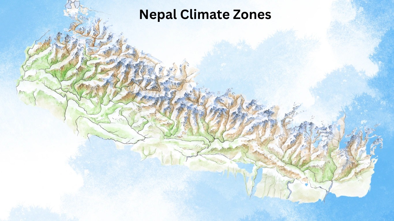
Nepal's terrain ascends from near sea level to above 8,000 metres within a horizontal distance of fewer than 200 kilometres. That remarkable compression of altitude produces five entirely distinct climate zones within one comparatively small country, a meteorological phenomenon that is virtually unparalleled at this scale anywhere in the world.
| Climate Zone | Altitude | Climate Character | Key Feature |
|---|---|---|---|
| Tropical & Subtropical | Below 1,200 m | Hot and humid | Includes the Terai plains. |
| Temperate | 1,200–2,400 m | Cool and seasonal | Kathmandu lies within this zone. |
| Cold | 2,400–3,600 m | Cold with winter snowfall | Common in upper hill regions and lower trekking areas. |
| Subarctic (Subalpine) | 3,600–4,400 m | Very cold and windy | Covers many high mountain passes and trekking routes. |
| Arctic (Alpine & Glacial) | Above 4,400 m | Perpetual cold and snow | Home to glaciers, Everest, and Nepal's highest peaks. |
Nepal also follows five seasons: spring (March to May), summer (June), monsoon (July to September), autumn (October to November), and winter (December to February). October and November consistently deliver the clearest skies and most meteorologically stable conditions for high-altitude trekking across the Himalayan ranges.
No. Nepal was never part of India.
This question ranks among the most persistently searched queries about Nepal, and the historical record is conclusive. Nepal was never a princely state under the British Raj. It was not absorbed into the Dominion of India when British colonial rule ended in 1947. It was not incorporated into the administrative reach of the Mughal Empire. And it has never, at any documented point in its recorded history, been governed by an Indian administration in any form.
The closest Nepal approached a territorial relationship with a foreign power was the Sugauli Treaty of 1816, signed in the aftermath of the Anglo-Nepalese War, which ran from 1814 to 1816.
The British East India Company had profoundly underestimated the combat effectiveness of Nepal's Gorkha armies and suffered significant early defeats before committing substantially larger military resources to the campaign. Nepal ultimately lost the war and signed the treaty, ceding the western territories of Kumaon, Garhwal, and Sikkim to the East India Company.
Ceding territory under the terms of a post-war treaty, however, is categorically distinct from losing sovereign independence. The British formally recognised Nepal as an independent kingdom, proceeded to recruit Gurkha soldiers into their armed forces, and left Nepal's internal governance entirely in the hands of its own rulers.
Nepal does not observe an Independence Day. That singular fact carries considerable historical weight. Virtually every nation across Asia marks independence from colonial subjugation on a precisely defined date. Nepal observes no such occasion, because no colonial subjugation occurred from which independence needed to be gained.
When India secured independence in 1947, Nepal was already a functioning independent state. When India became a republic in 1950, Nepal was already a sovereign kingdom. The two nations formalised their diplomatic relationship through a Treaty of Peace and Friendship in 1950, but that document was a treaty between two independent equals, not a declaration of Nepal's emancipation from Indian control.
No. Nepal was never part of China.
Nepal did engage in armed conflict with China. Between 1788 and 1792, the Sino-Nepali War was precipitated when Nepalese Gorkha forces invaded Tibet, which was then under the political suzerainty of the Qing dynasty. The Qing Emperor responded by dispatching a substantial military force southward. Nepal was pushed back to its own frontiers and compelled to sign a peace agreement that included the dispatch of tribute missions to Beijing at five-year intervals.
A tributary diplomatic relationship, however, bears no resemblance to territorial annexation or administrative absorption. Nepal was never governed by Chinese imperial officials. Chinese law never held jurisdiction over Nepalese territory. The tribute missions themselves ceased entirely in 1908 when the Qing dynasty collapsed, and Nepal continued to exercise full self-governance without any formalised relationship with China for several subsequent decades.
China and Nepal concluded a formal Treaty of Peace and Friendship in 1960, which established diplomatic relations between two sovereign and equal states. Nepal today maintains a carefully calibrated foreign policy equilibrium between India and China, accepting development assistance from both neighbours, sustaining open economic relations, and supporting the One China policy with regard to Tibet.
This strategic balancing act is not a manifestation of geopolitical vulnerability. It is a deliberate and sophisticated survival strategy that Nepal has practised with considerable effectiveness for over two centuries.
No, Nepal was never a part of Pakistan.
Nepal has always been an independent, sovereign nation. It was never colonized by the British, meaning it was never part of British India, which later became the modern nations of India and Pakistan in 1947.
The lack of political connection between the two regions is heavily defined by their geographical and historical backgrounds:
The earliest human settlements in Nepal have been dated to approximately 30,000 years ago. By 600 BCE, territorially defined kingdoms had consolidated in the southern regions. From one of those polities, the Shakya kingdom, came Siddhartha Gautama, who would attain enlightenment and become Gautama Buddha, the founder of Buddhism, born in Lumbini around 563 BCE.
| Dynasty | Period | Key Fact |
|---|---|---|
| Gopala & Kirata | Approx. 800 BCE – 300 CE | Kirata King Yalambar is mentioned in the Mahabharata. |
| Licchavi | Approx. 400 CE – 750 CE | Considered Nepal's golden age of art, culture, and governance. |
| Thakuri | 750 CE – 1200 CE | Transitional period between the Licchavi and Malla eras. |
| Malla | 12th Century – 18th Century | Built the historic Durbar Squares of Kathmandu, Patan, and Bhaktapur. |
| Shah | 1769 – 2008 | Prithvi Narayan Shah unified Nepal in 1769. |
| Rana Period | 1846 – 1951 | Rana prime ministers held real power while kings became figureheads. |
| Federal Republic | 2008 – Present | Nepal became a federal democratic republic on 28 May 2008. |
In September 2025, widespread youth-led protests over a social media ban, economic inequality, and deeply entrenched corruption precipitated severe civil unrest in Kathmandu, leading to the resignation of Prime Minister KP Sharma Oli. Former Chief Justice Sushila Karki assumed the role of interim prime minister.
General elections held in March 2026 produced a landslide victory for the Rastriya Swatantra Party, and Balendra Shah, a former structural engineer, rapper, and Mayor of Kathmandu, was sworn in as the 47th Prime Minister of Nepal on 27 March 2026.
At 35 years of age at the time of his swearing-in, Shah became the youngest prime minister in the constitutional history of the Federal Democratic Republic of Nepal, and is currently the world's youngest serving head of government.
Nepal officially observes the Bikram Sambat (BS) calendar system rather than the Gregorian calendar used across most of the world. The Bikram Sambat system is calculated from a starting point in 57 BCE, traditionally attributed to the legendary King Vikramaditya, which creates a structural temporal difference of approximately 56 years and 8 to 9 months relative to the internationally standardised Gregorian system.
In practical terms: the year 2026 AD corresponds to 2083 BS within Nepal's official administrative and cultural reckoning.
Nepal's New Year, called Naya Barsha, falls in mid-April each year, generally between April 13 and 15, not on January 1. This is not an administrative oversight that Nepal has neglected to correct. It is a deliberate, continuously maintained act of cultural preservation, employed across all government documents, public holidays, and official records throughout the country.
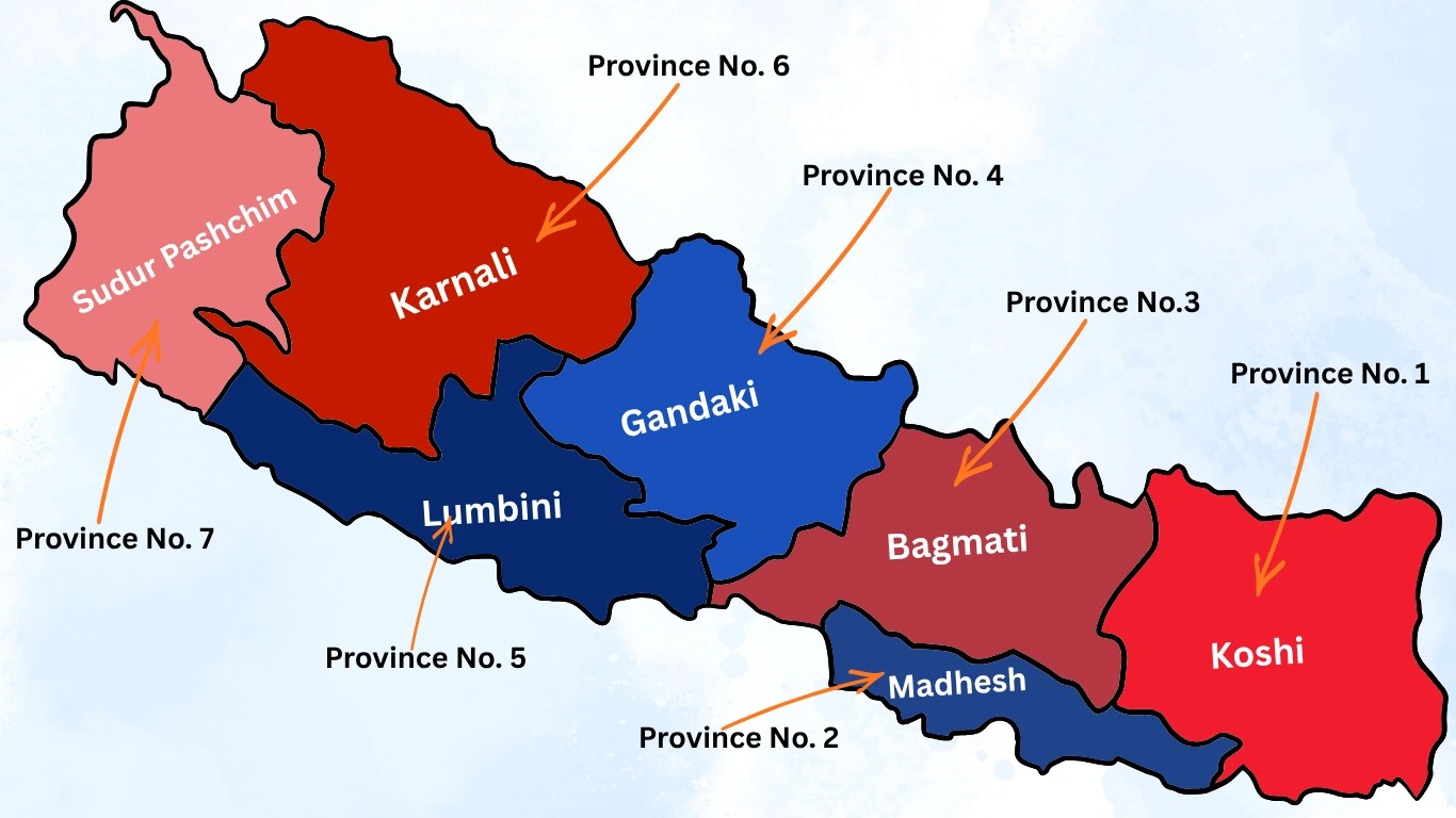
The Constitution of Nepal, adopted in 2015, restructured the country's administrative geography into a federal system comprising seven provinces, each governed by its own elected provincial assembly and cabinet.
| Province | Location | Known For |
|---|---|---|
| Koshi | Eastern Nepal | Eastern Himalayan region and the Kanchenjunga area. |
| Madhesh | Southern Terai Plains | Agricultural heartland and major India border trade routes. |
| Bagmati | Central Nepal | Kathmandu Valley, Nepal's capital region, and UNESCO World Heritage Sites. |
| Gandaki | West-Central Nepal | Annapurna region, Phewa Lake, and popular trekking routes. |
| Lumbini | Central-South Nepal | Birthplace of Lord Buddha and rich wildlife reserves. |
| Karnali | Western Nepal | Remote mountain landscapes, Dolpo, and Rara Lake. |
| Sudurpashchim | Far-Western Nepal | Api-Nampa region and unique far-western culture. |
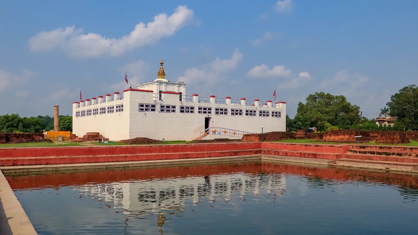
Lord Buddha, born Siddhartha Gautama, was born in Lumbini, located in what is now Rupandehi District of Lumbini Province in southern Nepal. Lumbini is a UNESCO World Heritage Site and one of the most spiritually significant destinations in the Buddhist world.
Around 249 BCE, Emperor Ashoka of the Maurya Empire undertook a pilgrimage to Lumbini and erected a stone pillar at the precise location of the Buddha's birth. That pillar stands to this day. Its inscriptions, unambiguously stating that Ashoka visited the site to honour the birthplace of the Shakyamuni Buddha, constitute among the oldest independently verified historical records in the South Asian subcontinent.
Buddha was born in Nepal. Not India. Nepal. This distinction carries deep significance for Nepali national identity, and it is corroborated by all available historical, epigraphic, and archaeological evidence.
Yes. Nepal is broadly safe for international visitors. The country maintains a dedicated Tourist Police unit at all major visitor entry points and trekking hubs, and it is consistently assessed as one of the more secure destinations in South Asia for independent travellers, including solo female travellers.
The political unrest of September 2025 was historically significant but geographically contained, concentrated primarily in Kathmandu and several other urban centres. The situation stabilised progressively following the installation of the interim administration and, subsequently, the March 2026 general elections, which produced a functioning majority government under Prime Minister Balendra Shah. Most international travel advisories currently classify Nepal as requiring standard travel precautions rather than elevated or specific warnings.
High-altitude trekking carries its own category of risk that is entirely separate from the country's political environment. Altitude sickness becomes a genuinely serious concern above 2,500 metres. Properly structured acclimatisation schedules, the engagement of experienced and certified local guides, and comprehensive high-altitude travel insurance substantially reduce that risk. Selecting a reputable, locally embedded trekking agency carries more practical weight here than almost anywhere else in the world.
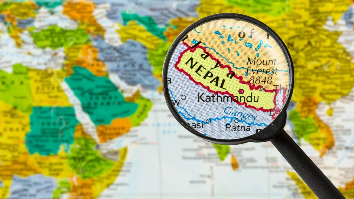
Nepal is located in South Asia, geographically defined by its position along the southern face of the Himalayan mountain range. It is a landlocked federal democratic republic bordered by China's Tibet Autonomous Region to the north and by India to the south, east, and west.
Its central coordinates rest at approximately 28°N and 84°E, placing it just north of the Tropic of Cancer in the Northern Hemisphere. The country spans approximately 880 kilometres from east to west and between 150 and 250 kilometres from north to south, covering a total area of 147,516 square kilometres.
Nepal ranks as the 93rd largest country in the world by land area and is home to eight of the planet's ten highest mountains, including Mount Everest at 8,848.86 metres.
Nepal is not inside India and is not a part of India in any administrative, constitutional, or historical sense. Nepal is a fully sovereign, independent country that happens to share a 1,690-kilometre land border with India along its southern, eastern, and western flanks.
The confusion arises predominantly from cartographic scale on small-format world maps, where Nepal's comparatively compact footprint can appear to fall within India's territory.
Nepal maintains its own elected government, its own constitution adopted in September 2015, its own military, its own currency (the Nepalese Rupee), and its own United Nations membership dating to 1955. It has never been administered by, colonised by, or incorporated into India at any point in recorded history.
Nepal is in neither India nor China. It is an independent, sovereign federal democratic republic in South Asia, sharing borders with both countries but constitutionally and legally distinct from either.
Nepal maintains its own government seated in Kathmandu, operates under a constitution adopted on 20 September 2015, and holds full UN membership. The country has never been colonised, administered, or governed by India or China at any point in its recorded history.
The India-Nepal border extends 1,690 kilometres across five Indian states, and the Nepal-China border runs 1,236 kilometres along the high Himalayan range to the north.
On a world map, Nepal appears as a small, roughly trapezoidal landmass wedged between the vast territories of India and China in South Asia. It lies along the southern escarpment of the Himalayas at approximately 28°N, 84°E, just above the Tropic of Cancer.
On most continental maps of Asia, Nepal occupies the northern portion of the South Asian subcontinent, east of India's Uttar Pradesh and north of Bihar and West Bengal. Because it measures only approximately 880 kilometres east to west and roughly 200 kilometres north to south, Nepal's full geographic complexity, including eight of the world's ten highest mountains and five distinct climate zones, is not apparent from its cartographic footprint alone.
If you locate the Himalayan mountain chain on any physical relief map, Nepal occupies the central and eastern stretches of that range's southern face.
Nepal's official currency is the Nepalese Rupee (NPR). It is issued and regulated by Nepal Rastra Bank, the country's central monetary authority, which was established in 1956.
The Nepalese Rupee is subdivided into 100 paisa, though paisa denominations are no longer in common daily circulation. The NPR is not freely convertible on international currency markets and is pegged to the Indian Rupee at a fixed exchange rate of 1.60 Nepalese Rupees per 1 Indian Rupee.
Foreign visitors exchanging currency in Nepal should do so through licensed banks or authorised money changers. Retaining exchange receipts is advisable, as they are typically required for reconversion on departure.
As of 2026, Nepal's population is estimated at approximately 29.6 million, according to United Nations demographic projections. Nepal ranks 52nd in the world by population and accounts for approximately 0.36% of the global total.
The country has a population density of approximately 207 people per square kilometre, a median age of 26.7 years, and an annual population growth rate of approximately 0.14%.
Significant labour migration to countries including Qatar, Saudi Arabia, Malaysia, and India results in a substantially negative net migration figure each year, a structural and defining feature of Nepal's contemporary demographic profile. Approximately 30% of the population currently resides in urban areas, a proportion that continues to increase annually.
Nepal is a predominantly Hindu country. According to national census data, approximately 81.3% of the population identifies as Hindu, making Nepal one of the most proportionally Hindu nations on Earth.
Buddhism is practised by approximately 9% of the population, Islam by 4.4%, the indigenous Kirant faith by approximately 3%, and Christianity by 1.4%. Nepal was the world's last official Hindu monarchy until it was declared a secular federal democratic republic on 28 May 2008.
Despite the transition to secular governance, Hinduism remains deeply embedded in the country's cultural life, ritual calendar, festivals, and civic traditions. The co-existence of Hindu and Buddhist practices is a defining feature of Nepali cultural identity, and many temples and sacred sites are venerated by both traditions simultaneously.
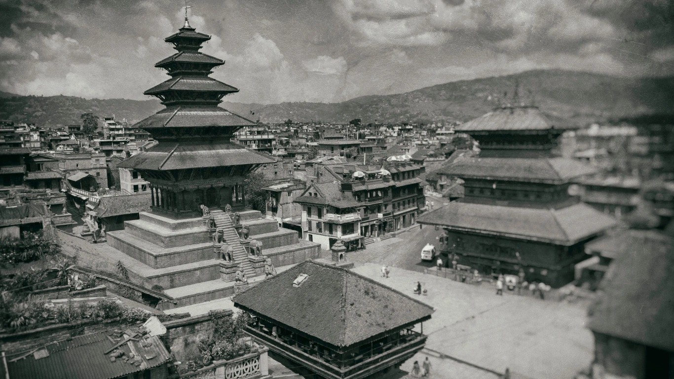
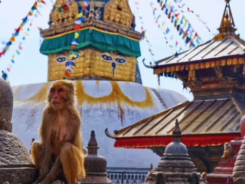
Kathmandu is the capital and largest city of Nepal, situated in the Kathmandu Valley at an elevation of approximately 1,400 metres above sea level. The valley, which also encompasses the historically and architecturally significant cities of Patan (Lalitpur) and Bhaktapur, contains seven of Nepal's ten UNESCO World Heritage Sites and serves as the country's political, economic, cultural, and administrative hub.
Kathmandu's metropolitan area population is estimated at approximately 800,000, though the broader valley's total population substantially exceeds that figure. The city is home to Nepal's federal parliament, the Supreme Court, the prime ministerial residence at Baluwatar, and Tribhuvan International Airport, which serves as the country's primary international gateway.
No. Nepal has never been a colony, princely state, protectorate, or administrative territory of British India or of the modern Republic of India. It maintained full sovereignty throughout the colonial period.
The Sugauli Treaty of 1816, concluded after the Anglo-Nepalese War, required Nepal to cede certain western territories to the British East India Company, but it did not affect Nepal's status as an independent sovereign nation. Nepal observes no Independence Day, because it was never colonised.
No. A limited tributary relationship with China's Qing dynasty was established following the Sino-Nepali War of 1788 to 1792, but Nepal was never administered by China or governed under Chinese law.
The tribute missions that formed the basis of that arrangement ceased in 1908 when the Qing dynasty collapsed. China and Nepal subsequently concluded a Treaty of Peace and Friendship in 1960, establishing formal diplomatic relations between two sovereign equals.
Nepal is in Asia, specifically in the South Asian subcontinent.
Kathmandu is the capital and largest city of Nepal, located at approximately 1,400 metres above sea level in the Kathmandu Valley. It is the country's political, cultural, and economic centre.
Yes. Nepal is a fully sovereign, independent federal democratic republic. Its formal name is the Federal Democratic Republic of Nepal, and it has maintained continuous United Nations membership since 1955.
Nepali is Nepal's official language, written in Devanagari script. Additional widely spoken languages include Maithili, Bhojpuri, Tamang, Tharu, and Newari (Nepal Bhasa). The country is home to over 120 distinct languages spoken across its diverse ethnic communities.
Nepal is classified as a lower-middle-income country by the World Bank. Its economy draws primarily from tourism, remittances sent by Nepalese workers abroad, agriculture, and a rapidly expanding hydropower sector.
Poverty rates have declined substantially over the past two decades, but development challenges in infrastructure, healthcare access, and economic diversification remain significant.
Yes. Nepal has no coastline and is entirely surrounded by land, with India on three sides and China's Tibet Autonomous Region to the north. The nearest coastline is the Bay of Bengal, located approximately 700 kilometres to the southeast, accessible only through the territories of Bangladesh and India.
Lord Buddha (Siddhartha Gautama) was born in Lumbini, Nepal, around 563 BCE. Lumbini is a UNESCO World Heritage Site in Rupandehi District, southern Nepal, and is recognised as one of the most sacred pilgrimage destinations in the Buddhist world.
Bikram Sambat (BS) is Nepal's official national calendar, approximately 56 years and 8 to 9 months ahead of the Gregorian calendar. The year 2026 AD corresponds to 2083 BS. Nepal's New Year, called Naya Barsha, falls in mid-April each year, generally between April 13 and 15.
Nepal comprises seven provinces: Koshi, Madhesh, Bagmati, Gandaki, Lumbini, Karnali, and Sudurpashchim, established under the 2015 Constitution. Each province maintains its own elected assembly, government, and administrative institutions.
India borders Nepal to the south, east, and west, spanning a 1,690-kilometre frontier across five Indian states. China's Tibet Autonomous Region borders Nepal to the north across a 1,236-kilometre high-altitude boundary. Nepal's total land border measures 2,926 kilometres.
Yes. Nepal is broadly safe for tourists. The September 2025 political unrest stabilised progressively, and the March 2026 general elections produced a functioning majority government under Prime Minister Balendra Shah.
Most international travel advisories currently classify Nepal as requiring standard travel precautions rather than elevated or specific warnings. High-altitude trekking carries altitude-specific physiological risks that experienced guides and properly structured acclimatisation schedules address effectively.
Nepal is a completely independent, sovereign country. It has never been part of India and maintains full constitutional independence, operating as a federal democratic republic with its own constitution, elected government, national currency, and United Nations membership.
Nepal shares borders with both countries, but India surrounds Nepal on three sides: south, east, and west. The India-Nepal border spans 1,690 kilometres across five Indian states.
The Nepal-China border runs 1,236 kilometres along the high Himalayas to the north. By land border extent and geographic encirclement, Nepal is substantially more extensively bordered by India than by China.
Nepal is not simply a small country positioned between two of Asia's largest territorial powers. It is one of the most layered, most intellectually and physically rewarding travel destinations on Earth, shaped by extraordinary geography, millennia of uninterrupted cultural development, and a sovereign identity that survived without colonial disruption.
Majestic Trails Nepal designs and operates fully supported trekking journeys across every major route in the country. Everest Base Camp. Annapurna Circuit. Manaslu Circuit. Upper Mustang. Langtang Valley. Gosaikunda. Kanchenjunga. Every journey includes permits, certified local guides, porter support, and comprehensive end-to-end logistics, so you can direct your full attention to the trail and the terrain that surrounds it.
Get in touch with our team to begin planning your Nepal trek. We will handle everything else.
Nepal is a country defined by mountains. Stretching across the country’s northern edge, the Himalayas pack Earth’s highest peaks into one nation. Eigh...

Introduction"Tailor-made Nepal trips put you in control: Discuss routes, adjust plans, and experience the Himalayas your way with expert local guides"...
Moderate treks in Nepal offer the perfect balance between challenging adventure and accessible exploration, making them ideal for trekkers who want br...

If you've ever wondered why trekking in Nepal captivates adventurers from every corner of the globe, the answer lies in its extraordinary combination...
Discover the Heart of NepalIf you're searching for the best places to go in Nepal Kathmandu, you've chosen one of Asia's most captivating destinations...
If you're curious about trekking in Nepal, you've landed in the right place. Nepal is home to the world's most breathtaking mountain trails, ancient c...
The Best Nepal treks from Kathmandu represent some of the most spectacular mountain journeys on Earth, all accessible from Nepal's vibrant capital cit...
Everest and the Sherpa people have been associated for the past 73 years. Years before the first Everest summit, the Sherpa people had already made th...
Nepal is home to 14 peaks over 8,000 meters. This includes all 8 internationally recognized eight-thousanders and 6 additional summits officially adde...
