
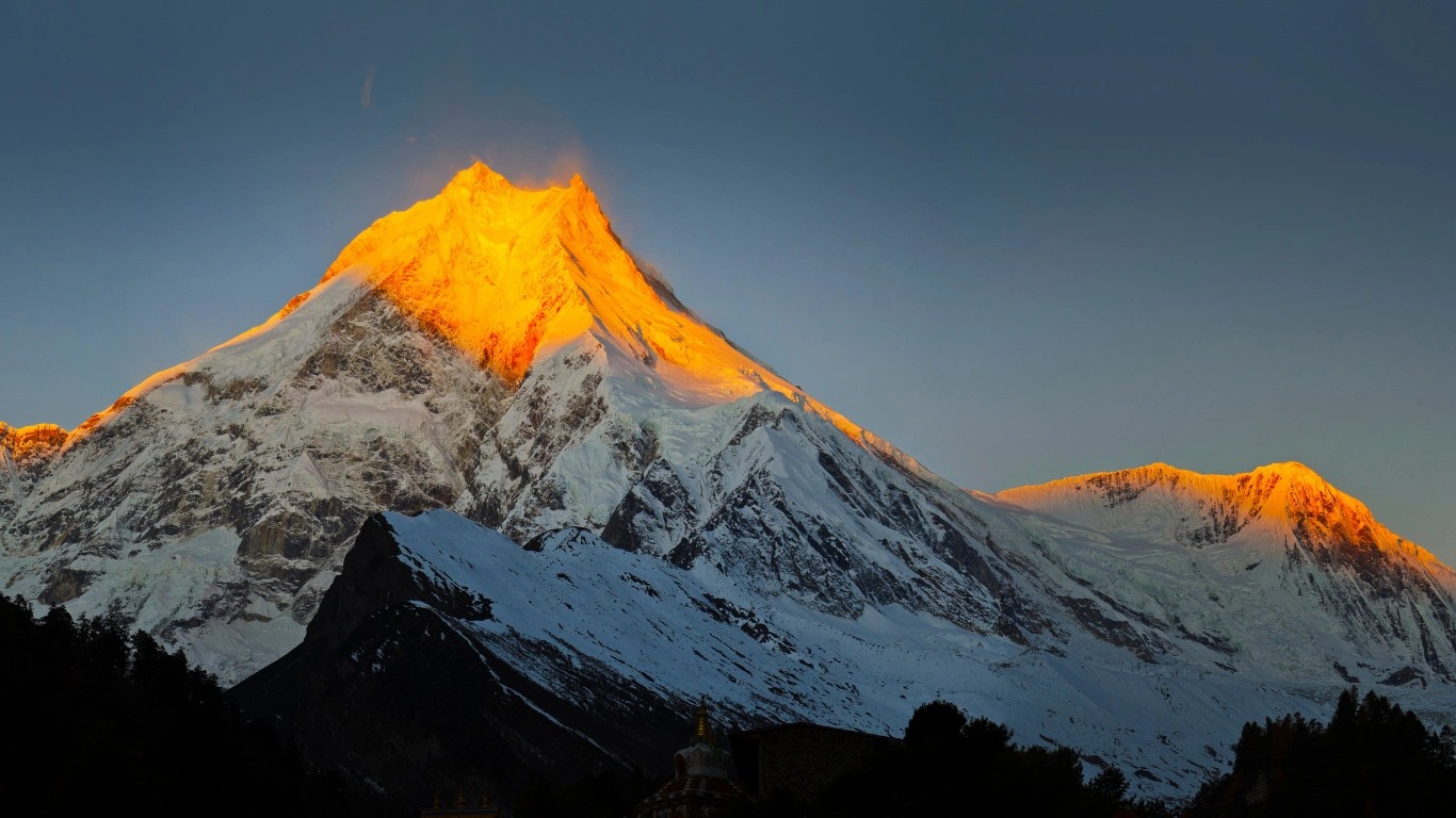
Macchapuchre (Fishtail) – The Sacred Unclimbed Mountain in Nepal
20 Feb 2026
Macchapuchre stands as one of the most iconic and mysterious peaks in the entire Himalayan range. Also commonly spelled Machhapuchhre, this magnificen...
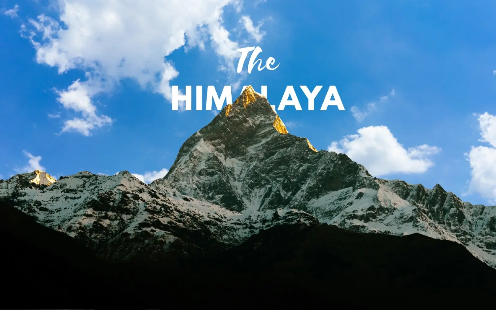

The first sight of the Himalayas rarely matches what people expect. From an airplane window on the approach to Kathmandu, travelers look for a single famous peak and instead find a horizon of them, wave after wave of white ridges running further than the eye can follow. That first glimpse answers the question better than any map. The Himalayas are not a mountain. They are a wall of them, and that wall crosses more of the world than most people realize.
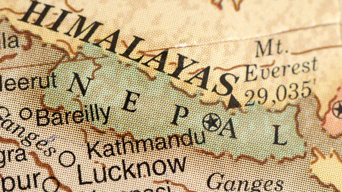
So where are the Himalayas, exactly? They stand in South Asia, running in a long arc across five countries: Nepal, India, Bhutan, China (Tibet), and Pakistan. The range stretches roughly 2,400 kilometers from west to east, dividing the Tibetan Plateau in the north from the plains of the Indian subcontinent in the south. Nepal holds the central section, where Mount Everest and most of the planet's highest peaks stand.
That is the location in one breath. The fuller answer, including a strange detail near the summit of Everest, is where the range gets interesting.
The Himalayas are the highest mountain range on Earth, a system of parallel ridges and deep valleys that forms the northern edge of the Indian subcontinent. The name comes from Sanskrit: hima, meaning snow, and alaya, meaning abode. The abode of snow. It is an accurate name for a range where the permanent snow line sits near 5,500 meters and never retreats.
A small point of usage clears up a common confusion. "Himalaya," singular, refers to the mountain system as a whole. "Himalayas," plural, is the more common English form and treats the range as the many mountains it contains. Both are correct. The plural simply won.
What sets this range apart is not only height but youth. In geological terms the Himalayas are still new, still rising, and still moving. That fact, more than any other, explains where they are and why.
Ask ten travelers where the Himalayas begin and most will point to Nepal. The reality is broader. The range runs along the northern rim of the Indian subcontinent, through the zone where South Asia meets Central Asia, forming a curved barrier between two entirely different worlds. To the south lie the warm, low, densely settled plains of India, Nepal, and Bangladesh. To the north sits the cold, thin-aired Tibetan Plateau. The Himalayas are the line drawn between them.
The mountains run uninterrupted for about 2,400 kilometers, anchored at each end by a great peak. In the west stands Nanga Parbat, in the Pakistani-administered part of Kashmir. In the east rises Namcha Barwa, in Tibet, where the range bends sharply and ends. Everything the word "Himalaya" usually describes lies between those two summits. Measured across, the range spans between 200 and 350 kilometers, and its total area covers close to 595,000 square kilometers, an expanse larger than many countries it borders.
Location, then, is not a single dot on a map. It is a belt, and the belt is the point.
This is the question that trips people up, because it assumes a single answer. There isn't one. The Himalayas belong to no country and to five at once. Each nation holds a different stretch, and each stretch has its own character, its own peaks, and its own way of living with the mountains.
Nepal sits at the center and carries the greatest weight of them. Around 75 percent of the country is mountainous, roughly 800 kilometers of the range fall within its borders, and eight of the world's fourteen peaks above 8,000 meters stand in or along its edges. For a great many visitors, Nepal is the Himalayas, and the geography does little to argue otherwise.
The other four nations complete the arc. India holds a long section curving across its northern states, from the high desert of Ladakh in the west to the forested ridges of Arunachal Pradesh in the east. China's share lies mainly on the northern flank, in Tibet, including the dry and formidable north face of Everest. Bhutan, small and almost entirely mountainous, covers the eastern Himalayas. Pakistan holds the western tip, where the range meets its neighbor, the Karakoram.
The table below sets out each country's place in the range at a glance.
| Country | Where the Himalayas sit | Notable peaks and regions |
| Nepal | The central Himalayas, the heart of the range | Everest, Annapurna, Manaslu, Dhaulagiri, Langtang, Kanchenjunga |
| India | A long northern arc across several states | Kashmir, Ladakh, Himachal Pradesh, Uttarakhand, Sikkim, Arunachal Pradesh |
| China (Tibet) | The northern slopes and the far eastern end | Everest's north face, Namcha Barwa, Shishapangma |
| Bhutan | The eastern Himalayas, most of the country | Gangkhar Puensum, high monastic valleys |
| Pakistan | The western end, running into Kashmir | Nanga Parbat, the link to the Karakoram |
Beyond these five, the wider system fades into other regions. The foothills descend toward Bangladesh in the east, and connected ranges like the Hindu Kush reach into Afghanistan. But the core Himalayan countries remain the five above. Which countries touch the Himalayas is a question with a firm answer, and leaving out any of the five gives an incomplete map.
Knowing which countries the range crosses is one thing. Seeing where it sits makes the scale far easier to grasp. On a map, the Himalayas appear as a long crescent drawn across the top of South Asia, bending gently from the northwest near Pakistan, sweeping east through India, Nepal, and Bhutan, and finishing in Tibet. Geographers describe the shape as bow-shaped or crescent-shaped, and once seen, the outline stays with you.
The range is easiest to picture through three neighboring regions. To the south lie the flat, crowded plains of the Ganges basin. To the north sits the vast, near-empty Tibetan Plateau. The line of snow-capped peaks between the two is the Himalayas. That line traces India's northern border, runs through the middle of Nepal, and curves into Bhutan and Tibet.
On a world map, the range sits in the northern hemisphere, in the eastern half of Asia, well above the equator and just north of the Tropic of Cancer. It forms the highest section of a much longer mountain belt that runs, on and off, from North Africa to Southeast Asia. For a labeled map or a study reference, the cleanest way to mark the Himalayas is as an arc along India's northern border, with Nepal at the center point and Everest positioned on the Nepal-China line.
A range this large resists a single coordinate, though the searches for one are constant. A rough central reference falls near 28° north latitude and 84° east longitude. The full belt spreads well beyond that, from roughly 26° to 35° north and 74° to 95° east. Mount Everest itself sits at about 27.99° north, 86.93° east.
Treat any of these figures as a point inside the range rather than its boundary. The Himalayas cover too much ground for a pin to define them, which is exactly why a single latitude and longitude has never told the whole story.
The Himalayas are in Asia, across its southern and central regions. Every part of the range, and all five countries that share it, sit on the Asian continent. The mountains form the tallest section of the great east-west belt of highlands that crosses the middle of Asia, and nowhere else on Earth does that belt rise so high.
The central and highest stretch of the range runs directly across Nepal, which is why so many searches for the mountains resolve, in the end, to a map of this one country. Travelers regularly ask our guides where in Nepal the giants actually stand, and the answer runs neatly from one border to the other.
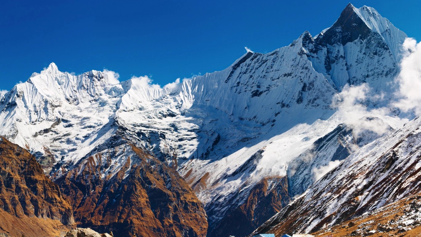
The section holding Everest is called the Mahalangur Himal. It straddles the Nepal-Tibet border and gathers four of the six tallest mountains on the planet into a single massif: Everest at 8,848.86 meters, alongside Lhotse, Makalu, and Cho Oyu. Move west and the range opens into the Annapurna and Dhaulagiri massifs, split by the Kali Gandaki, one of the deepest river gorges anywhere in the world. Between and around these peaks lie the valleys travelers come to walk.
Placed from east to west, Nepal's principal Himalayan regions run as follows:
On a clear morning the mountains reveal themselves from Kathmandu itself. The Langtang and Ganesh Himal ranges rise above the valley rim, visible from the city's higher edges. Everest lies too far east and too deep in the range to see from the capital, which is why travelers drive to viewpoints like Nagarkot or take an early mountain flight to catch it.
The Himalayas are not one wall of rock but a series of parallel belts climbing from the plains toward Tibet. These divisions explain why the scenery changes so quickly with height, and why a single day of walking can carry you from rice paddies to pine forest to bare ice.
From south to north, the range rises in four broad steps:
There is also an east-west grammar to the range. The Western Himalayas cover Kashmir and Himachal, the Central Himalayas run through Nepal and hold most of the highest peaks, and the Eastern Himalayas cover Sikkim, Bhutan, and Arunachal, where the monsoon arrives wetter and the forests grow thicker. The long trekking routes in Nepal pass through the vertical belts in sequence, and the shift in vegetation, temperature, and even the languages spoken along the trail is the range itself, ordered by altitude.
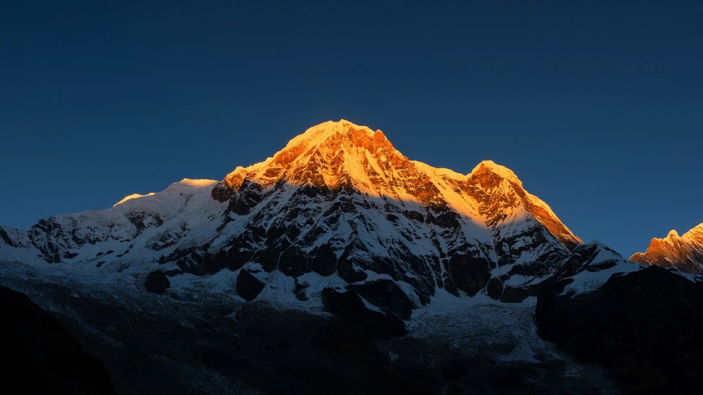
Here the strange detail near Everest's summit finally makes sense. Embedded in the pale limestone of the highest ground on Earth are fossils of marine animals, creatures that lived on a shallow sea floor more than 450 million years ago. The roof of the world is built, in part, from old seabed. The reason is a collision that has not yet ended.
Around 50 million years ago, the Indian plate, drifting north at a speed remarkable for a landmass, met the Eurasian plate. No ocean was deep enough and no crust strong enough to absorb the impact cleanly. The seabed that had lain between the two continents, the floor of an ancient sea called the Tethys, was scraped up, folded, and driven into the sky. That former ocean floor is why marine fossils rest near the summit of the tallest mountain on Earth. The fossils did not climb. The ground beneath them rose. This is why geologists call the Himalayas young fold mountains: young because they formed recently in Earth's history, fold because the collision buckled the crust into the ridges we see.
The collision continues today. India still pushes north, and the Himalayas still grow, rising by a few millimeters each year in many sections. The earthquakes that shake Nepal and northern India are the sound of that movement carrying on. These mountains are still rising while we watch.
The rise did more than build peaks. Once the range climbed past roughly 4,000 meters, it began to block the moist air sweeping in off the Indian Ocean, forcing it upward until it cooled and dropped its water as rain on the southern slopes. The result is the South Asian monsoon on one flank and a dry rain shadow on the other. The green, wet southern valleys of Nepal and the arid, brown highlands of Mustang and Tibet are two faces of the same mountain wall. The position of the Himalayas governs the weather of much of the continent.
The location of the range is more than a point of geography. It shapes daily life across a large part of Asia, and in three ways above all.
They are the water tower of the continent. Snow and roughly 15,000 glaciers feed the major rivers that rise here, among them the Indus, the Ganges, and the Brahmaputra, and those rivers supply the farms and cities of nearly two billion people downstream. Every one of those rivers begins as a drop of Himalayan snow.
They are a climate barrier. By blocking cold air from the north and wringing rain from the monsoon, the range hands South Asia much of the climate it has. Without that wall, weather across India and Nepal would look entirely different.
And they are among the richest living zones on the planet. Because the land climbs from subtropical jungle to permanent ice within a few hundred kilometers, the range holds an exceptional spread of habitats. Snow leopards, red pandas, and thousands of plant species found nowhere else survive within its folds. The Himalayas do not simply divide Asia. In large measure, they define it.
The Himalaya, or Himalayas, is located in South Asia along the northern edge of the Indian subcontinent. The range spans five countries, Nepal, India, Bhutan, China (Tibet), and Pakistan, and separates the Tibetan Plateau to the north from the plains of India and Nepal to the south.
The Himalayas are the highest mountain range on Earth, a system of parallel ridges and valleys that runs about 2,400 kilometers across South Asia. The name means "abode of snow" in Sanskrit. The range contains Mount Everest and most of the world's peaks above 8,000 meters.
No single country. The Himalayas span five: Nepal, India, Bhutan, China (Tibet), and Pakistan. Nepal holds the central and highest section, including Everest, while India covers a long northern arc and China holds the northern slopes in Tibet.
It runs along the northern border of the Indian subcontinent, from Nanga Parbat in Pakistan-administered Kashmir in the west to Namcha Barwa in Tibet in the east, crossing Nepal, India, Bhutan, China, and Pakistan.
On a map, the range appears as a long crescent along India's northern border. It curves from Pakistan in the northwest, through India, Nepal, and Bhutan, and ends in Tibet, sitting between the Ganges plains to the south and the Tibetan Plateau to the north.
There is no single coordinate for a range this large. A rough central point sits near 28° north and 84° east, while the full belt spreads from about 26° to 35° north and 74° to 95° east. Everest sits at roughly 27.99° north, 86.93° east.
The Himalayas formed from the collision of the Indian plate and the Eurasian plate, which began around 50 million years ago. The two continents are still converging, which is why the range continues to rise today.
Both, along with three other countries. Nepal holds the central section with the greatest concentration of high peaks, while India covers a wide northern stretch. Everest itself sits on the Nepal-China border, not in India.
Yes, on clear days. The Langtang and Ganesh Himal ranges are often visible from the higher edges of the Kathmandu valley. Everest lies too far east to see from the city, so travelers head to viewpoints like Nagarkot or take a mountain flight.
Most people meet the Himalayas first as a line on a map or a shape against the sky from a plane window. The mountains become something else entirely from a trail inside them, where the scale stops being a number and starts being the air you breathe. The central section, the highest and most storied part of the whole range, runs directly through Nepal, and it is more within reach than most travelers assume.
Majestic Trails Nepal runs guided treks across every major region described on this page, from the classic approach to Everest to the quiet circuit around Manaslu and the short valleys of Langtang. When you are ready to stand inside the range rather than read about it, our team can plan a route matched to your time, fitness, and the part of the Himalayas you most want to see.
Macchapuchre stands as one of the most iconic and mysterious peaks in the entire Himalayan range. Also commonly spelled Machhapuchhre, this magnificen...
Annapurna I is the 10th highest mountain in the world. It is located in the country of Nepal, in Asia. It was the first mountain above 8,000 meters to...
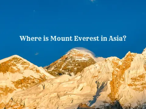
Mount Everest sits on the border between Nepal and the Tibet Autonomous Region of China, deep within the eastern Himalayas of South Asia. It is the hi...
