
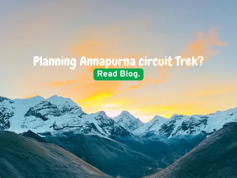
Annapurna Circuit Trek Nepal – Complete Guide, Itinerary, Cost & Best Time
23 Jan 2026
The Annapurna Circuit Trek is one of the world’s most legendary long-distance treks — a journey that circles the Annapurna massif through Nepal’s most...

The Annapurna Circuit Trek altitude is both the greatest challenge and the most rewarding aspect of this legendary Himalayan journey. As a trekking company that has guided thousands of adventurers through these ancient trails, we at Majestic Trails Nepal understand that altitude isn't just a number — it's the defining factor that shapes your entire experience.
Starting from the village of Jagat at 1,300 meters (4,265 feet) and going up to Thorong La Pass at 5,416 meters (17,769 feet), the Annapurna Circuit climbs a huge amount and is one of the most famous treks in the world. This guide will show you each village, the harder sections, and tips we've learned from guiding trekkers for years.
Whether you're a first-time trekker or an experienced mountaineer, understanding the Annapurna Circuit elevation profile is crucial for a safe and enjoyable journey. Let's dive into everything you need to know.
The Annapurna trek height profile is unique among Nepal's major trekking routes. Unlike treks that start high and stay high, the Annapurna Circuit begins in lush, warm valleys and gradually ascends through multiple climate zones before reaching its apex at Thorong La Pass.
"The Annapurna Circuit is like climbing through five different worlds in two weeks," says Ram Gurung, our senior guide with 18 years of experience. "From rice paddies to snow peaks, your body must adapt continuously. This is why understanding altitude is not optional — it's essential."
The gradual elevation gain is actually one of the circuit's advantages. Your body has more time to acclimatize compared to treks that gain altitude rapidly. However, this doesn't mean you can take altitude lightly. Every year, we see trekkers underestimate the effects of high altitude, leading to shortened trips or, in worst cases, emergency evacuations.
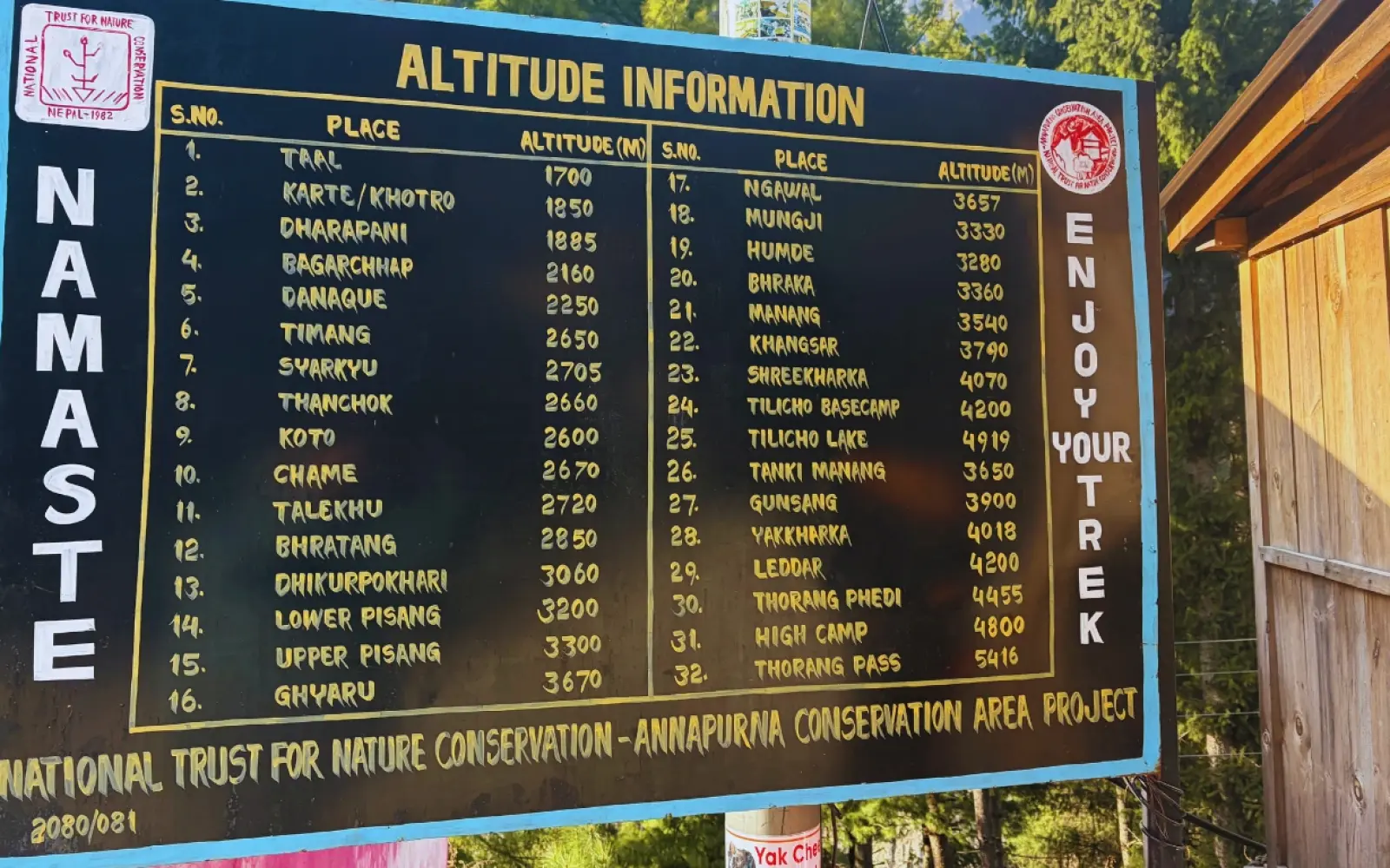
Understanding where you'll sleep each night and how high you'll climb is fundamental to planning your trek. Here's our comprehensive breakdown of the Annapurna Circuit elevation at each major stop:
| Village/Stop | Altitude | Notes |
|---|---|---|
| Jagat | 1,300m / 4,265ft | Starting Point |
| Dharapani | 1,860m / 6,102ft | Entry point to Manang district |
| Chame | 2,670m / 8,760ft | District headquarters, last big village with shops |
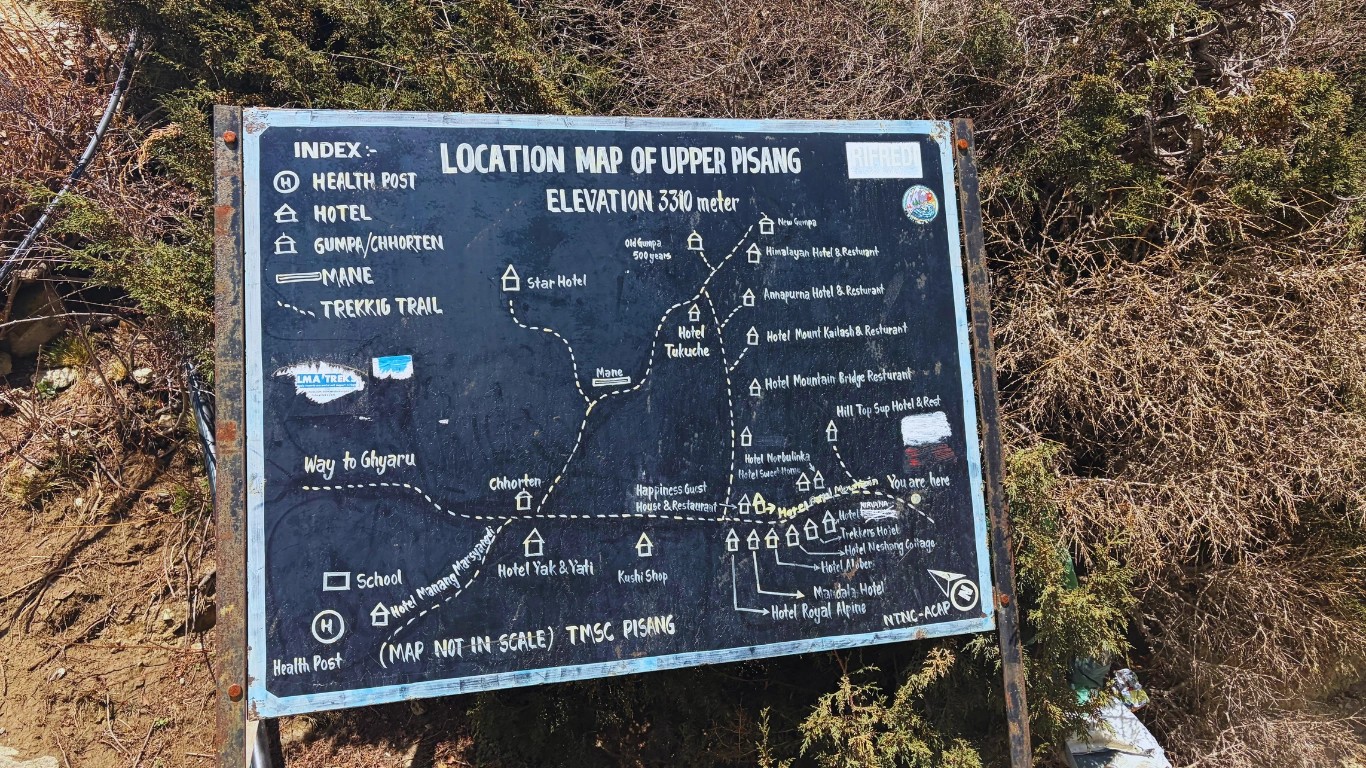
| Upper Pisang | 3,300m / 10,827ft | Stunning monastery views, perfect acclimatization spot |
| Manang | 3,540m / 11,614ft | Major acclimatization stop; explore village and lakes |
| Yak Kharka | 4,018m / 13,182ft | High-altitude camp; grazing yaks and small lodges |
| Thorong Phedi | 4,450m / 14,600ft | Base camp for Thorong La Pass; final preparation |
| High Camp | 4,850m / 15,912ft | Optional stop before pass for extra acclimatization |
| Thorong La Pass | 5,416m / 17,769ft | Highest point on the trek; panoramic Himalayan views |
| Muktinath | 3,800m / 12,467ft | Sacred pilgrimage site ( You can drive to Pokhara Next day from here too) |
| Jomsom | 2,720m / 8,924ft | Trek endpoint; flight or bus connection to Pokhara/Kathmandu |
If you're extending your trek to include the famous Poon Hill viewpoint, here's what to expect:
| Village/Stop | Altitude | Notes |
|---|---|---|
| Marpha | 2,670m/8,760ft | Apple capital of Nepal |
| Ghasa | 2,010m/6,594ft | Deepest gorge section |
| Tatopani | 1,190m/3,904ft | Hot springs village |
| Shikha | 1,935m/6,348ft | Quiet mountain village |
| Ghorepani | 2,860m/9,383ft | Gateway to Poon Hill |
| Poon Hill | 3,210m/10,531ft | Sunrise viewpoint |
The Ghorepani altitude of 2,860m/9,383ft is significantly lower than the main circuit's highest points, making this extension a wonderful way to gradually descend while still experiencing spectacular mountain views.
Here's a typical daily altitude chart Annapurna Circuit for a 14-day classic itinerary:
The first few days feel deceptively easy. Starting from Jagat, the terrain alternates between gentle valleys and steep sections. These days are perfect for finding your walking rhythm and enjoying Nepal’s riverside landscapes, small villages, and teahouses. While the altitude is still manageable, it’s a good time to hydrate and settle into trekking life.
As you leave Dharapani and move toward Chame and Upper Pisang, the air thins noticeably. Uphill stretches feel longer, and your breathing slows. The Annapurna Circuit starts to demand respect here, and trekkers should monitor for mild altitude symptoms. Upper Pisang offers spectacular monastery views, and Chame serves as the last major village for supplies.
Manang is the key acclimatization stop. Spending 1–2 nights here allows your body to adjust to the higher elevations. Optional day hikes to nearby lakes or viewpoints help “climb high, sleep low,” boosting acclimatization. Enjoy exploring the village, resting, and preparing for the challenging high-altitude days ahead.
From Manang, the trek becomes more demanding. Yak Kharka and Thorong Phedi separate the well-prepared trekkers from those who underestimate the journey. Every step feels heavier, and proper pacing, hydration, and rest are critical. These stops are small camps with limited lodges, so plan your gear and acclimatization carefully.
The highlight of the trek is Thorong La Pass. Trekkers usually start very early, around 4–5 AM, to reach the pass in 6–8 hours. The effort is intense, but the panoramic Himalayan views make every step worth it. After crossing, descend slightly toward Muktinath for a well-earned rest.
Descending from Muktinath toward Jomsom brings relief to your lungs and legs. The thicker air and gentler paths reward your efforts. Muktinath’s temples and sacred springs provide a cultural highlight, and arriving in Jomsom marks the successful completion of this classic trekking adventure.
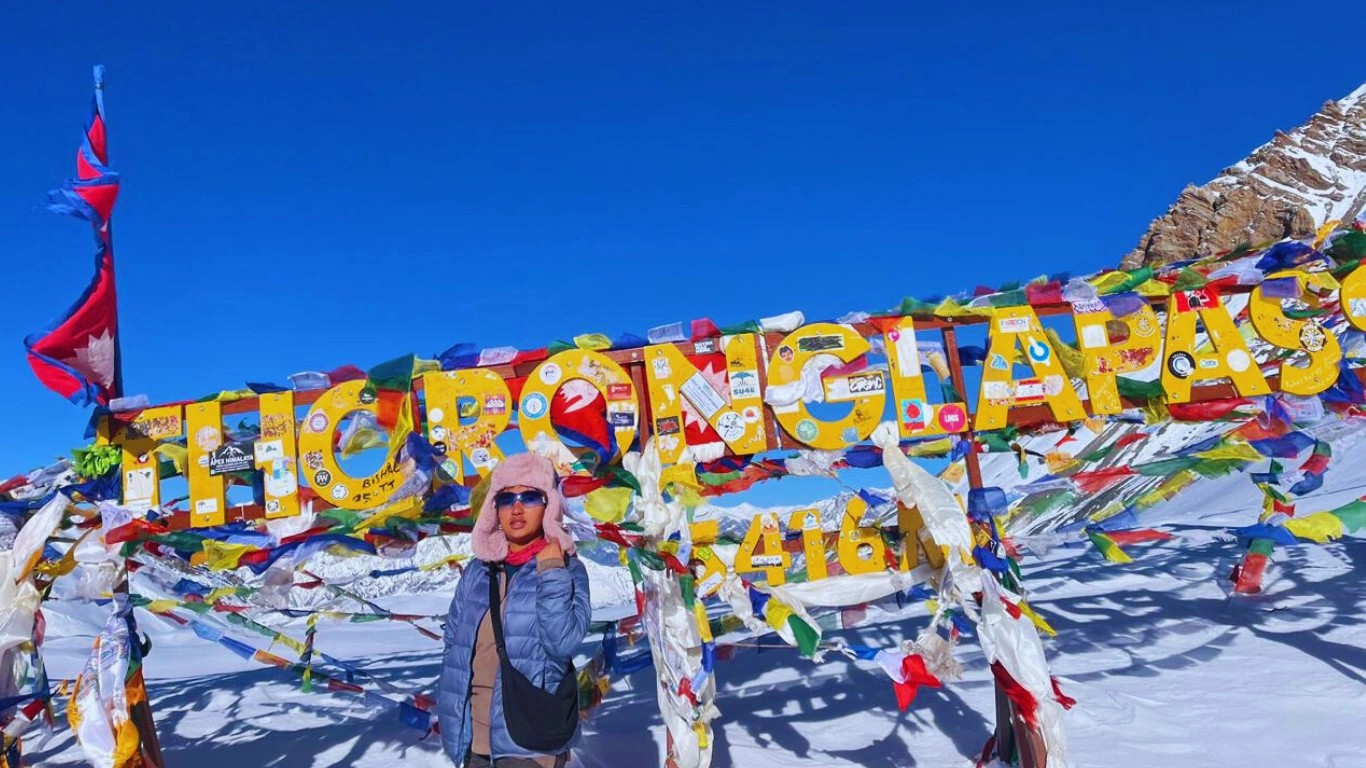
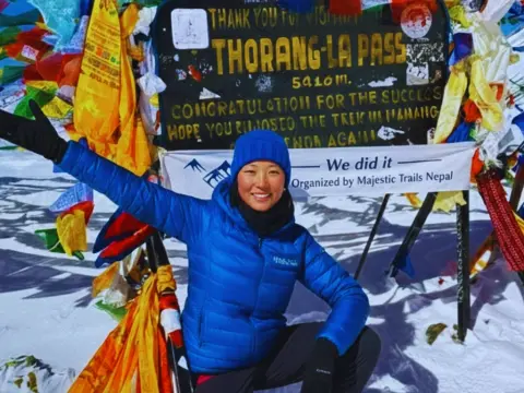
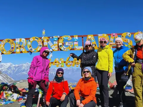
The Thorong La Pass height of 5,416m/17,769ft represents the pinnacle of your Annapurna Circuit experience. This is one of the highest trekking passes in the world, and crossing it is a defining achievement for any trekker.
Physical Conditions:
The Crossing Timeline:
"Crossing Thorong La is like meeting an old friend who tests you every time," shares Pemba Sherpa, our lead expedition guide. "The mountain doesn't care about your fitness level back home. It only cares about how you've prepared and how you respect the altitude."
Altitude sickness is the single biggest threat to your Annapurna Circuit trek. Here's our stage-by-stage guide to prevention, based on years of guiding experience:
Symptoms to Watch:
Prevention Tips:
Majestic Trails Nepal Advice: "This is where we start monitoring our clients closely. A mild headache is normal; a persistent, worsening one is not."
The Manang altitude of 3,540m/11,614ft presents your first real altitude challenge. This is why every responsible trekking company includes a rest day here.
Acclimatization Activities:
Prevention Tips:
This intermediate camp is where altitude effects intensify for many trekkers.
Common Symptoms:
Prevention Tips:
Insider Knowledge: The Thorong Peak Hotel at Yak Kharka is one of our favorite tea houses. The dal bhat is excellent, the rooms are warm, and the owner has emergency oxygen available. We always recommend staying here over some of the newer, less-equipped lodges.
"Phedi" means "foot of the hill" in Nepali, and that's exactly what this camp represents — your launching point for Thorong La.
Critical Warning Signs:
Emergency Protocols:
If any severe symptoms appear:
Using Horses: At this altitude, there's no shame in using horse assistance. Local horsemen maintain animals specifically for this purpose. If you're struggling, we can arrange a horse to carry you to High Camp or back down to Yak Kharka. Your safety and completion of the trek matter more than pride.
Final Preparations:
During the Climb:
Post-Summit Descent:
Many trekkers experience relief descending to Muktinath. However, stay alert — knee injuries are common on the steep descent.
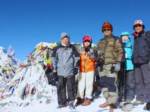
Beyond the main trail, the Annapurna Circuit hides spectacular viewpoints that most trekkers miss. Our guides have spent years discovering these gems:
Location: 30-minute detour above Upper Pisang village
Altitude: Approximately 3,400m/11,155ft
Best Time: Sunrise or late afternoon
The Upper Pisang Monastery (Braga Gompa) sits on a ridge with unobstructed views of Annapurna II, Pisang Peak, and the Manang Valley. The morning light paints the peaks in golden hues, and you'll often be alone here while other trekkers stick to the main trail.
Photography Tips:
Location: Above Manang, off the main trail
Altitude: Approximately 4,100m/13,451ft
Best Time: Afternoon on your Manang rest day
Green Lake is a hidden glacial lake that reflects the surrounding peaks. The 3-4 hour round trip from Manang serves double duty as an excellent acclimatization hike.
What to Expect:
The Annapurna Circuit isn't just about altitude and adventure — it's a journey through living Himalayan culture.
This 500-year-old Tibetan Buddhist monastery is one of the circuit's most significant cultural sites. The resident monks welcome respectful visitors, and the interior murals depicting Buddhist cosmology are extraordinary.
Visiting Tips:
Perched above Braga village near Manang, this monastery contains some of the oldest religious artifacts in the region. The 500-year-old structure houses sacred texts, butter lamps, and ancient statues.
The Muktinath altitude of 3,800m/12,467ft makes it one of the highest pilgrimage sites in the world. Sacred to both Hindus and Buddhists, the temple complex features:
Cultural Insight: Muktinath represents a rare example of Hindu-Buddhist harmony. Pilgrims from both faiths visit year-round, despite the challenging altitude.
Winter and early spring treks offer unique cultural experiences. Villages become isolated, and trekkers witness traditional mountain life:
"During one December trek, we were snowed in at Manang for two extra days," recalls our guide Dawa. "The village treated us like family. We participated in their winter rituals, drank butter tea until we couldn't drink more, and learned songs in Tibetan dialect. Those are memories no summer trekker ever experiences."
After guiding thousands of trekkers, we've identified the most common errors that lead to problems. Learn from others' mistakes:
The Mistake: Many trekkers underestimate temperature drops at high altitude. The Annapurna trek height gain means temperatures can plummet from 20°C/68°F to -20°C/-4°F within a few days.
The Reality:
Our Advice: Pack for the coldest conditions you might encounter. It's easier to remove layers than to wish you had them.
The Mistake: Some trekkers, especially fit ones, feel "fine" at Manang and want to push ahead.
The Reality:
Our Protocol: We never skip the Manang rest day, regardless of how clients feel. This isn't negotiable.
The Mistake: Not carrying or using a pulse oximeter, dismissing early warning signs.
The Reality:
Our Equipment: Every Majestic Trails Nepal guide carries a pulse oximeter and monitors client saturation levels twice daily at high altitudes.
The Mistake: Not drinking enough water due to cold weather or inconvenience.
The Reality:
Our Tip: Carry at least 2 liters and drink constantly, even when not thirsty. We recommend water purification tablets or a SteriPen.
The Mistake: Treating the Annapurna Circuit like a race, trying to complete it in minimum days.
The Reality:
Our Philosophy: The mountains have stood for millions of years. Taking an extra day won't diminish them, but rushing might diminish you.
The Mistake: Insisting on crossing Thorong La despite guide warnings about weather.
The Reality:
Our Policy: When our guides say we don't go, we don't go. Period.
Not all tea houses are created equal. Here are our recommendations, accumulated over years of guiding:
Yak Kharka: Thorong Peak Hotel
Manang: Tilicho Hotel
Upper Pisang:Hotel Mandala
Marpha: Tanpopo Restaurant
Jomsom: Himalayan Hotel
Chame: Eagle Eye
Instead of the crowded main villages, consider these alternatives:
| Instead of... | Try... | Benefits |
|---|---|---|
| Lower Pisang | Upper Pisang | Better views, fewer crowds |
| Bharkha | Manang | Authentic village experience |
| Thorong Phedi | High Camp | Shorter summit day, better altitude prep |
| Tatopani main strip | Tatopani upper village | Quieter hot springs experience |
Preparing for the Annapurna Circuit altitude challenge starts months before you arrive in Nepal. Here's our comprehensive training guide:
Weekly Goals:
Key Exercises:
Focus Areas:
Recommended Exercises:
"We tell all our clients the same thing: if you can walk 4 hours daily with a small backpack and still feel good, you're ready for the Annapurna Circuit," advises our training consultant, Bikash Thapa.
Weekend Training Hikes:
Physical fitness is only part of the equation. Mental resilience matters enormously at high altitude.
Mental Training Techniques:
Pre-Trek Diet:
The Annapurna Circuit altitude experience varies dramatically by season:
Choosing between Nepal's two most famous treks? Here's how they compare from an altitude perspective:
| Factor | Annapurna Circuit | Everest Base Camp |
|---|---|---|
| Starting altitude | 1300m/4265ft (Jagat) | 2,860m/9,383ft (Lukla) |
| Highest point | 5,416m/17,769ft (Thorong La) | 5,644m/18,517ft (Kala Patthar) |
| Total elevation gain | ~4,656m/15,276ft | ~2,784m/9,134ft |
| Days above 4,000m/13,123ft | 2 days | 6-8 days |
| Acclimatization approach | Gradual climb from low | Start high, acclimatize en route |
Annapurna Circuit:
Everest Base Camp:
"It's not a straightforward comparison," explains our operations manager, Sanjay Shrestha. "The Everest trek keeps you higher for longer, but the Annapurna Circuit has one massive day crossing Thorong La. Different challenges."
Annapurna May Be Better If:
Everest May Be Better If:
Proper gear is crucial when dealing with Annapurna Circuit elevation changes. Here's our comprehensive list:
Base Layer:
Mid Layer:
Outer Layer:
"The biggest clothing mistake is bringing cotton," warns our gear specialist. "Cotton kills in the mountains — it holds moisture and destroys your body heat."
Trekking Boots:
Camp Shoes:
Essential:
Recommended:
Trekking Poles:
We cannot emphasize this enough — trekking poles are essential. They reduce knee impact by up to 30% on descents and provide stability on uneven terrain.
Backpack:
Sleeping Bag:
Water:
Snacks:
Basic First Aid Kit:
High-Altitude Essentials:
Majestic Trails Nepal includes:
After decades of combined experience, our guides have learned hard lessons about high-altitude safety:
"The most important safety tip I can give is this: trust your guide," says senior guide Ram Gurung. "We're not trying to ruin your trip when we say we can't go. We're trying to make sure you come back next year."
When We Say Stop:
Blocked Trails:
When trails are blocked by snow, landslide, or other hazards:
Extreme Weather:
What to Do in Emergency:
Helicopter Evacuation:
Never:
Always:
The Annapurna Circuit Trek altitude is both the challenge and the reward of this incredible journey. From the subtropical valleys to the roof of the Thorong La Pass, every meter of elevation gain brings new landscapes, cultures, and personal achievements.
We've guided thousands of trekkers over these ancient trails, and the common thread among successful completions is always respect — respect for the mountains, respect for the altitude, and respect for the guidance of those who know these trails intimately.
"The Annapurna Circuit doesn't require you to be an elite athlete," summarizes our founder. "It requires you to be humble, prepared, and open to the experience. Come with that attitude, and the mountains will welcome you."
At Majestic Trails Nepal, we combine local expertise with international safety standards to create unforgettable Himalayan experiences. Our team includes:
All treks include: Professional guides, ACAP permits, airport transfers, accommodations in Kathmandu, and 24/7 emergency support.
The highest point of the Annapurna Circuit is Thorong La Pass at 5,416m/17,769ft. This mountain pass crosses between the Manang and Mustang districts and represents the climax of the trek. On a clear day, you can see peaks including Annapurna, Dhaulagiri, and the entire Great Barrier range.
Proper acclimatization on the Annapurna Circuit involves:
Thorong La Pass stands at 5,416m/17,769ft above sea level. This makes it one of the highest trekking passes in the world and the defining challenge of the Annapurna Circuit. At this altitude, oxygen levels are approximately 50% of what they are at sea level.
Yes, beginners can complete the Annapurna Circuit with proper preparation. The key factors for beginner success are:
Physical Preparation:
Smart Planning:
Mental Readiness:
"Some of our most successful trekkers were complete beginners," notes our client relations manager. "What matters is attitude, preparation, and willingness to listen to guidance."
October is widely considered the best month for the Annapurna Circuit. The post-monsoon skies are clear, temperatures are moderate, and the trails are in good condition. September and November are also excellent choices.
For spring, late March to mid-April offers good conditions with fewer crowds than autumn.
We recommend a minimum of one dedicated acclimatization day at Manang (Day 8-9 of most itineraries). However, if you have flexibility, additional acclimatization days can only benefit you. Some trekkers add an extra day at Chame or take two rest days at Manang.
Consult your doctor before the trek about Diamox (acetazolamide), the most commonly prescribed altitude sickness prevention medication. Typical dosage is 125-250mg twice daily, starting 1-2 days before reaching altitude.
Important: Diamox is not a substitute for proper acclimatization. It helps your body adapt faster but doesn't prevent altitude sickness if you ascend too quickly.
Emergency oxygen is available at:
However, oxygen is a temporary solution. If you need it, you typically need to descend as well.
If weather, health, or trail conditions prevent a Thorong La crossing:
Our Policy: We never force a crossing when conditions are dangerous. Client safety always comes first.
The daily elevation gain varies significantly throughout the trek:
At the Thorong La Pass height of 5,416m/17,769ft, temperatures can range from:
Wind chill can make these temperatures feel 10-15°C/18-27°F colder. Always prepare for the worst-case scenario.
The Annapurna Circuit Trek is one of the world’s most legendary long-distance treks — a journey that circles the Annapurna massif through Nepal’s most...
The ACT Nepal Trek stands as one of the most iconic high-altitude adventures on Earth, drawing thousands of trekkers annually to Nepal's magnificent A...
The Annapurna Circuit stands among the world's most celebrated trekking routes, drawing thousands of adventurers each year to experience its dramatic...
Choosing the right Annapurna Circuit trek agency is genuinely one of the most consequential decisions you will make in planning this journey. Not beca...
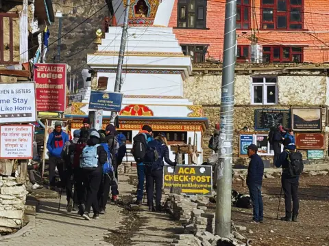
The Annapurna Circuit requires only one permit in 2026: the Annapurna Conservation Area Permit (ACAP). It costs NPR 3,000 for foreign nationals and NP...
