
Must-Visit Villages on the Annapurna Circuit Trek
14 Feb 2026
Let us guide you through the must-visit villages on the Annapurna Circuit Trek, where breathtaking Himalayan landscapes meet centuries-old traditions...

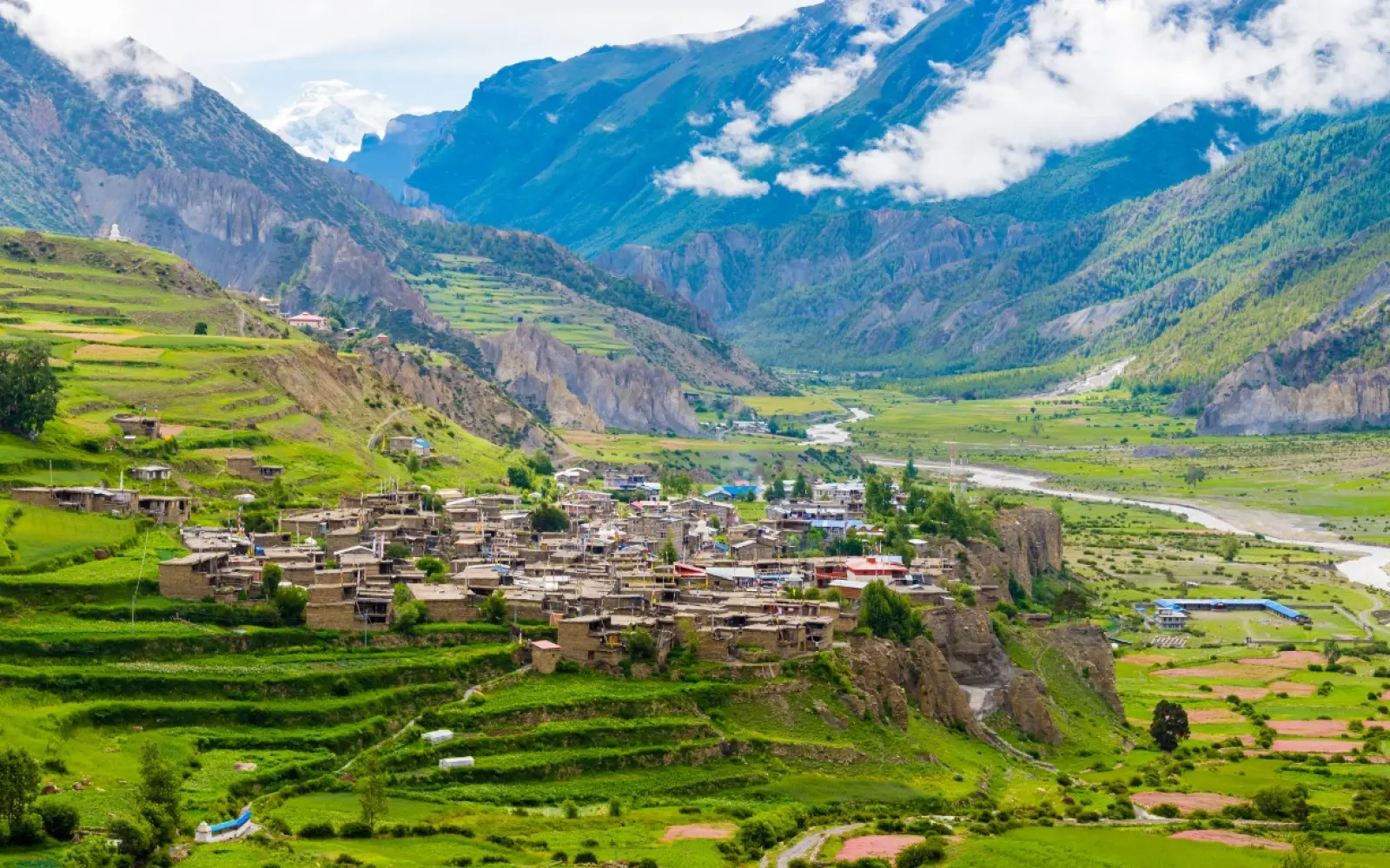

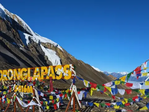
Manang is the most important stop on the Annapurna Circuit. Sitting at 3,519 m in a wide, dry valley beneath the Annapurna massif, it is where every trekker stops for a mandatory acclimatization day before pushing on toward the Thorong La Pass at 5,416 m. How you spend your time in Manang — resting, or climbing high on one of its acclimatization hikes — does more to decide whether you cross that pass successfully than almost anything else on the trek.
It is also the last real town on the northern side of the Circuit: a place with bakeries, gear shops, an ATM, a medical clinic, and even a cinema, set against a backdrop of glaciers. This guide covers everything about Manang — how to get there, how many days to stay, which acclimatization hike to choose, the Tilicho Lake side trip, and what comes next.
Key Takeaways:
| Detail | Information |
|---|---|
| Altitude | 3,519 m (11,545 ft) |
| District | Manang District, Gandaki Province |
| Position on Circuit | Northern side, before Thorong La |
| Days to spend | 2 nights minimum (1 acclimatization day) |
| Best acclimatization hike | Ice Lake / Kicho Tal (~4,600 m) |
| Big side trip | Tilicho Lake (4,919 m) — adds 3–4 days |
| Next stop | Yak Kharka (4,050 m) |
| Facilities | Bakeries, ATM, gear shops, clinic, cinema |
| Permit | ACAP only (covers all side trips) |
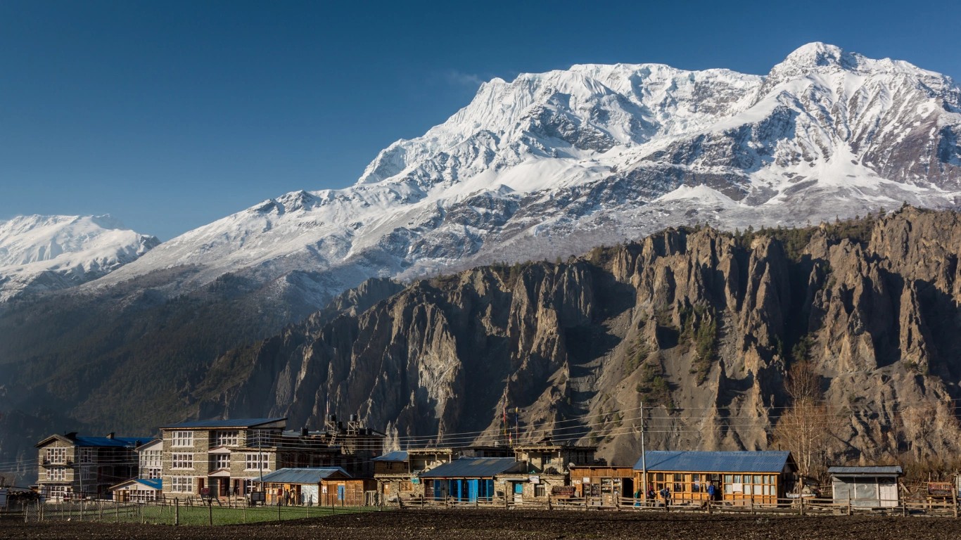
Manang is a large Himalayan village at 3,519 m on the Annapurna Circuit, and it is famous for one thing above all: it is where trekkers acclimatize before crossing the Thorong La Pass. Every sensible itinerary builds in at least one rest day here, and what you do with that day shapes the rest of your trek.
But Manang is famous for more than altitude admin. It is known for:
Manang sits in the rain shadow of the Annapurnas, which is why it looks nothing like the green lower valleys you have walked through to reach it. Ahead of you: bare brown hillsides, whitewashed stone houses, prayer flags, and a wall of ice.
Manang lies in Manang District, Gandaki Province, in the upper Marsyangdi valley, on the northern arc of the Annapurna Circuit. It sits between Chame and Pisang (below it) and Yak Kharka (above it), roughly two-thirds of the way to the Thorong La Pass.
Its position on the Circuit:
| Stage | Altitude |
|---|---|
| Jagat | 1,300 m |
| Dharapani | 1,860 m |
| Chame | 2,670 m |
| Upper Pisang | 3,300 m |
| Braga | ~3,475 m |
| Manang | 3,519 m |
| Yak Kharka | 4,050 m |
| Thorong Phedi | 4,540 m |
| Thorong La Pass | 5,416 m |
A note worth knowing: Braga (Bhraka) is a smaller, quieter village about 20–30 minutes' walk below Manang, with one of the oldest monasteries in the region. Many experienced trekkers stay there instead — it is calmer than Manang and a slightly better starting point for the Ice Lake hike.
Manang is roughly 200 km from Kathmandu by road, and the journey takes a full day — typically 9 to 12 hours by jeep, depending on road conditions. The route runs Kathmandu → Besisahar → Jagat/Dharapani → Chame → Manang, with everything beyond Besisahar on a rough, unpaved mountain road.
| Route | Distance | Time |
|---|---|---|
| Kathmandu → Besisahar | ~175 km | 6–7 hrs |
| Besisahar → Jagat / Dharapani | — | 2–4 hrs (rough jeep road) |
| Dharapani → Chame | — | 2–3 hrs (jeep) |
| Chame → Manang | ~30 km | 3–4 hrs (jeep) or 2–3 days walking |
The honest picture: the road now reaches Manang, which has changed the Circuit significantly. Trekkers no longer walk from Besisahar — they drive to Jagat, Dharapani, or Chame and start walking from there, skipping the dusty road sections and keeping the best of the trail.
There are three ways to reach Manang, and which you choose depends on how much of the Circuit you want to walk.
Walk in from Jagat, Dharapani, or Chame, following the Marsyangdi valley up through Pisang and Braga to Manang. Because the road now runs deep into the valley, almost nobody walks from Besisahar any more — trekkers drive to one of these higher trailheads and start walking from there.
| Start point | Altitude | Walking days to Manang |
|---|---|---|
| Jagat | 1,300 m | ~5 days |
| Dharapani | 1,860 m | ~4 days |
| Chame | 2,670 m | ~2–3 days |
This is the approach we use on our Annapurna Circuit Trek and our Annapurna Circuit Short Trek — driving to the trailhead, then walking the section that actually matters, so you gain altitude gradually and arrive in Manang properly acclimatized.
Take the Upper Pisang route, not the lower one. Between Pisang and Manang the trail splits. The lower route (via Hongde) is faster and follows the road. The upper route via Upper Pisang and Ngawal is harder but vastly more beautiful — high above the valley, with a magnificent panorama of Annapurna II and IV — and it gains altitude, which helps you acclimatize. Every experienced guide recommends the upper route.
A rough 9–12 hour jeep journey from Kathmandu can now take you directly to Manang. It saves days, but it skips the acclimatization your body needs — arriving at 3,519 m straight from Kathmandu (1,400 m) is a genuine altitude risk. If you drive up, build in extra rest days before going higher.
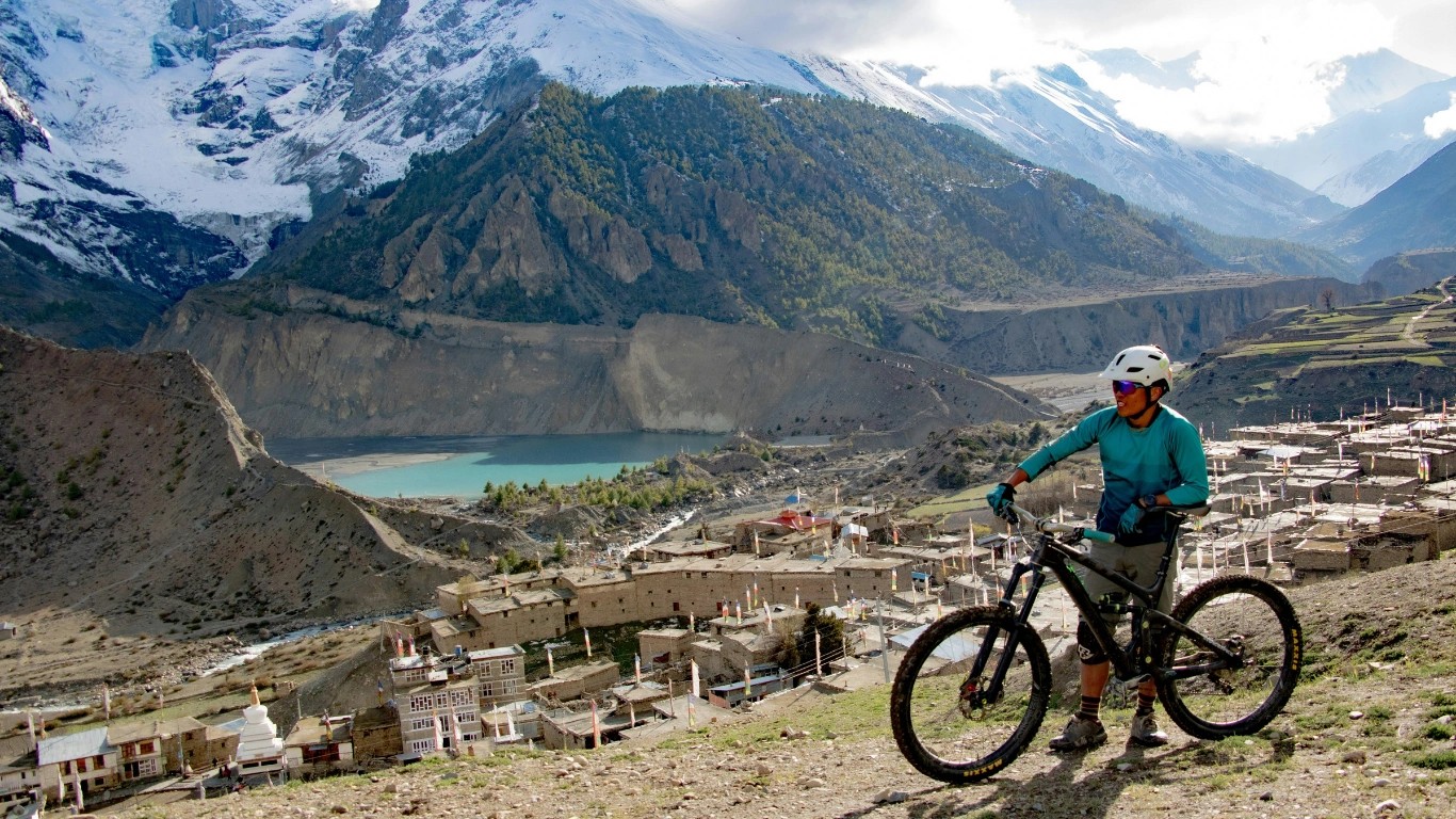
Manang matters because of a simple physiological fact: at 3,519 m, your body is high enough to start adapting, but still low enough to do it safely. It is the last comfortable place to prepare for the 5,416 m Thorong La Pass, and the acclimatization you do here largely decides whether you cross successfully.
Above 3,500 m, the standard rule applies: do not increase your sleeping altitude by more than 300–500 m per day, and take a rest day every 1,000 m or so. Manang is where that rest day happens.
What acclimatizing properly here does:
The critical principle is climb high, sleep low. That is why the acclimatization hikes matter far more than a lazy rest day — and why our guides always take trekkers up.
Spend at least two nights in Manang — that is, arrive, take a full acclimatization day, and leave on the third morning. That is the minimum for a safe Thorong La crossing.
Here is the honest guidance by trekker type:
Our honest position after years of guiding this trail: the day you "save" in Manang is the day you lose at Thorong Phedi. Nobody has ever regretted an extra day in Manang; plenty of people have regretted skipping one.
Manang offers three main acclimatization hikes, and choosing the right one for your energy and fitness is the most useful decision of your rest day. All follow the climb-high, sleep-low principle. None requires an extra permit — your ACAP covers everything.
| Hike | Altitude | Time | Difficulty |
|---|---|---|---|
| Ice Lake (Kicho Tal) | ~4,600 m | 6–9 hrs round trip | Hard — the best |
| Gangapurna Lake & Viewpoint | ~3,700 m | 2–3 hrs | Easy–moderate |
| Praken Gompa | ~3,900 m | 2–3 hrs | Moderate |
| Milarepa's Cave | ~4,000 m | 4–5 hrs | Moderate |
Ice Lake, known locally as Kicho Tal, sits at around 4,600 m and is the single most effective acclimatization hike available to Annapurna Circuit trekkers. The round trip from Manang or Braga takes 6 to 9 hours and gains roughly 1,100 m of altitude — a serious day.
Why it works so well: you climb to 4,600 m, then return to sleep at 3,519 m. That is textbook climb-high-sleep-low, and it prepares your body for Thorong La better than anything else on the trail. It is also spectacular — a cluster of glacial lakes in a natural amphitheatre, with Annapurna II, III, IV, Gangapurna, and the Chulu peaks arranged around you.
The honest reality: this is not a rest day. It is a hard, steep climb, and only around a third of Circuit trekkers do it. Start early (by 6–7 AM), pack a lunch from your lodge, and take it slowly — there are no teahouses at the lake, though there is a small tea shop around 4,200 m.
Our advice: do it even if you feel fine. The benefit is physiological, not psychological. Feeling good at Manang does not mean your body is ready for 5,416 m.
A short walk from Manang brings you to the turquoise glacial lake beneath the Gangapurna Glacier, with a viewpoint climb above it. Two to three hours, moderate effort, lovely views. This is the right choice if you are tired, feeling the altitude, or genuinely need a rest — you still get some climb-high benefit without wrecking yourself.
A steep but short climb to a small monastery on the hillside above Manang, at around 3,900 m. Two to three hours, with a resident lama who gives blessings to trekkers heading for the pass. A good compromise: real altitude gain, moderate effort.
East of Braga, the cave where the 11th-century Tibetan yogi Milarepa is said to have meditated. A moderate half-day hike with genuine cultural interest, gaining useful altitude along the way.
Tilicho Lake (4,919 m) is one of the highest lakes in the world, and the trip from Manang adds 3 to 4 days to the Annapurna Circuit. It is the most popular and most spectacular extension on the whole trek — and also the most demanding.
| Day | Route | Altitude |
|---|---|---|
| 1 | Manang → Khangsar → Shree Kharka | 3,756–4,050 m |
| 2 | Shree Kharka → Tilicho Base Camp | 4,150 m |
| 3 | Base Camp → Tilicho Lake → back down | 4,919 m |
| 4 | Rejoin the Circuit at Yak Kharka | 4,050 m |
What to know honestly:
Should you do it? Honestly — if you have the days and reasonable fitness, yes. It is one of the great sights in Nepal: a vast blue-green glacial lake in a bare high basin beneath Tilicho Peak. But if you are already struggling with altitude, tight on time, or nervous about exposed terrain, skip it and do the Ice Lake hike instead. The Circuit is not diminished by leaving Tilicho for another trip.
Once you leave Manang, the Circuit gets serious. The route to the pass climbs steadily through increasingly barren, high country, and there is no going back to comfort.
| Stage | Altitude | Time |
|---|---|---|
| Manang → Yak Kharka | 4,050 m | 4–5 hrs |
| Yak Kharka → Thorong Phedi | 4,540 m | 3–4 hrs |
| Thorong Phedi → High Camp | 4,880 m | 1–2 hrs |
| Thorong Phedi → Thorong La → Muktinath | 5,416 m | 8–12 hrs |
The days are short in distance but the altitude gain is what matters. Walk slowly, drink 3–4 litres of water, and tell your guide immediately about any headache or nausea. Read our full Thorong La Pass crossing guide before you leave Manang — the pass day is the hardest of the trek, and it starts at 4 AM.
This is a common question, and the honest answer is that they are two halves of the same trek, not rivals. On the Annapurna Circuit you pass through Manang on the way up to the Thorong La, and descend into Mustang on the way down the other side.
| Manang | Mustang (Lower) | |
|---|---|---|
| Position | Ascent side (east) | Descent side (west) |
| Landscape | Alpine, glaciers overhead, Tibetan-influenced | Arid high desert, dramatic canyons |
| Altitude | 3,519 m | Muktinath 3,800 m; Jomsom 2,700 m |
| Feel | A trekking town, busy, well-supplied | Windswept, ancient, pilgrimage country |
| Role on the Circuit | The acclimatization stop | The reward after the pass |
If you are trekking the Annapurna Circuit, you see both. The question only becomes real if you are choosing a separate trip: Upper Mustang is a distinct restricted-area trek into a former Tibetan kingdom, requiring a special permit and a much bigger budget.
Our honest take: Manang is where the Circuit is hardest and most anxious — the altitude, the pass looming. Mustang is where it becomes beautiful and relieved — you have crossed, and a strange desert opens up in front of you. You need both to have done the trek.
Manang sits in the rain shadow of the Annapurna massif, which means it is far drier than the valleys below — and this shapes both the landscape and the trekking conditions.
| Season | Day | Night | Verdict |
|---|---|---|---|
| Autumn (Oct–Nov) | 10–18°C | −5 to 0°C | Best — clear, dry, stable |
| Spring (Mar–May) | 10–18°C | −5 to 2°C | Excellent — warmer, some haze |
| Winter (Dec–Feb) | 0–10°C | −15 to −5°C | Cold; pass may close |
| Monsoon (Jun–Aug) | 12–20°C | 3–8°C | Surprisingly dry — rain shadow |
The rain-shadow effect is genuinely useful: while the lower Circuit is drenched in monsoon, Manang stays comparatively dry, which is why the upper Circuit is one of the few trekking regions in Nepal that works in summer.
Whatever the season, nights are cold at 3,519 m, the sun is fierce, and the wind picks up in the afternoons. Layers, sunscreen, and sunglasses are non-negotiable.
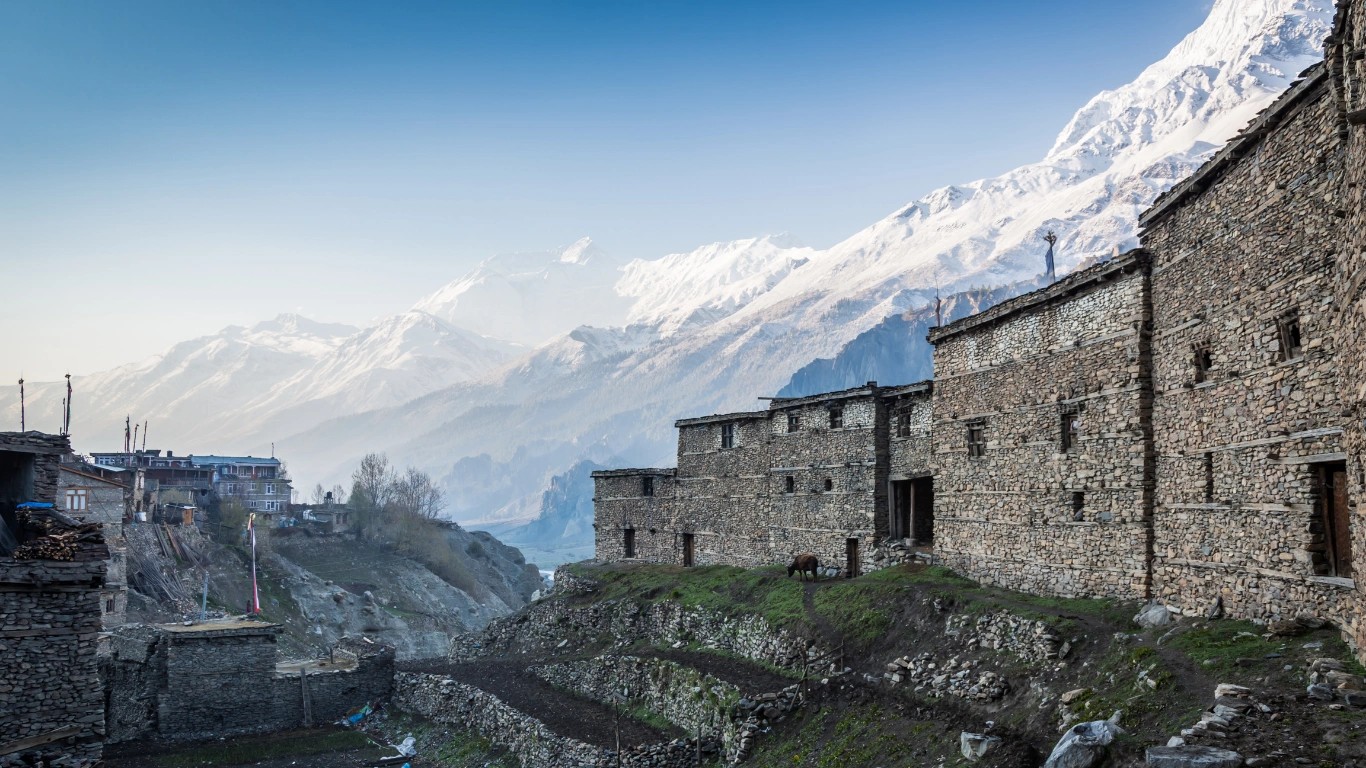
Manang is the last properly equipped town on the northern Circuit, and its facilities are genuinely surprising for a village at 3,519 m.
What you will find:
One critical practical point: restock here. Beyond Manang, supplies get scarce and prices climb steeply. Anything you need for the pass — snacks, batteries, sunscreen, medicine, gloves — buy it in Manang.
Book ahead in peak season (October, April). Manang fills up, and so do the good lodges.
The Himalayan Rescue Association (HRA) runs a health post in Manang staffed by volunteer doctors during the trekking seasons, and it is one of the most valuable resources on the entire Circuit.
Go to the free altitude talk at 3:00 PM. It runs daily in season, it costs nothing, and it is genuinely excellent — volunteer doctors explain Acute Mountain Sickness, how to recognise it, what to do about it, and when to descend. You can also:
The HRA was founded in 1973 and exists specifically to stop people dying of altitude sickness on this trail — trekkers, guides, and porters alike. Attending the talk takes an hour of your rest day and is one of the highest-value hours of your whole trek.
Manang is famous as the key acclimatization stop on the Annapurna Circuit, at 3,519 m. It is known for the Ice Lake and Tilicho Lake hikes, the Himalayan Rescue Association altitude clinic, and its surprising comforts — bakeries, an ATM, gear shops, and even a cinema — set beneath the Gangapurna Glacier.
Most trekkers walk in from Jagat, Dharapani, or Chame over several days, following the Marsyangdi valley — this is the recommended route, because it acclimatizes you properly. It is also possible to drive by jeep from Kathmandu (9–12 hours, around 200 km), though arriving quickly at 3,519 m carries a real altitude risk.
Roughly 200 km by road, taking a full day (9–12 hours) by jeep via Besisahar and Chame. Everything beyond Besisahar is on a rough, unpaved mountain road.
At least two nights — arrive, take one full acclimatization day, then continue. Three nights is better if you drove up quickly, are new to altitude, or felt any symptoms on the way. Skipping the acclimatization day is the most common reason trekkers fail at Thorong La.
The Ice Lake (Kicho Tal) hike at around 4,600 m is the best — a 6–9 hour round trip gaining about 1,100 m, which is textbook climb-high-sleep-low preparation for Thorong La. Easier alternatives are Gangapurna Lake and Praken Gompa.
Tilicho Lake (4,919 m) adds 3 to 4 days to the Annapurna Circuit from Manang, via Khangsar and Tilicho Base Camp. No extra permit is needed — your ACAP covers it.
They are different stages of the same trek rather than alternatives — on the Annapurna Circuit you pass through Manang on the way up to Thorong La, and descend into Mustang afterwards. Manang is alpine and glaciated; Mustang is arid, ancient high desert. You experience both on the Circuit.
There are two ways: trek in from Jagat, Dharapani, or Chame over several days (recommended — it acclimatizes you properly), or drive by jeep from Kathmandu (9–12 hours, around 200 km). There are no flights to Manang — the Hongde airstrip is closed and no scheduled service operates.
Manang sits at 3,519 m (11,545 ft). Nearby Braga is slightly lower at around 3,475 m, and the next stop up the trail, Yak Kharka, is at 4,050 m.
Yes — Manang has an ATM, and it is the last reliable one before Muktinath. It does run out of cash in peak season, so carry enough rupees from Kathmandu rather than depending on it.
Manang lies in the rain shadow of the Annapurnas, so it is dry year-round. Autumn (Oct–Nov) days run 10–18°C with nights around −5°C; spring is similar and slightly warmer. Even in monsoon, Manang stays comparatively dry — one of the few places in Nepal that does.
Manang is where the Annapurna Circuit is won or lost. Not on the pass itself — the pass is just the day you find out. It is here, at 3,519 m, in the decision to take the extra day, to climb up to Ice Lake when you would rather sit in the bakery, to go to the 3 PM talk and get your oxygen checked, to listen honestly to what your body is telling you.
Trekkers who rush through Manang are the ones we see turning back from High Camp. Trekkers who respect it stand on the pass at sunrise.
So take the two nights. Do the hike. Eat the apple pie afterwards — you will have earned it. And if you have the days, take the extra ones and go up to Tilicho, because the sight of that vast blue lake under Tilicho Peak is not something you forget.
→ See our Annapurna Circuit Trek (15 days) — with proper acclimatization built into the itinerary, from USD 1,260
→ Short on time? Annapurna Circuit Short Trek (10 days)
→ Read the Thorong La Pass crossing guide — what Manang is preparing you for
→ Best time to trek the Annapurna Circuit — month by month
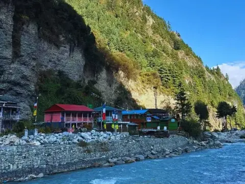
Let us guide you through the must-visit villages on the Annapurna Circuit Trek, where breathtaking Himalayan landscapes meet centuries-old traditions...

Nepal is a land where nature paints its most spectacular masterpieces. From the towering peaks of the Himalayas to serene alpine lakes, dense jungles...

The ACT Nepal Trek stands as one of the most iconic high-altitude adventures on Earth, drawing thousands of trekkers annually to Nepal's magnificent A...
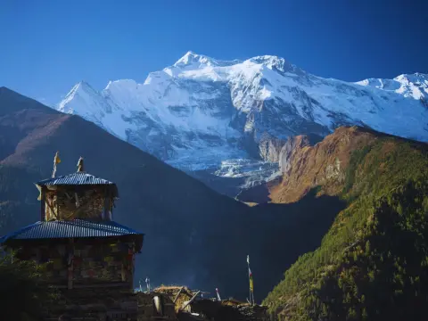
If you've ever scrolled through trekking forums or chatted with someone who's walked through Nepal's mountains, you've probably heard the phrase apple...
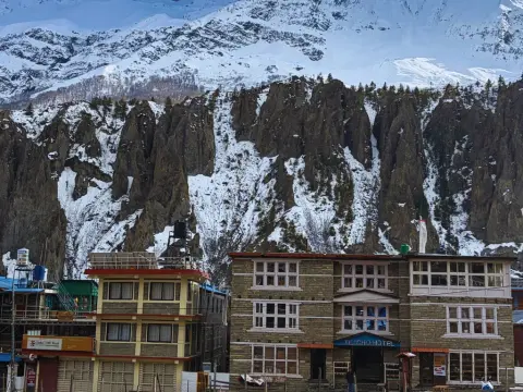
Planning your accommodation during Annapurna Circuit trek requires understanding Nepal's unique teahouse culture—a system that has welcomed trekkers f...
The best time to trek the Annapurna Circuit is during autumn (September to November) and spring (March to May), when the skies are clear, the weather...
